
Seismic Hazards
Folien in diesem Satz (9)
-
-
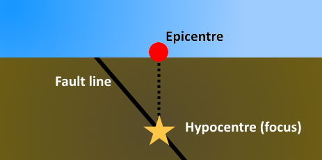
- Earthquakes are caused by sudden movements along a fault line.
- The movements are preceded by a gradual build-up of tectonic strain, which stores elastic energy in crustal rocks.
- When the pressure exceeds the strength of the rock, the rock fractures. The point of the rupture is called the hypocentre and can vary in depth.
- This produces a sudden release of energy, creating seismic waves that radiate from the fracture.
- The brittle crust rebounds either side of the fracture, making it shake.
-
The Benioff Zone and Subduction Processes
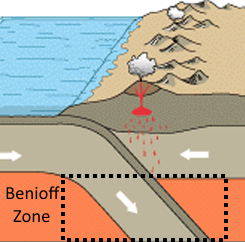
- The Benioff Zone is an area of seismicity corresponding with a subducted piece of crust.
- The different speeds and movements of rock at this point produce numerous earthquakes.
- It is the site for deep-focus earthquakes in particular. The depth of the hypocentre of an earthquake can help to determine its magnitude.
- Locked faults are common in Benioff Zones. This is when the frictional resistance on a fault is greater than the shear stress across the fault, meaning that it doesn't move and is left to build up energy for an extended period of time.
-
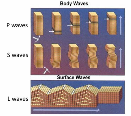
- There are three type of seismic wave. These can be measured with a seismometer.
- P (Primary) waves are usually caused by compression. They spread quickly from the fault at a rate of 8km/second.
- S (Secondary) waves vibrate at right angles to the direction of travel and cannot move through liquids. They are much slower than P waves and move at a speed of 4km/s.
- L (Love) waves are surface waves with a vibration occurring in the horizontal plain. These waves have a high amplitude.
-
-
Primary Hazards of Earthquakes
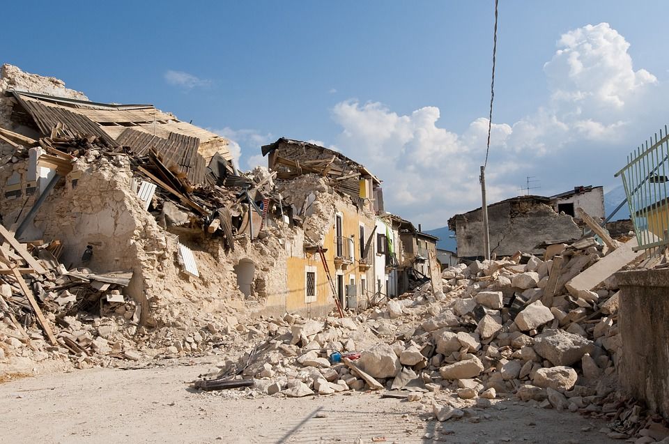
- Death and destruction
- Damage to the landscape
-
Secondary Hazards of Earthquakes
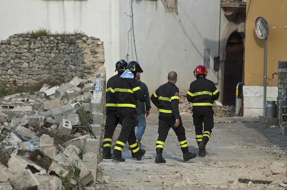
- Fires
- Soil liquefaction - soil turning to a liquid causes buildings to tilt and collapse
- Tsunamis
- Landslides
- Restriction of water supplies
- Spread of disease
- Economic recession
- Increase in homelessness
- Increase in crime rates
-
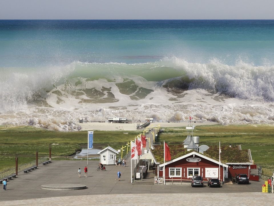
- Tsunamis are initiated by undersea earthquakes, landslides and, sometimes, volcanic eruptions. A tsunami is not a single wave but a series of waves.
- Most tsunamis occur near subduction zones, particularly the Japan-Taiwan Island Arc and South America.
- They are characterised by:
- Long wavelengths (150-1000km)
- Low amplitude (wave height) at sea - they grow bigger near land
- Fast velocities (up to 600km/h)
-
Factors affecting Earthquake Hazards
- Earthquakes
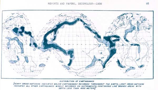
- Location - For example, areas around the Pacific Ocean in particular are susceptible to tectonic hazards due to their location near the Pacific Ring of Fire. Location also plays a large role in determining climate.
- Population - A larger population will mean more people are vulnerable to natural hazards.
- Nature of settlements and the buildings within - durability of buildings within a settlement will often determine the amount of damage after an earthquake or eruption.
- Telecommunications - though lines may be damaged in an event, good telecommunication networks in an area can affect responses to an event.
- Tsunamis
- The duration of the event
- The wave amplitude, water column displacement and the distance travelled
- The physical geography of the coast - water depth and gradient of the coastline
- The degree of coastal ecosystem buffer - eg. mangroves and coral reefs
- The timing of the event (night vs day) and the quality of warning systems
- The degree of coastal development and proximity of the development to the coastline.
Informationen
- Beschreibung
- Der Nutzer hat seine Fachbereichs-Information gelöscht. Folienset am Seismic Hazards, erstellt von Gelöschter Nutzer am 09/08/2017.
- Erstellt von
- Gelöschter Nutzer
- Aufrufe
- 40
- Verlauf
-
- Erstellt von Antonia Blankenberg · 2 Aug 2017
- Kopiert von Antonia Blankenberg · 9 Aug 2017
- Bewertung