
Mindmap
Geography- Rivers
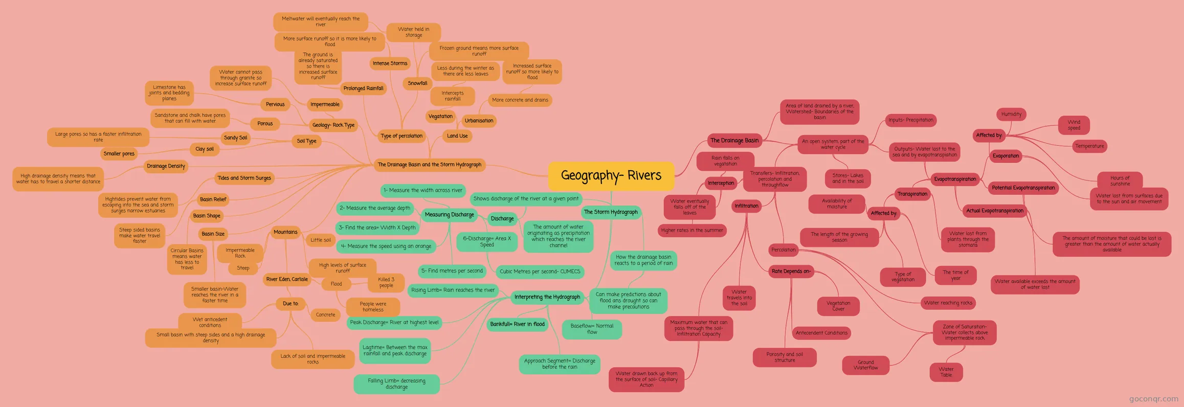
Mind map: Geography rivers
Inhalt der Mindmap
Geography- Rivers
The Drainage Basin
- Area of land drained by a river, Watershed- Boundaries of the basin
- An open system, part of the water cycle
- Inputs- Precipitation
- Outputs- Water lost to the sea and by evapotranspiation
- Evapotranspiration
- Evaporation
- Water lost from surfaces due to the sun and air movement
- Affected by:
- Temperature
- Wind speed
- Humidity
- Hours of sunshine
- Transpiration
- Water lost from plants through the stomata
- Affected by:
- The time of year
- Type of vegatation
- Availability of moisture
- The length of the growing season
- Potential Evapotranspiration
- The amount of moisture that could be lost is greater than the amount of water actually available
- Actual Evapotranspiration
- Water available exceeds the amount of water lost
- Evaporation
- Evapotranspiration
- Stores- Lakes and in the soil
- Transfers- Infiltration, percolation and throughflow
- Interception
- Rain falls on vegatation
- Higher rates in the summer
- Water eventually falls off of the leaves
- Infiltration
- Water travels into the soil
- Maximum water that can pass through the soil- Infiltration Capacity
- Water drawn back up from the surface of soil- Capillary Action
- Rate Depends on-
- Antecendent Conditions
- Porosity and soil structure
- Vegetation Cover
- Percolation
- Water reaching rocks
- Zone of Saturation- Water collects above impermeable rock
- Water Table
- Ground Waterflow
- Interception
The Storm Hydrograph
- How the drainage basin reacts to a period of rain
- Can make predictions about flood ans drought so can make precautions
- Shows discharge of the river at a given point
- Discharge
- The amount of water originating as precipitation which reaches the river channel
- Measuring Discharge
- 1- Measure the width across river
- 2- Measure the average depth
- 3- Find the area= Width X Depth
- 4- Measure the speed using an orange
- 5- Find metres per second
- 6-Discharge= Area X Speed
- Cubic Metres per second- CUMECS
- Discharge
- Interpreting the Hydrograph
- Baseflow= Normal flow
- Approach Segment= Discharge before the rain
- Rising Limb= Rain reaches the river
- Peak Discharge= River at highest level
- Lagtime= Between the max rainfall and peak discharge
- Falling Limb= decreasing discharge
- Bankfull= River in flood
- How the drainage basin reacts to a period of rain
The Drainage Basin and the Storm Hydrograph
- Basin Size
- Smaller basin-Water reaches the river in a faster time
- Basin Shape
- Circular Basins means water has less to travel
- Basin Relief
- Steep sided basins make water travel faster
- Type of percolation
- Prolonged Rainfall
- The ground is already saturated so there is increased surface runoff
- Intense Storms
- More surface runoff so it is more likely to flood
- Snowfall
- Water held in storage
- Meltwater will eventually reach the river
- Frozen ground means more surface runoff
- Water held in storage
- Prolonged Rainfall
- Land Use
- Vegatation
- Intercepts rainfall
- Less during the winter as there are less leaves
- Intercepts rainfall
- Urbanisation
- More concrete and drains
- Increased surface runoff so more likely to flood
- More concrete and drains
- Vegatation
- Geology- Rock Type
- Porous
- Sandstone and chalk have pores that can fill with water
- Pervious
- Limestone has joints and bedding planes
- Impermeable
- Water cannot pass through granite so increase surface runoff
- Porous
- Soil Type
- Sandy Soil
- Large pores so has a faster infiltration rate
- Clay soil
- Smaller pores
- Sandy Soil
- Drainage Density
- High drainage density means that water has to travel a shorter distance
- Tides and Storm Surges
- Hightides prevent water from escaping into the sea and storm surges narrow estuaries
- Mountains
- Impermeable Rock
- Steep
- Little soil
- High levels of surface runoff
- River Eden, Carlisle
- Flood
- Killed 3 people
- People were homeless
- Due to:
- Concrete
- Wet anticedent conditions
- Small basin with steep sides and a high drainage density
- Lack of soil and impermeable rocks
- Flood
- Basin Size
Informationen
- Beschreibung
- Mindmap am Geography- Rivers, erstellt von HannahRoseD am 24/02/2015.
- Erstellt von
- HannahRoseD
- Aufrufe
- 2
- Bewertung