
Mindmap
River Landforms
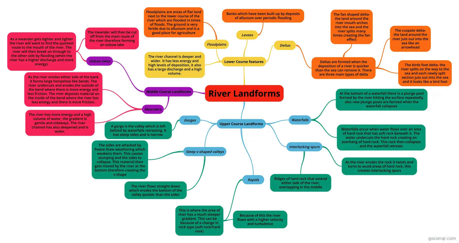
Mind map: River landforms
Inhalt der Mindmap
River Landforms
Upper Course Landforms
- Steep v-shaped valleys
- The river flows straight down which erodes the bottom of the valley quicker than the sides
- The sides are attacked by freeze thaw weathering which weakens them. This causes slumping and the sides to collapse. This material then gets moved by the river at the bottom therefore creating the v-shape
- Interlocking spurs
- Ridges of hard rock that extend either side of the river, overlapping in the middle
- As the river erodes the rock it twists and turns to avoid areas of hard rock, this creates interlocking spurs
- Rapids
- This is where the area of river has a much steeper gradient. This can be because of a change in rock type (soft rock/hard rock)
- Because of this the river flows with a higher velocity and turbulence
- This is where the area of river has a much steeper gradient. This can be because of a change in rock type (soft rock/hard rock)
- Waterfalls
- Waterfalls occur when water flows over an area of hard rock that has soft rock beneath it. The water undercuts the hard rock creating an overhang of hard rock. This rock then collapses and the waterfall retreats
- At the bottom of a waterfall there is a plunge pool formed by the river hitting the surface repeatedly, also new plunge pools are formed when the waterfall collapses
- Gorges
- A gorge is the valley which is left behind by waterfalls retreating. It has steep sides and is narrow.
- Steep v-shaped valleys
Middle Course Landforms
- Meanders
- The river has more energy and a high volume of water, the gradient is gentle and sideways. The river channel has also deepened and is wider.
- As the river erodes either side of the bank it forms large horseshoe like bends. The river undercuts and erodes the outside of the bend where there is more energy and less friction. The river deposits material on the inside of the bend where the river has less energy and there is more friction.
- Oxbow lakes
- As a meander gets tighter and tighter the river will want to find the quickest route to the mouth of the river. The river will then break on through to the other side by flooding (when the river has a higher discharge and more energy).
- The meander will then be cut off from the main route of the river therefore forming an oxbow lake
- As a meander gets tighter and tighter the river will want to find the quickest route to the mouth of the river. The river will then break on through to the other side by flooding (when the river has a higher discharge and more energy).
- Meanders
Lower Course features
- Floodplains
- Floodplains are areas of flat land next to the lower course of the river which are flooded in times of floods. The ground is very fertile due to alluvium and is a good place for agriculture
- Levees
- Banks which have been built up by deposits of alluvium over periodic flooding
- Deltas
- Deltas are formed when the deposition of a river is quicker than the sea can remove it. There are three main types of delta
- The fan shaped delta- the land around the river mouth arches into the sea and the river splits many times creating the fan effect
- The cuspate delta- the land around the river juts out into the sea like an arrowhead
- The birds foot delta- the river splits on the way to the sea and each newly split section juts out into the sea and it looks like a bird foot
- Deltas are formed when the deposition of a river is quicker than the sea can remove it. There are three main types of delta
- The river channel is deeper and wider. It has less energy and high levels of deposition, it also has a large discharge and a high volume.
- Floodplains
Informationen
- Beschreibung
- Mindmap am River Landforms, erstellt von lucychelseaandso am 26/03/2016.
- Erstellt von
- lucychelseaandso
- Aufrufe
- 0
- Bewertung