
Notizen
Fluvial Landforms
Inhalt der Notizen (10)
Seite 1
River Profiles
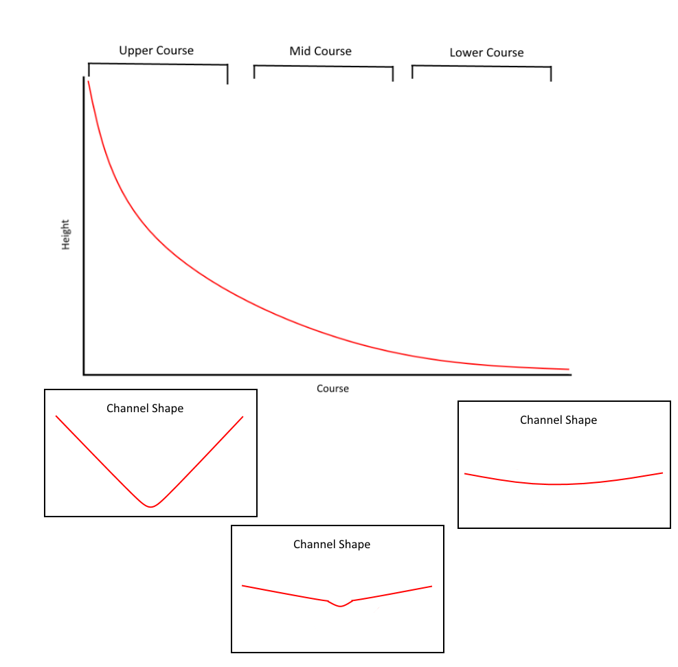
A river profile is a way of viewing the shape of a river from source to sea to determine its characteristics.
River profiles are viewed as a cross-section or side view of a river.
This allows for the gradient, or shape, of the river to be seen.
A river is divided into upper course, mid course, and lower course. These sections of the river are determined mostly by the river's level of energy.
As the gradient of a river decreases, as does the energy of the river.
The upper course of the river typically has high energy and many erosive landforms. Typical landforms include; v-shaped valleys, waterfalls and gorges, and interlocking spurs.
The mid course of the river has a lower energy and few erosive landforms. Typical landforms include; meanders.
The lower course of a river has low energy and depositional features. Typical landforms include; oxbow lakes levees, and floodplains.
Seite 2
Interlocking Spurs
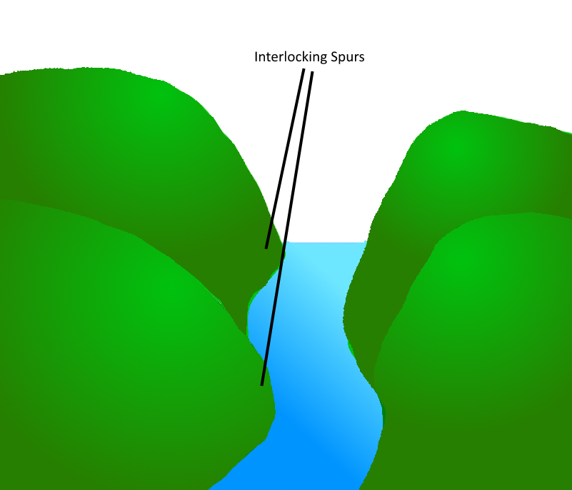
Interlocking spurs are projections of high land that alternate from either side of a valley.
This feature forms in the upper course of the river where there is high energy and a shallow channel.
Scree slopes may also be found with interlocking spurs due to high amounts of upland freeze-thaw weathering.
Usually, upland areas are formed of harder rock, such as granite. This means the river will try to work its way around these pieces of hard rock as rivers always take the easiest route available. This forms the alternating pattern found with this feature.
Seite 3
V-Shaped Valley
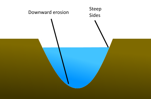
V-Shaped valleys form in the upper course of a river due to high energy.
In the upper course of the river, downward erosion occurs. This erodes the bed of the river.
The sides of the channel become steep, giving the valley a V shape.
Weathering of the surrounding land can also contribute to this shape.
Seite 4
Rapids
Rapids are turbulent sections of a river formed where the river has a rapidly steep gradient.
Rapids usually form in the upper course of the river where there is high energy.
These can form where hard rock lies beside soft rock; differential erosion occurs, forming a drop where there was once soft rock.

Seite 5
Waterfalls
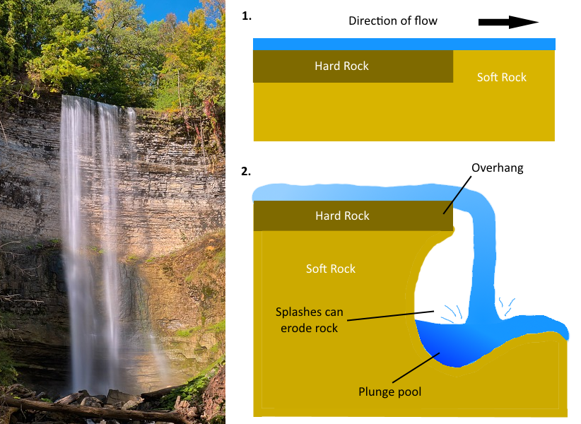
A waterfall occurs when there is a drop in the channel.
Waterfalls form in the upper course of the river where there is soft rock lying nearby hard rock.
The soft rock will erode quicker than the hard rock, forming a drop for the water.
If the hard rock becomes unsupported it can fall, pushing the position of the waterfall backwards.
Seite 6
Gorges
A gorge is a narrow, steep-sided valley that is formed downstream of a waterfall.
The sides of this valley are usually very steep, bare, and rocky.
This feature forms when a waterfall begins to erode and recede.

Seite 7
Meanders
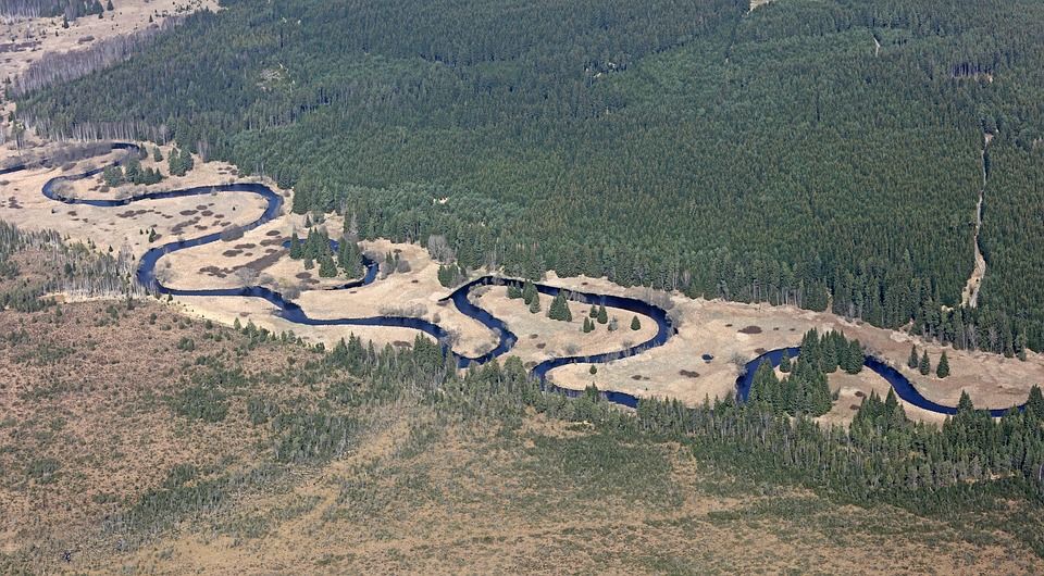
Meanders are bends that form in the mid course of a river.
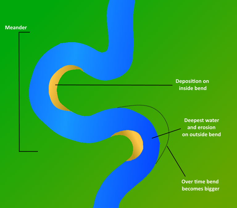
Meanders are features of erosion and deposition.
Deposition occurs in the inner part of the bend, where water is more shallow.
The outside of the bend is deeper and is eroded due to the faster flowing water.
Over time, meanders can form oxbow lakes.
Seite 8
Oxbow Lakes
An oxbow lake is a horseshoe shaped body of water that forms when a meander is cut off from a river.
When a meander becomes very large, the neck is eroded.
Over time, the meander is not used as the main flow of water and is cut off.
Deposition begins to occur at the limbs of the previous meander, this separates it from the river, forming an oxbow lake.

Seite 9
Levees
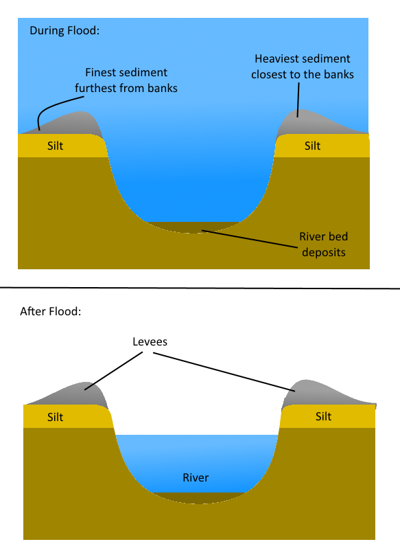
Levees form on the banks of a river during flood periods.
They are heightened flood banks formed from deposited sediment.
As a river floods, the largest sediment is dropped the closest to the banks and the smallest sediment is deposited further away. This gives a levee its shape.
Levees are landforms of deposition and form in the lower course of the river.
Seite 10
Floodplains
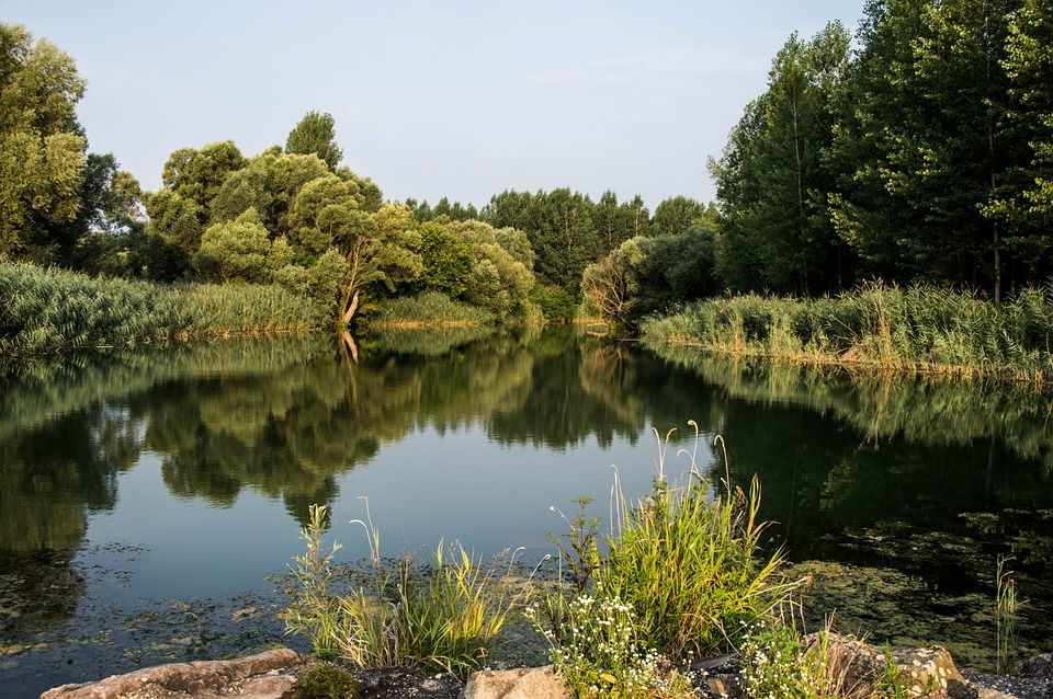
A floodplain is a large area of flat land found on either side of a river.
These landforms are found in the lower course of the river and are prone to flooding.
Informationen
- Beschreibung
- Der Nutzer hat seine Fachbereichs-Information gelöscht. Notiz am Fluvial Landforms, erstellt von Gelöschter Nutzer am 21/06/2017.
- Erstellt von
- Gelöschter Nutzer · Jun 2017
- Aktualisiert
- 21 Jun 2017
- Aufrufe
- 143
- Verlauf
-
- Erstellt von Antonia Blankenberg · 19 Jun 2017
- Kopiert von Antonia Blankenberg · 21 Jun 2017
- Bewertung