103753
Beschreibung
Karteikarten von mezhievaseda, aktualisiert more than 1 year ago
|
|
Erstellt von mezhievaseda
vor fast 11 Jahre
|
|
| Frage | Antworten |
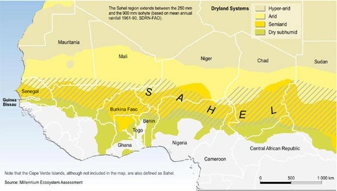
| Location: Mali and Niger are located in the Sahel region, which is the southern edge of the Sahara desert. |
Image:
sahel (image/jpg)
|
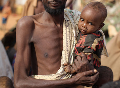
| Scale (number of people affected)- By 2005 it was estimated that 3.3 million people (including 800,000 children) were at risk from a serious food storage. | |
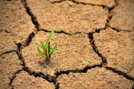
| Problem: In 2004 the subsistence farmers (growing crops to feed family) of Mali and Niger were hit by a double problem: a particularly severe droughts and a plague which virtually destroyed their crops. | |
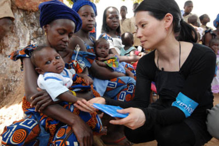
| Actions taking (help): UNICEF, already working in Niger because it has a programme of long-term aid in the country, was struggling to cope with the scale of the problem and asked for extra help to enable it to give emergency aid. |
Image:
LL-unicef (image/jpg)
|
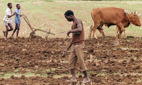
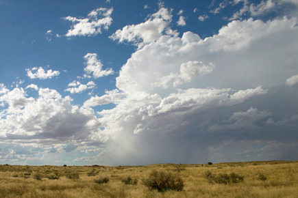
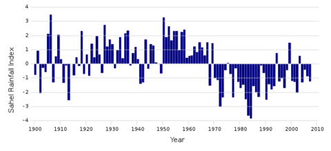
| Desertification (and its causes): Rainfall in the Sahel region of Africa is extremely variable from year to year. Rainfall is lowest in the north of the region. Rainfall of around 600mm per year is usual in the southern Sahel; This is sufficient for some crops to grow. |
Image:
Rain-Kgalagadi-L (image/jpg)
|
| This region is experiencing climate change: annual rainfall totals in most years since 1968 have been lower than in earlier years of the 20th century. As a result the area is becoming more arid, there is less vegetation so when it is windy the dry soil is easily blown away. Desertification is taking place and it is as though the Sahara desert is expanding. | |
| Why is Sahel becoming drier? The reasons for desertification are complex, also there might be several causes combined, creating a bigger impact on the area. | • Some scientists believe that the region naturally experiences a cynical climate: wetter periods are separated by drier periods that last for decades. • Other scientists believe that the climate is changing as a result of human actions. |
| Another theory is that population growth and overgazing destroys vegetation which causes less evaporisation and higher soil temps leading to less rainfall and resulting in land erosion. The climate becomes less sustainable and therefore not reliable for growing crops. | |
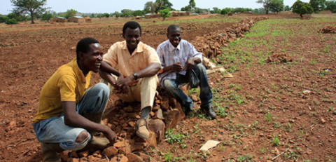
| Managing problems of desertification. Low technology rainwater harvesting and soil conservation strategies are used to solve the problems of lack of water and soil erosion in the Sahel region. These include: | • Tree planting • Building small rock dams • Building terraces on steep slopes • Building stone lines on gentle slopes (bunds) • Planting grass strips along the bunds |
| One strategy that has been used successfully in crop-growing regions is the construction of low stone lines known as bunds. Stones are placed along the contours on gentle slopes. Sometimes the bunds are reinforced by planting tough grasses along the lines. The stones and grass encourage the water to infiltrate the soil and reduce the amount of rainwater that is lost by run-off. They also prevent soil erosion. |
Image:
Ghana-440 (image/png)
|
Möchten Sie mit GoConqr kostenlos Ihre eigenen Karteikarten erstellen? Mehr erfahren.