
Mapa mental
Geography Tectonic Hazards Case Studies
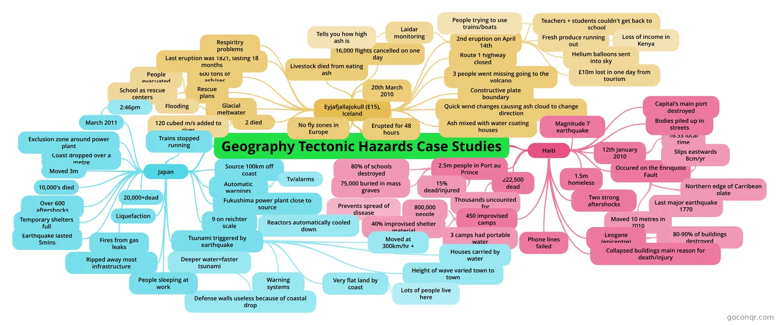
Mind map: Tectonic hazards case studies
Contenido del mapa
Geography Tectonic Hazards Case Studies
Eyjafjallajokull (E15), Iceland
- 20th March 2010
- Erupted for 48 hours
- Quick wind changes causing ash cloud to change direction
- 3 people went missing going to the volcano
- 2 died
- Constructive plate boundary
- 600 tons of ash/sec
- Rescue plans
- People evacuated
- School as rescue centers
- No fly zones in Europe
- Last eruption was 1821, lasting 18 months
- 16,000 flights cancelled on one day
- Ash mixed with water coating houses
- Livestock died from eating ash
- Route 1 highway closed
- Glacial meltwater
- 120 cubed m/s added to river
- Flooding
- Respiritry problems
- 2nd eruption on April 14th
- £10m lost in one day from tourism
- Teachers + students couldn't get back to school
- People trying to use trains/boats
- Fresh produce running out
- Loss of income in Kenya
- Laidar monitoring
- Tells you how high ash is
- Helium balloons sent into sky
Haiti
- Magnitude 7 earthquake
- 12th January 2010
- 16:53 local time
- Occured on the Enriquillo Fault
- Northern edge of Carribean plate
- Moved 10 metres in 2010
- Slips eastwards 8cm/yr
- Last major earthquake 1770
- Two strong aftershocks
- 222,500 dead
- Thousands uncounted for
- 2.5m people in Port au Prince
- 15% dead/injured
- 75,000 buried in mass graves
- Prevents spread of disease
- 80% of schools destroyed
- Bodies piled up in streets
- 1.5m homeless
- 450 improvised camps
- 800,000 people
- 40% improvised shelter material
- 3 camps had portable water
- Capital's main port destroyed
- Phone lines failed
- Leogane (epicentre)
- 80-90% of buildings destroyed
- Collapsed buildings main reason for death/injury
Japan
- March 2011
- 2:46pm
- Coast dropped over a metre
- Moved 3m
- 10,000's died
- Ripped away most infrastructure
- Source 100km off coast
- Automatic warnings
- Tv/alarms
- Fukushima power plant close to source
- Reactors automatically cooled down
- 9 on reichter scale
- Earthquake lasted 5mins
- Liquefaction
- Tsunami triggered by earthquake
- Moved at 300km/hr +
- Height of wave varied town to town
- Deeper water=faster tsunami
- Warning systems
- Very flat land by coast
- Lots of people live here
- Defense walls useless because of coastal drop
- Houses carried by water
- Fires from gas leaks
- Trains stopped running
- People sleeping at work
- Exclusion zone around power plant
- Over 600 aftershocks
- Temporary shelters full
- 20,000+dead
- March 2011
Información
- Descripción
- Mapa Mental sobre Geography Tectonic Hazards Case Studies, creado por nicolaswarbrick el 10/03/2014.
- Creado por
- nicolaswarbrick
- Visitas
- 311
- Valoración