
Fluvioglacial Processes and Landforms
Diapositivas del conjunto (14)
-
Fluvioglacial Processes and Landforms
- The word fluvioglacial relates to the meltwater of a glacier.
- This meltwater often flows under great pressure and has a large role in shaping glacial landscapes.
- The main sources of meltwater are surface melting and basal melting:
- Surface melting mainly occurs during the summer and is the only source of meltwater for cold-based glaciers.
- Basal melting occurs due to high pressure at the base of the glacier. This is more common with warm-based glaciers.
-
- Meltwater streams from glaciers tend to act similarly to normal streams/rivers. However, the amount of sediment being carried and the lack of vegetation changes them slightly.
- Meltwater streams within a glacier are usually under a lot of pressure, causing erosion.
- Fluvioglacial erosion processes follow the same four types of erosion present in rivers:
- Abrasion - the force of sand and pebbles in the meltwater scraping away at the channel.
- Attrition - the wearing away of rocks in the river by hitting off one another.
- Hydraulic action - the wearing away of rocks by the force of the water. This can also occur through the compression of air in small gaps by water.
- Solution - the chemical breakdown of rock by the meltwater.
-
Landforms of Erosion: Meltwater Channels
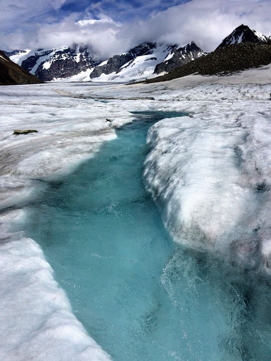
- Meltwater channels form where the meltwater from a glacier follows a pre-existing river channel.
- The water released from the glacier has high energy and a large load in the form, which results in rapid erosion taking place.
- The river channels are deepened to form meltwater channels. These may also take the form of glacial overflow channels.
-
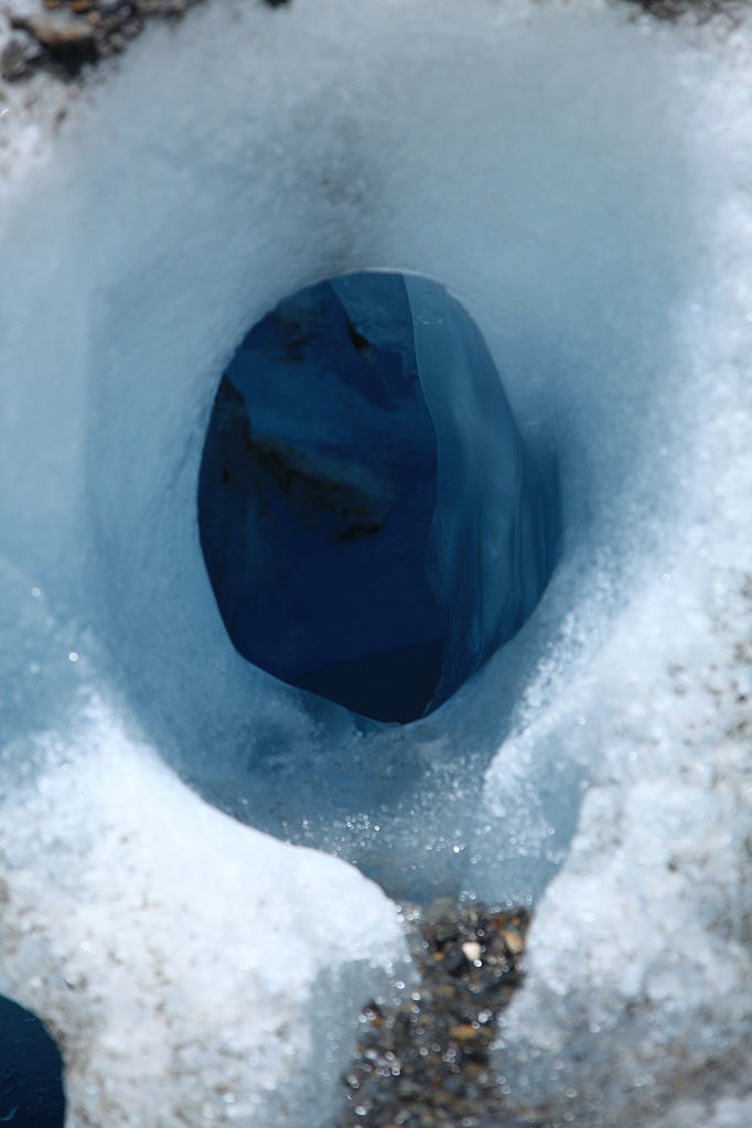
- A moulin is a roughly circular, vertical well-like shaft within a glacier which water enters from the surface.
- This feature is formed by the force of the meltwater and through abrasion.
-
- Moulins are responsible for considerable quantities of meltwater flowing within the body of the glacier and contribute to many depositional fluvioglacial landforms.
-
- Fluvioglacial deposition occurs when glacial ablation periodically reduces so meltwater streams have a smaller discharge.
- When meltwater deposits material subglacially, englacially and supraglacially, the deposited material is called an ice-contact fluvioglacial deposit.
-
- When material is deposited beyond the ice margin, it is referred to as an outwash or proglacial deposit.
-
Characteristics of Outwash Deposits
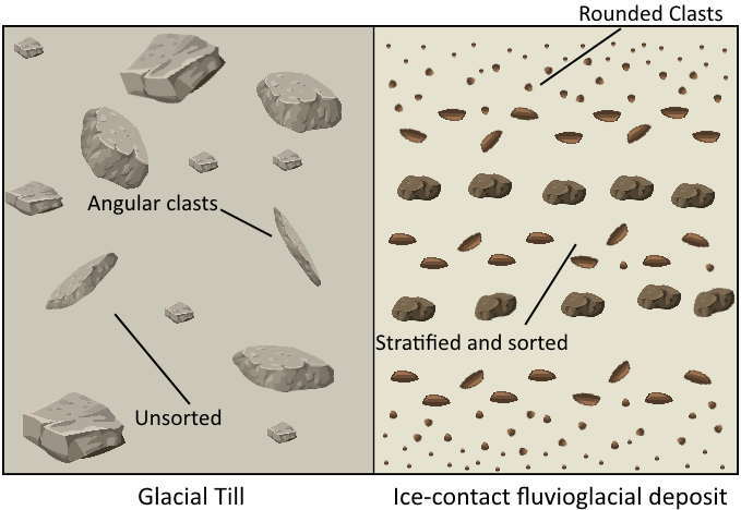
- Smaller than glacial till as the meltwater streams have less energy than large valley glaciers
- Smoother and rounder due to attrition
- Sorted horizontally
- Stratified vertically
- Are sorted into 3 zones (see next slide)
-
- Proximal Zone:
- In front of the glacier snout
- Meltwater has the most energy here so deposits are large in particle size
- May be mixed with some glacial till
- Outwash occurs in alluvial fan forms
- Medial Zone:
- Further from the glacier
- Anastomosing/braided channels because of variability in discharge
- Particle size is smaller and clasts are more rounded
- Distal Zone:
- Furthest from the glacier
- Meanders and flood plain in river system
- Deposits are well sorted
- Particle size is very fine
-
Ice-Contact Deposition Landforms: Eskers
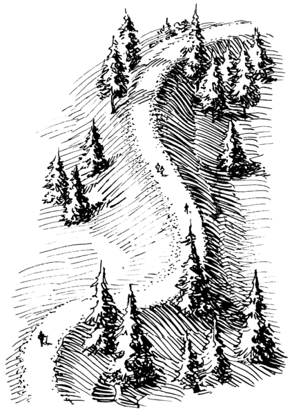
- Formed when there is a sub-glacial meltwater channel flowing within the body of the glacier and sediment is deposited within this channel.
- Eskers appear as long, sinuous ridges ranging from 5-20m high on the valley floor.
- After the ice age when the glacier melts, a ridge of sediment is left behind representing where the previous meltwater tunnel deposits descended to the valley floor as the surrounding ice melted.
-
Ice-Contact Deposition Landforms: Kames
- Kames appear as small mounds on the valley floor. They are accumulations of partially-sorted material found at the front of a glacier.
- Kames are deltaic deposits formed when meltwater streams lose energy flowing into a lake.
- These lakes are formed from dammed meltwater building up between the retreating glacier and terminal moraines.
- The process continues and material is repeatedly deposited on top of the growing kame and may form a kame delta.
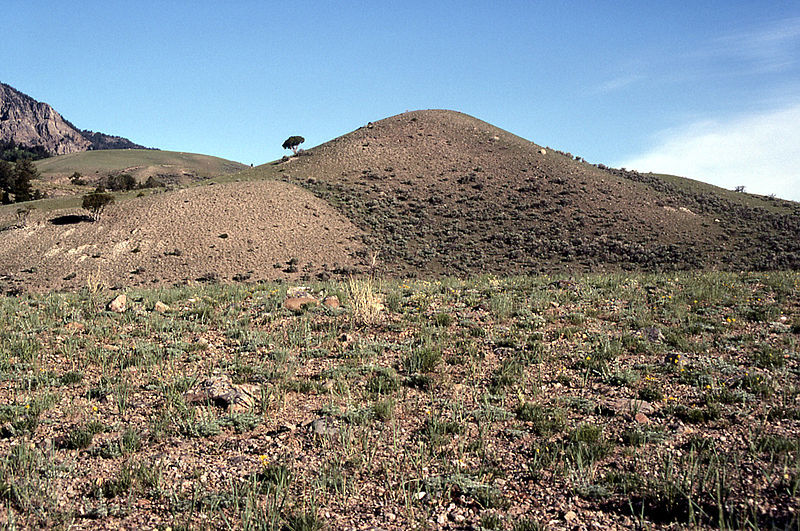
- Pie de imagen: Dude Hill, Yellowstone, USA
-
Ice-Contact Deposition: Kame Terraces
- Kame terraces are formed similarly to kames.
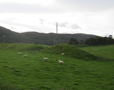
- These appear as ridges of material running along the edge of the valley floor.
- Meltwater streams flow along the convergence of the glacier’s lateral edge and the valley side. When they lose energy, they deposit their load into temporary channels.
- When the glacier retreats, these channels collapse to leave a ridge of partially sorted and rounded material to slump along the valley side.
-
Proglacial Deposition Landforms: Kettle Holes
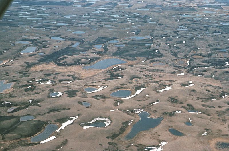
- Kettle holes are small circular lakes that often accompany kames. When these features are found together, it is referred to as kettle and kame topography.
- Kettle holes are formed when large blocks of ice calve from the main glacier onto an outwash plain.
- Sediment builds up around these blocks of ice and when they melt, a small hollow is left behind.
- Water often accumulates in these hollows, forming lakes known as kettle lakes.
-
Proglacial Deposition Landforms: Lakes
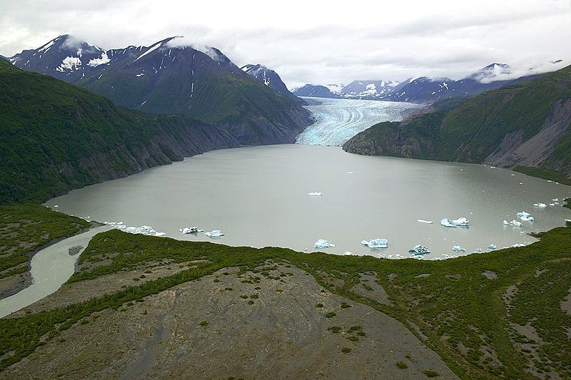
- Proglacial lakes are formed along the front of glaciers and ice sheets where meltwater becomes blocked.
- These features are often referred to as ice-margin lakes.
- Proglacial lakes are common in the English Midlands.
-
Proglacial Deposition Landforms: Varves
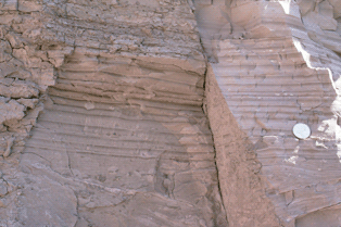
- Varves are layers of sediment found at the bottom of glacial lakes.
- They are formed when sediment carried by meltwater loses energy entering a lake.
- In summer, the discharge of meltwater streams is higher, so the stream can carry coarser sediment and deposits accumulate more rapidly.
- In winter, there is less meltwater available, meaning that sediment is limited and smaller in size. This makes the bands of sediment thin and fine.
-
Proglacial Deposition Landforms: Outwash
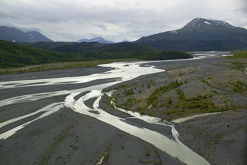
- Outwash plains (sandur) are flat expanses of deposited sediment.
- These are formed in front of a glacier and are where material is deposited over a wide area, carried out from the glacier by meltwater.
-
- The largest material is deposited closest to the glacier and gradually gets smaller as the meltwater loses energy.
Información
- Descripción
- El usuario ha eliminado su información de asignaturas Diapositivas sobre Fluvioglacial Processes and Landforms, creado por Usuario eliminado el 15/08/2017.
- Creado por
- Usuario eliminado · ago 2017
- Actualizado
- 15 ago 2017
- Visitas
- 60
- Historial
-
- Creado por Antonia Blankenberg · 11 ago 2017
- Copiado por Antonia Blankenberg · 15 ago 2017
- Valoración