22004070
Description
Flashcards by mark kurly, updated more than 1 year ago
|
|
Created by mark kurly
over 5 years ago
|
|
| Question | Answer |
|
Image:
Pic5 (binary/octet-stream)
|
Image:
Pic2 (binary/octet-stream)
|
|
Image:
Pic4 (binary/octet-stream)
|
Image:
Pic2 (binary/octet-stream)
|
|
Image:
Pic3 (binary/octet-stream)
|
Image:
Pic2 (binary/octet-stream)
|
|
flood
Image:
Pic+1 (binary/octet-stream)
|
Image:
Pic2 (binary/octet-stream)
|
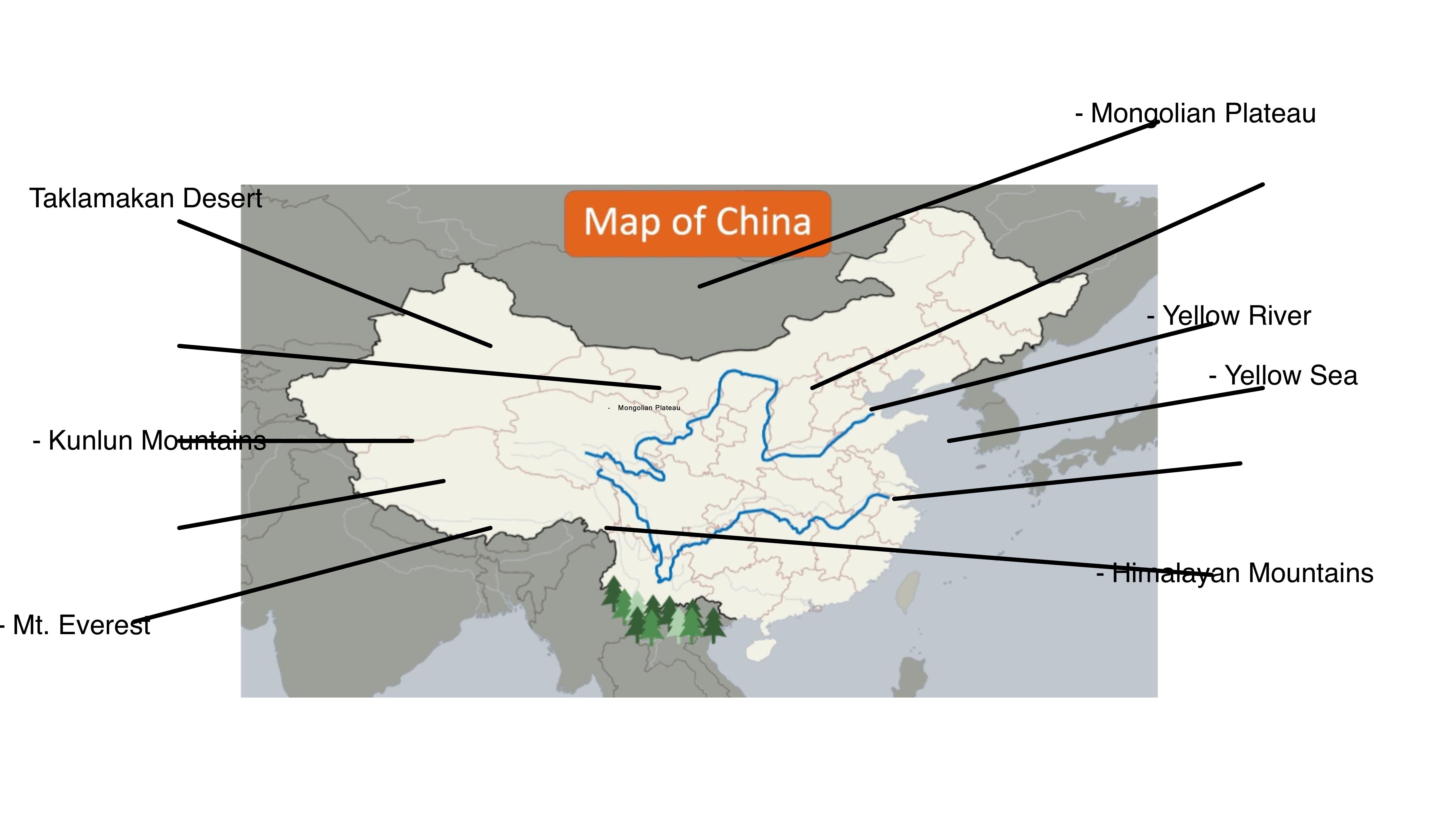
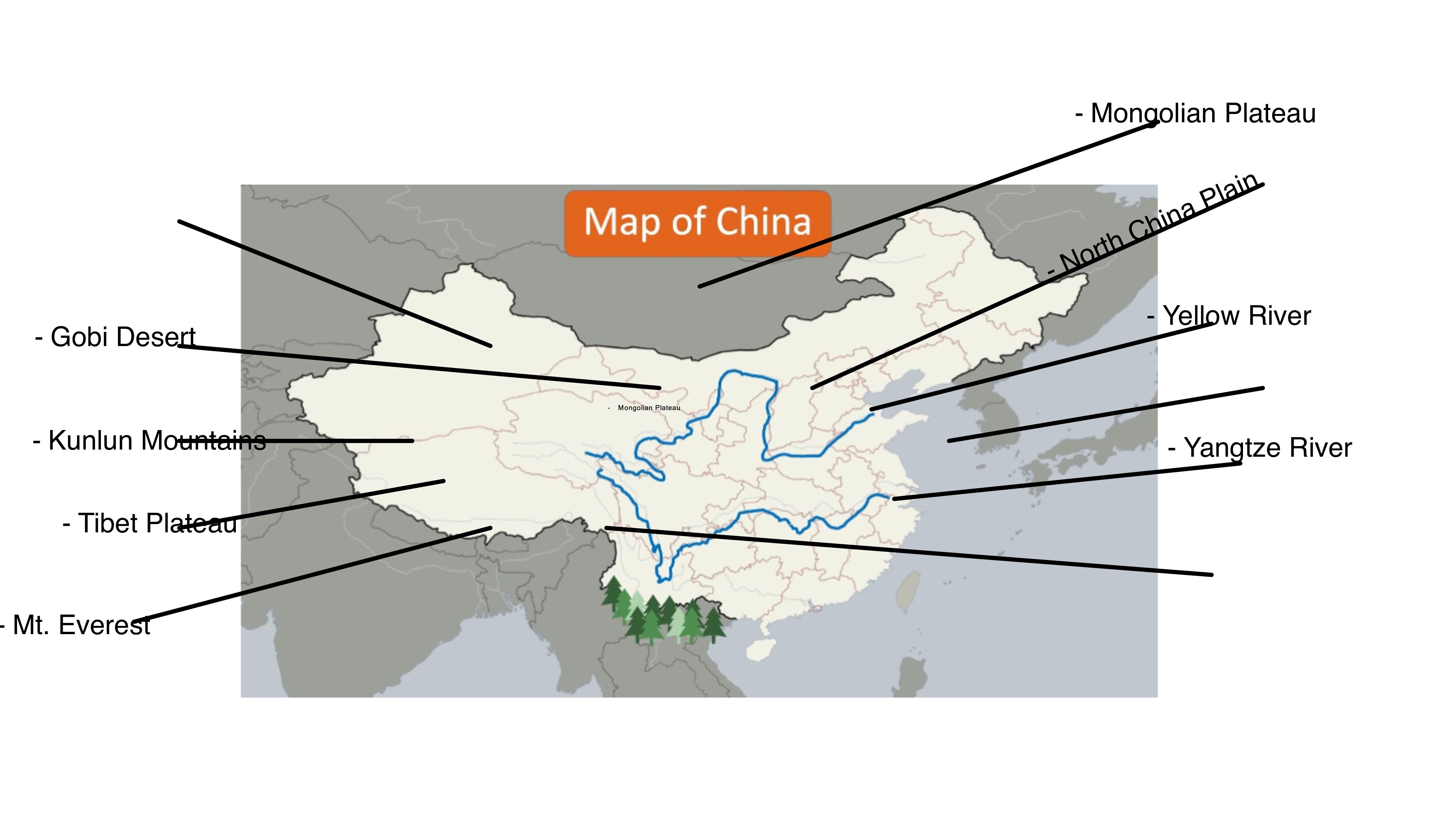
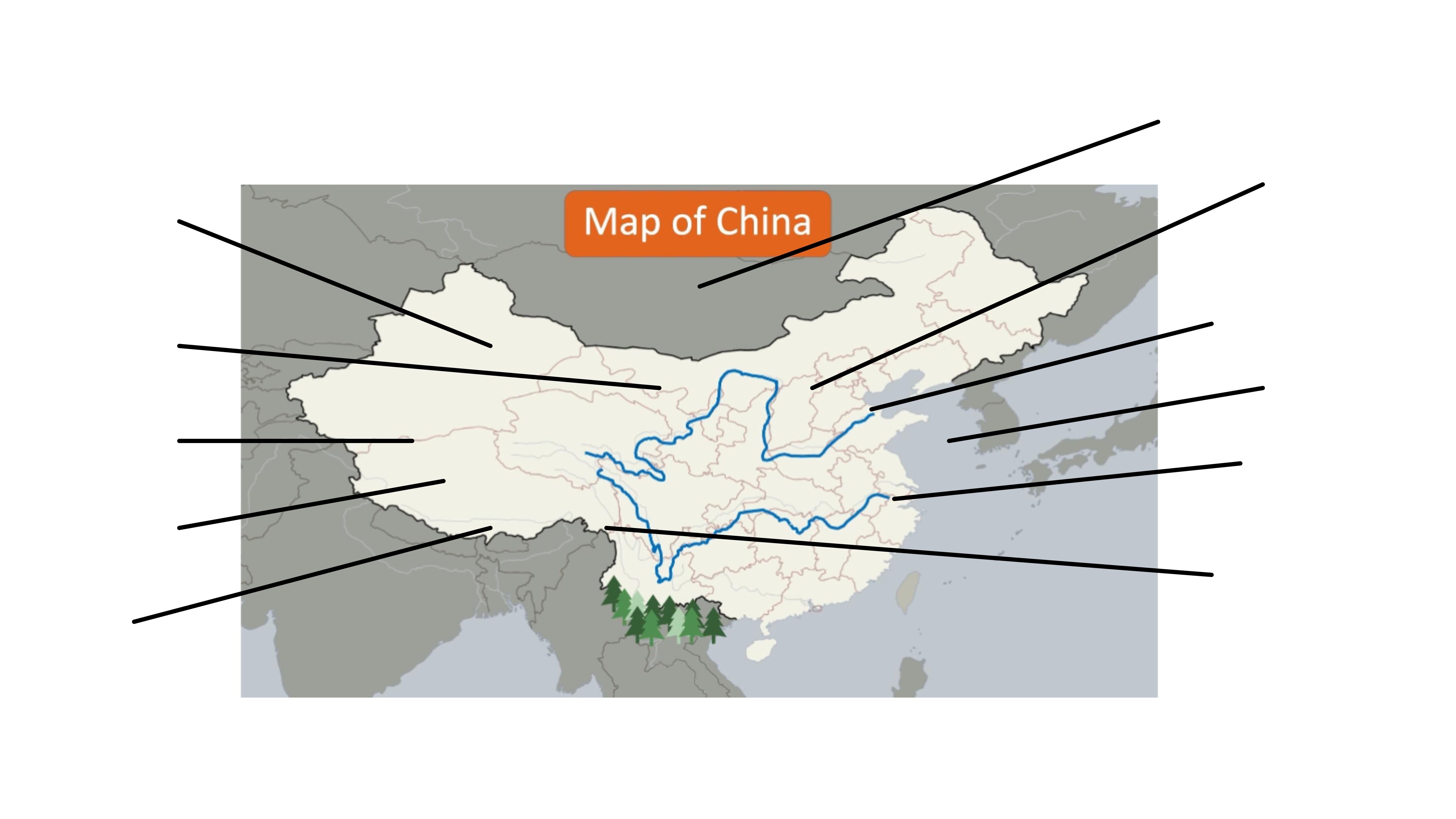
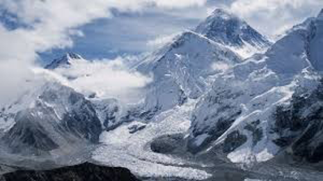
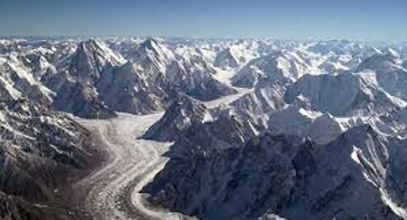
| roof of the world”, “the Third Pole”, and the “Asian water tower” | The Tibetan Plateau |
| The TibetanPlateau is not only tallest | in the world, but also the largest. |
| The TibetanPlateau is surrounded | by the highest peaks in the Himalaya, Pamir, and Karakoram mountain ranges. |
| Mount Everest, which is part of the Himalayas, | is the tallest mountain in the world at an astonishing 29,028 feet. |
| Two billion people in more than a dozen countries - nearly a third of the world's population | depend on rivers fed by the snow and ice of the Tibetan plateau region.” |
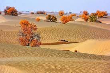
| The Taklimakan Desert is considered to be one of the most | dangerous deserts in the world. |
| To locals, the name “Taklimakan” has come to mean | “If you go in, you don’t come out.” |
| If you were planning on crossing Taklimakan desert then you had better get used to | over 100 yards tall dunes as over 85% of the desert is made up of them! |
| Living in Taklimakan desert is nearly impossible due to its lack of water. However | many oasis towns were able to thrive here, such as Kashgar and Marin |
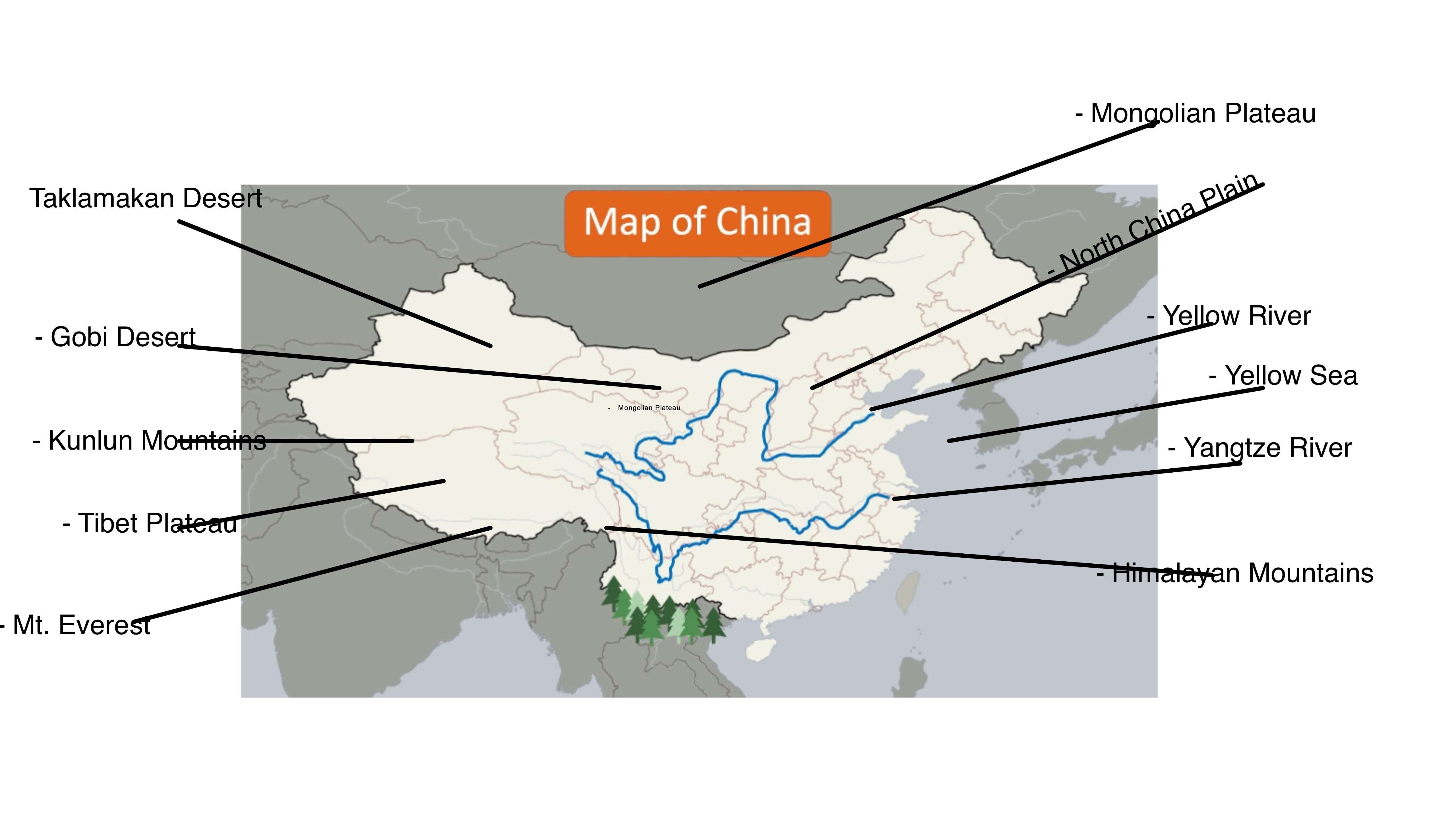
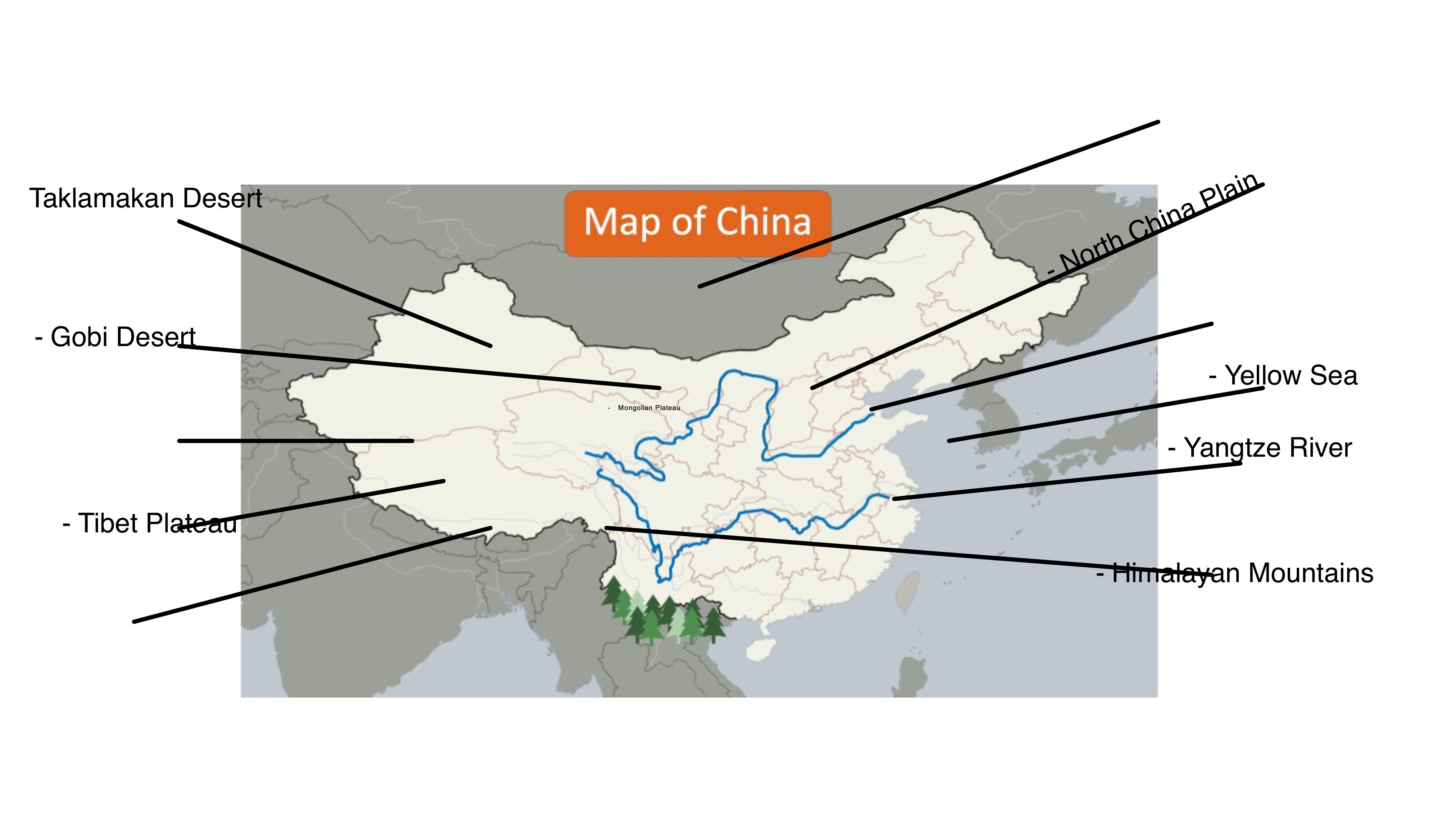
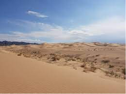
| The Gobi Desert borders the Taklamakan Desert to the east and is | one of the world’s largest deserts. |
| Most of the Gobi is not sandy | but instead contains bare rock and gravel. |
| the Gobi’s climate is one of extremes; | the temperature can change as much as 63°F in just 24 hours! |
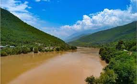
| Due to annual flooding, the Huang He (Yellow River)river provides | for a very fertile basin that has given life to millions of settlers. |
| Due to its fertile environment, North China plain has become | one of the most densely populated regions in the world |
| Emperor Qin first ordered construction of the Great Wall in northernChina | in 210 B.C.E. to protect from the invading Mongols. |
| The great winds of the Gobi Desert blow the silt into the river; the silt makes | the river appear with a yellow tint. |
| the Yellow River has also been called the “the cradle of Chinese civilization.” It was | this river that lead to one of the first great human civilizations. |
| The river has flooded over one thousand times and has brought much death and destruction to the region.The main reason the floods occur | is due to the silt that settles in the bottom of the river, thus causing water levels to rise. |
| Today Yangtze River area is home to | one-third of China’s entire population. |
| The Yangtze River aka Chang Jiang is measured to be around 3,900 miles long. This makes the Chang Jiang | the longest river in all of Asia and the third-longest in the world |
| The length of this great river has led to the basin having some of the highestlevels of | biodiversity in the entire world - ranging from dense forests to fertile wetlands. |
| over 70% of China's rice and 40% of its grain come from | the basin surrounding the Yangtze River |
| Being a sub-tropiczone the region receives plenty of rainfall as well. As a result, rice is | a major crop in pearl river region, both today and in ancient times. |
| The Pearl River gets its name from a large boulderthat rests in the river'spath .Ancient people referredto the large rock island as | a pearl due to its round, smooth appearance from years of erosion |
| the basin around the river has provided an ideal climate for silkworms to thrive. The silkworm produces the valuable silk cocoon that was highly sought after by traders in ancient times. So important was | this good that merchants from Europe and Africa traveled thousands of miles across the legendary Silk Road to obtain it. |
| The river has allowed modern people to travel easily as well, which has contributed in part to | the growth of Hong Kong as a major international city. |
| Like many other ancient civilisations, the early settlements were along the banks of | the major rivers, the Yellow River (also known as the Huang He River) in the north and the Yangtze River in the south. |
| In the seasons where the rivers flooded and in the months that followed, the soil that was left was | filled with rich minerals and nutrients that are ideal for farming. |
| Due to the size, China experiences vastly different climates.These range from | tropical to sub-arctic conditions. |
|
Image:
Yr (binary/octet-stream)
|
- Yellow River Nicknamed “China’s Sorrow”. |
| Gobi Desert- Mongolian for “waterless place” and is an overall cold desert. | |
|
Image:
Gob (binary/octet-stream)
|
- Taklamakan Desert- Nicknamed the “sea of death” |
|
Image:
Hmpng (binary/octet-stream)
|
Himalayan Mountains -his mountainrange has some of the world’s highestpeaks. |
| Tibetan Plateau- It is the largest and highest plateau in the world with an average elevation of around4,500 meters.” | |
| 1. What are some similarities and differences betweenthe Himalayan Mountains and the TibetanPlateau? | Both Himalayas and the Tibetan plateau were formed as the Indian tectonic plate collided into the Eurasian plate. The major difference between them is that Himalaya represents with high peaks, deep valleys whereas the plateau is composed of igneous and metamorphic rocks with gently rising hills and wide valleys. |
| 2. What are some similarities and differences betweenthe Yellow River and the Pearl River? | Both river provides an abundance of food for ancient people as well as those living today. Yellow River starts high up in the Tibetan Plateau and flows through the northern end of China Proper while The Pearl River has several different sources as many tributaries merge to form this great river |
| 3. What are thesimilarities and differences between the Taklamakan and Gobi Deserts? | They both are located on the northwestern frontier, share a border, are difficult places to live due to a sweltering hot climate, and both provided challenging situations for travellers along the Silk Road. Taklamakan Desert, has tall sand dunes but Gobi is stony. Most of the Gobi is not sandy but instead contains bare rock and gravel. |
Want to create your own Flashcards for free with GoConqr? Learn more.