19502150
Description
Mind Map by JOSE IGNACIO LOPEZ QUINTERO, updated more than 1 year ago
|
|
Created by JOSE IGNACIO LOPEZ QUINTERO
over 6 years ago
|
|
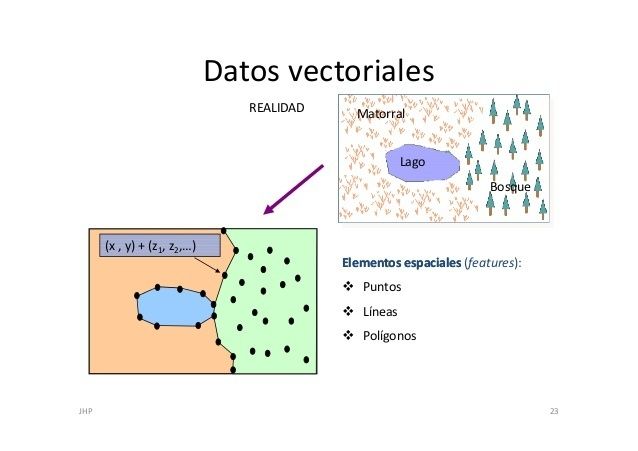
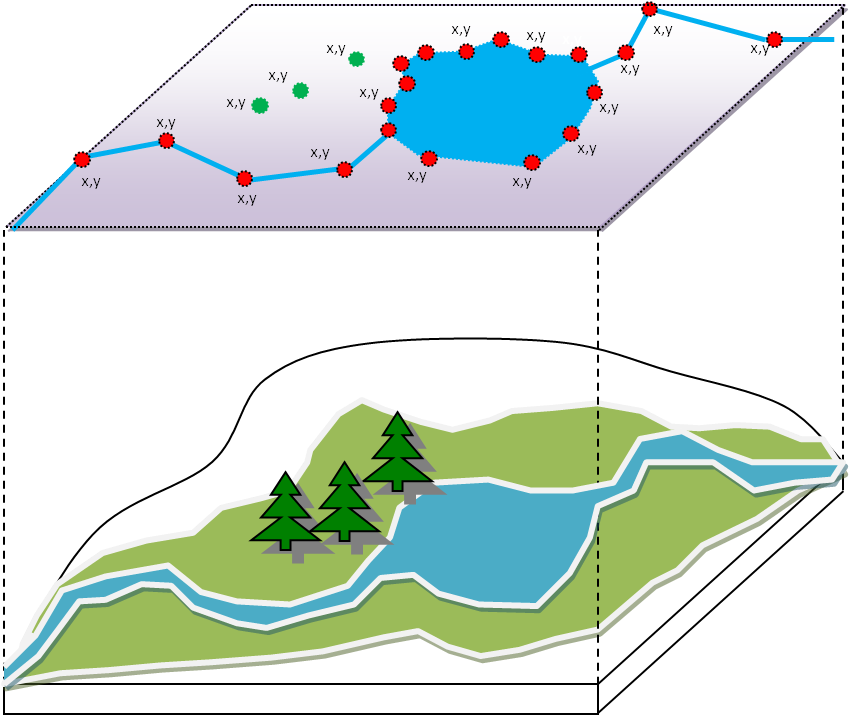
FORMATO VECTORIAL
- Representación de objetos con
puntos, lineas o polígonos
- PUNTOS: Se utilizan para
representar entidades
geográficas de interes ,
como ciudades, lugares.
Trasmiten muy poca
información
- Lineas o PoliLíneas: Son usadas para representar
o trazar ríos, caminos, vías ferreas, lineas
topográficas o curvas de nivel
- Polígonos: Son
grafícos
bidimensionales que
se utilizan para
representar áreas
en particular en la
superficie. Pueden
representar lagos,
limites de parques,
edificios.
- PUNTOS: Se utilizan para
representar entidades
geográficas de interes ,
como ciudades, lugares.
Trasmiten muy poca
información
Media attachments
Want to create your own Mind Maps for free with GoConqr? Learn more.