32918991
Description
Mind Map by MARIAGRACIA DELGADO, updated more than 1 year ago
|
|
Created by MARIAGRACIA DELGADO
over 4 years ago
|
|
KUELAP
- LOS CHACHAPOYAS
- Construyeron y habitaron
- 1000 a 1400 d.c
- 1000 a 1400 d.c
- Conjunto de curacazgos
- Organización política
- Organización política
- Monumentos
- Olán
- Yalapé
- Vira Vira
- Olán
- Construyeron y habitaron
- CRONOLOGÍA
- Construida en
- Periodo intermedio tardío
- Periodo intermedio tardío
- Funcionamiento
- Periodo horizonte tardío
- Periodo horizonte tardío
- Construida en
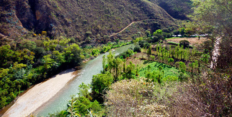
- UBICACIÓN
- Valle del rio Utcubamba
- Dpto. Amazonas, Perú
- Dpto. Amazonas, Perú
- Valle del rio Utcubamba
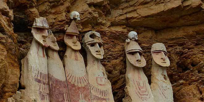
- DESCRIPCIÓN
- Dos grandes plataformas
- Estructuras
- "El Tintero"
- "El Torreón"
- "El Castillo"
- "El Tintero"
- Dos grandes plataformas
- ECONOMÍA
- Posiblemente
- Cultivaban
- Tarhui
- Achira
- Mashua
- Tarhui
- Criaban
- Llamas
- Majas
- Cuyes
- Llamas
- Cultivaban
- Posiblemente
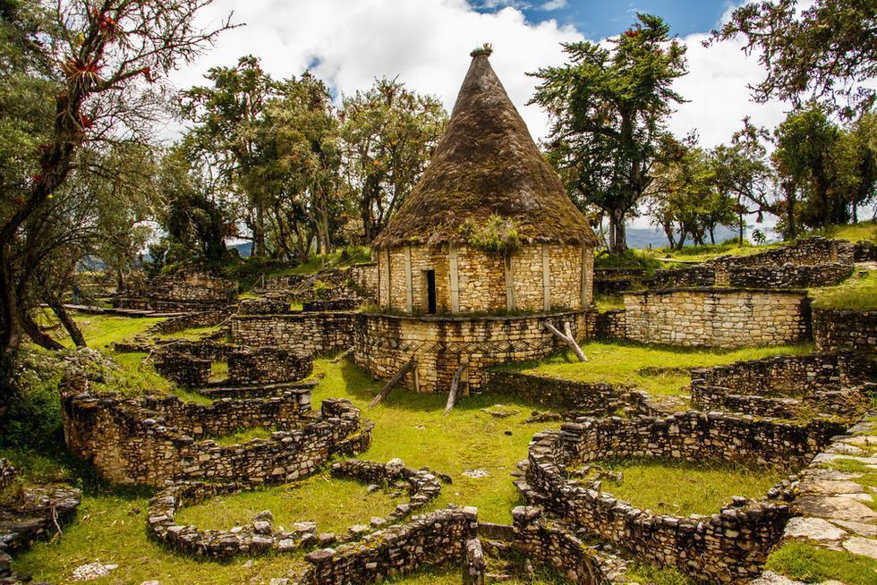
- VIVIENDAS
- Setecientos en total
- Forma circular
- Siete metros de diámetro
- Forma circular
- Setecientos en total
- ARQUITECTURA
- Principal material
- Piedra caliza sin pulir
- Piedra caliza sin pulir
- Principal material
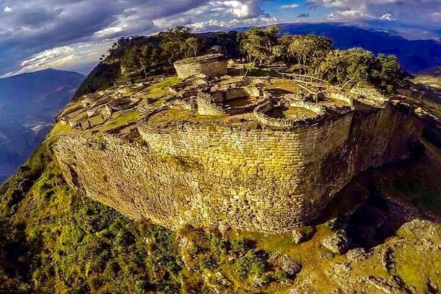
- ¿QUÉ ES?
- Conjunto arqueológico
- Más importante
- De la selva montañosa
- De la selva montañosa
- Más importante
- Conjunto arqueológico
Media attachments
Want to create your own Mind Maps for free with GoConqr? Learn more.