216688
Descrição
Mapa Mental por sophie.norrington, atualizado more than 1 year ago
|
|
Criado por sophie.norrington
mais de 10 anos atrás
|
|
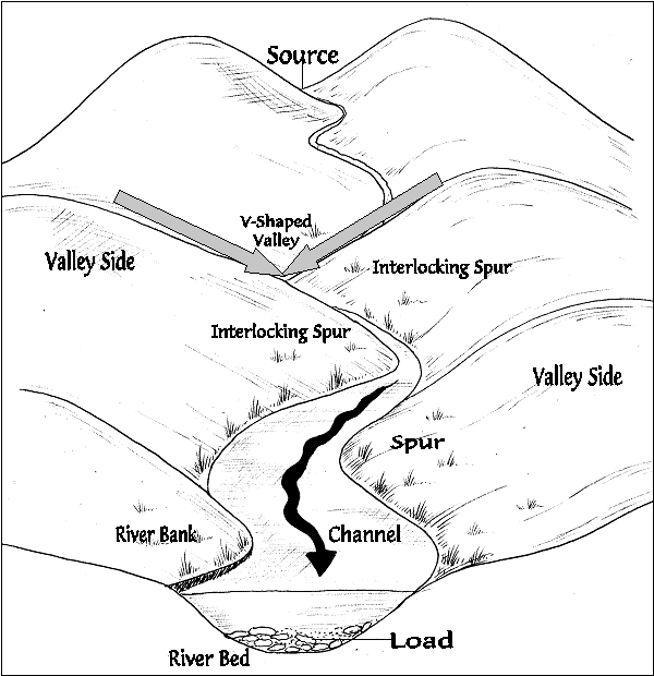
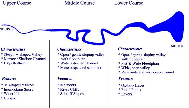
River Landforms: The V-shaped valley
- A valley eroded by a river into a V shape
- interlocking spur: ridges of land around which the river winds
- lower course: an area of the river close to the mouth. The land is very flat
- Weathering: how animals, plants and the weather breaks down rock
- Upper course: an area of a river close to the source. The land is very hilly
- Transportation: the movement of eroded material by sea, ice the wind and rivers
Anexos de mídia
Quer criar seus próprios Mapas Mentais gratuitos com a GoConqr? Saiba mais.