
Mapa mental
River Landforms
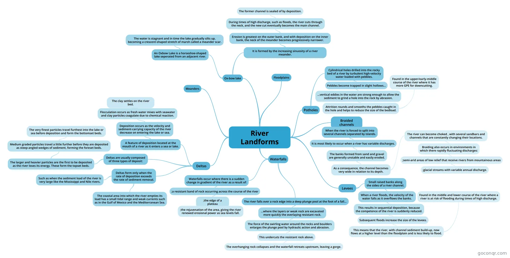
Mind map: River landforms
Conteúdo do mapa
River Landforms
Meanders
Floodplains
Waterfalls
- Waterfalls occur where there is a sudden change in gradient of the river as a result of:
- ;a resistant band of rock occurring across the course of the river
- ;the edge of a plateau
- ;the rejuvenation of the area, giving the river renewed erosional power as sea levels fall.
- ;the edge of a plateau
- ;a resistant band of rock occurring across the course of the river
- The river falls over a rock edge into a deep plunge pool at the foot of a fall...
- ...where the layers or weak rock are excavated more quickly the overlaying resistant rock.
- The force of the swirling water around the rocks and boulders enlarges the plunge pool by hydraulic action and abrasion.
- This undercuts the resistant rock above.
- The overhanging rock collapses and the waterfall retreats upstream, leaving a gorge.
- This undercuts the resistant rock above.
- The force of the swirling water around the rocks and boulders enlarges the plunge pool by hydraulic action and abrasion.
- ...where the layers or weak rock are excavated more quickly the overlaying resistant rock.
- Waterfalls occur where there is a sudden change in gradient of the river as a result of:
Potholes
- Cylindrical holes drilled into the rocky bed of a river by turbulent high-velocity water loaded with pebbles.
- Pebbles become trapped in slight hollows...
- ...vertical eddies in the water are strong enough to allow the sediment to grind a hole into the rock by abrasion.
- Attrition rounds and smooths the pebbles caught in the hole and helps to reduce the size of the bedload.
- Found in the upper/early-middle course of the river where it has more GPE for downcutting.
- Attrition rounds and smooths the pebbles caught in the hole and helps to reduce the size of the bedload.
- ...vertical eddies in the water are strong enough to allow the sediment to grind a hole into the rock by abrasion.
- Pebbles become trapped in slight hollows...
- Cylindrical holes drilled into the rocky bed of a river by turbulent high-velocity water loaded with pebbles.
Ox-bow lake
- An Oxbow Lake is a horseshoe-shaped lake seperated from an adjacent river.
- The water is stagnant and in time the lake gradually silts up, becoming a crescent-shaped stretch of marsh called a meander scar.
- It is formed by the increasing sinuosity of a river meander.
- Erosion is greatest on the outer bank, and with deposition on the inner bank, the neck of the meander becomes progressively narrower.
- During times of high discharge, such as floods, the river cuts through the neck, and the new cut eventually becomes the main channel.
- The former channel is sealed of by deposition.
- During times of high discharge, such as floods, the river cuts through the neck, and the new cut eventually becomes the main channel.
- Erosion is greatest on the outer bank, and with deposition on the inner bank, the neck of the meander becomes progressively narrower.
- An Oxbow Lake is a horseshoe-shaped lake seperated from an adjacent river.
Braided channels
- When the river is forced to split into several channels separated by islands.
- It is most likely to occur when a river has variable discharges.
- The banks formed from sand and gravel are generally unstable and easily eroded.
- As a consequence, the channel becomes very wide in relation to its depth.
- The river can become choked , with several sandbars and channels that are constantly changing their locations.
- Braiding also occurs in environments in which there rapidly fluctuating discharges:
- ;semi-arid areas of low relief that receive rivers from mountainous areas
- ;glacial streams with variable annual discharge.
- ;semi-arid areas of low relief that receive rivers from mountainous areas
- Braiding also occurs in environments in which there rapidly fluctuating discharges:
- The river can become choked , with several sandbars and channels that are constantly changing their locations.
- As a consequence, the channel becomes very wide in relation to its depth.
- The banks formed from sand and gravel are generally unstable and easily eroded.
- It is most likely to occur when a river has variable discharges.
- When the river is forced to split into several channels separated by islands.
Deltas
- A feature of deposition located at the mouth of a river as it enters a sea or lake.
- Deposition occurs as the velocity and sediment-carrying capacity of the river decrease on entering the lake or sea.
- Flocculation occurs as fresh water mixes with seawater and clay particles coagulate due to chemical reaction.
- The clay settles on the river bed.
- Flocculation occurs as fresh water mixes with seawater and clay particles coagulate due to chemical reaction.
- Deposition occurs as the velocity and sediment-carrying capacity of the river decrease on entering the lake or sea.
- Deltas form only when the rate of deposition exceeds the rate of sediment removal.
- Such as when the sediment load of the river is very large like the Mississippi and Nile rivers.
- The coastal area into which the river empties its load has a small tidal range and weak currents such as in the Gulf of Mexico and the Mediterranean Sea.
- Deltas are usually composed of three types of deposit:
- The larger and heavier particles are the first to be deposited as the river loses its energy. These form the topset beds.
- Medium graded particles travel a little further before they are deposited as steep-angled wedges of sediment, forming the foreset beds.
- The very finest particles travel furthest into the lake or sea before deposition and form the bottomset beds.
- Medium graded particles travel a little further before they are deposited as steep-angled wedges of sediment, forming the foreset beds.
- The larger and heavier particles are the first to be deposited as the river loses its energy. These form the topset beds.
- A feature of deposition located at the mouth of a river as it enters a sea or lake.
Levees
- Small raised banks along the sides of a river channel.
- When a river floods, the velocity of the water falls as it overflows the banks.
- This results in sequential deposition, because the competence of the river is suddenly reduced.
- Subsequent floods increase the size of the levees.
- This means that the river, with channel sediment build-up, now flows at a higher level than the floodplain and is less likely to flood.
- Found in the middle and lower course of the river where a river is at risk of flooding during times of high discharge.
- This means that the river, with channel sediment build-up, now flows at a higher level than the floodplain and is less likely to flood.
- Subsequent floods increase the size of the levees.
- This results in sequential deposition, because the competence of the river is suddenly reduced.
- When a river floods, the velocity of the water falls as it overflows the banks.
- Small raised banks along the sides of a river channel.
Informações
- Descrição
- Mapa Mental sobre River Landforms, criado por l3wis.t em 09-01-2015.
- Criado por
- l3wis.t
- Visualizações
- 2
- Avaliação