
Karteikarten
Rivers
Karten in diesem Stapel (56)
- 1Drainage basinArea of land that is drained by a river and its tributaries.
- 2WatershedRidge of high land that separates one drainage basin from another.
- 3River dischargeThe volume of water that is carried by a river at a given point.
- 4VelocityThe speed that the water in the river is moving at.
- 5GradientHow steep the slope that a river is flowing on. The steeper the slope, that faster the river should flow.
- 6Turbulent flowThe type of flow that occurs where the riverbed is rough. As the water flows, it is mixed and thrown around. It is important for erosion and transportation.
- 7Drainage patternThe overall layout of a river and its tributaries on an area.
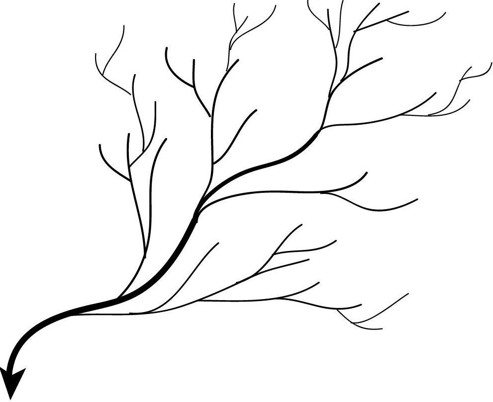
- 8Dendritic drainage patternDrainage pattern that resembles a tree in Winter.Develops on gently sloping land. Eg River Shannon.
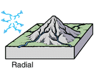
- 9Radial drainage patternStreams drain outwards in all directions, away from a high central point. Eg the Twelve Pins in Co. Mayo.
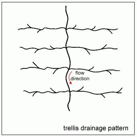
- 10Trellised drainage patternDrainage pattern where tributaries join the main river at right angles, in a ridge and valley landscape or in glaciated valleys. Eg. River Lee
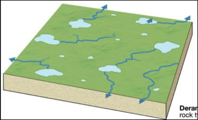
- 11Deranged drainage patternDrainage pattern that has a chaotic appearance. Rivers run in random patterns creating small lakes. This is associated with marshy or boggy lowlands, and glaciated landscapes. Eg. Monaghan
- 12Dendritic drainage pattern
- 13Radial drainage pattern
- 14Trellis drainage pattern
- 15Deranged drainage pattern
- 16ErosionA collection of processes that wear away the landscape and transport a load to another location.
- 17Hydraulic actionErosion caused by the force of moving water.
- 18CavitationA form of hydraulic action that takes place when air bubbles in the water collapse sending out tiny shockwaves.
- 19AbrasionWhen the river uses the force of its load to erode.
- 20AttritionA way of eroding the rivers load through small collisions between the particles of the load.
- 21SolutionChemical weathering of the rock, whereby soft rocks are dissolved by the water in the river.
- 22Vertical erosionErosion that is active in the youthful stage of a river, making the valley deeper.
- 23Lateral erosionErosion that is active in the mature and old age stage of the river, making the river channel and valley wider.
- 24Headward erosionErosion that is active upstream of the rivers source, lengthening the river in an upstream direction.
- 25LoadThe various materials which are transported by the river
- 26SolutionSlightly acidic water in the river dissolves soluble minerals in the rock, transporting them as solution.
- 27SuspensionThe lightest particles of the load are carried along in the flow of the river without settling.
- 28SaltationParticles of sand, gravle and small stones are picked up by the water, carried forward only to be dropped to the riverbed. Particles hop downstream.
- 29TractionThe largest stones and boulders are rolled and dragged along the riverbed.
- 30BedloadThe load the river moves along its bed by saltation or traction.
- 31AlluviumThe general term for sorted sediments (sand, clay and silt) that are deposited in layers (strata) by rivers.
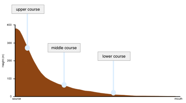
- 32Long profileShows how a rivers gradient changes as it flows from its source to its mouth.
- 33Base levelThe level below which a river cannot erode vertically. This may be sea level or where a river flows into a lake or reservoir.
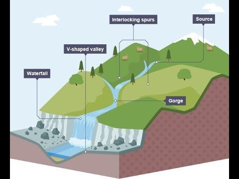
- 34Youthful/Upper courseIn this stage, the gradient is steep, the river channel is narrow and erosion is the dominant process.
- 35Youthful/Upper course
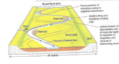
- 36Mature/Middle courseThe river has more energy and volume in this stage. The gradient is gentler and the river course has become deeper. Vertical erosion gives way to lateral erosion.
- 37Mature/Middle course
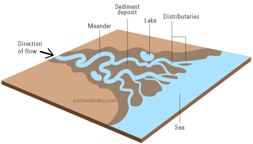
- 38Old/Lower CourseVolume of water is at its greatest in this stage. River channel is deep and wide. While there is some lateral erosion, deposition is the dominant process.
- 39Old/Lower Course
- 40Long profile
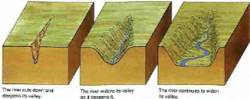
- 41V-shaped valley
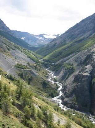
- 42V-shaped valley
- 43Waterfall
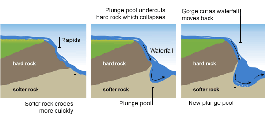
- 44Waterfall
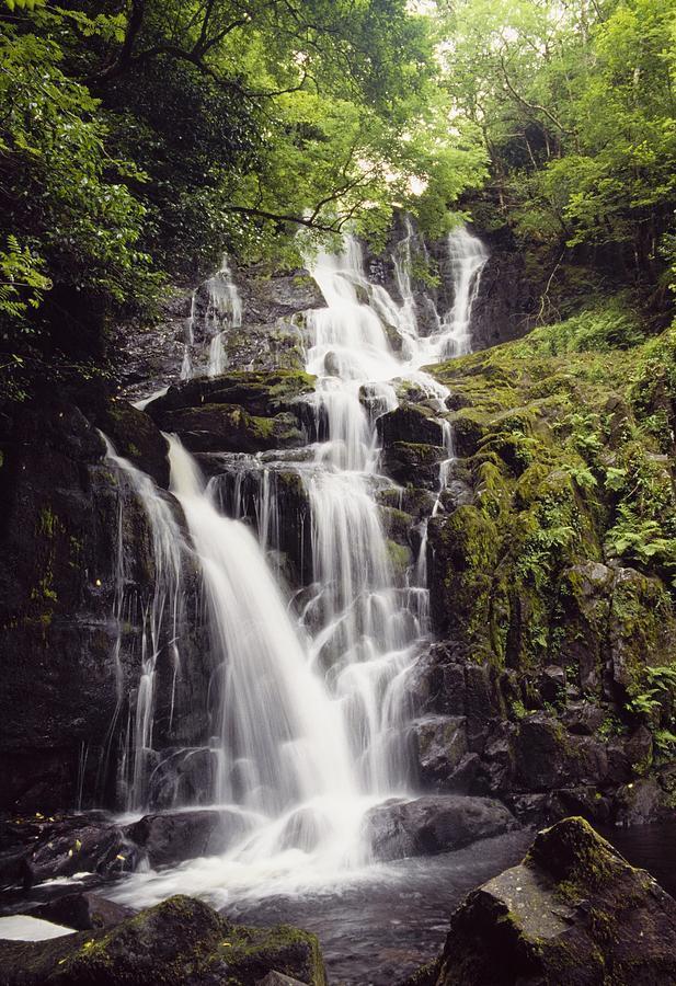
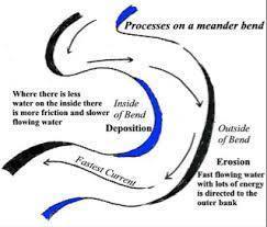
- 45Meanders
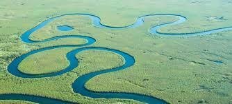
- 46Meanders
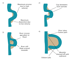
- 47Ox-bow lake
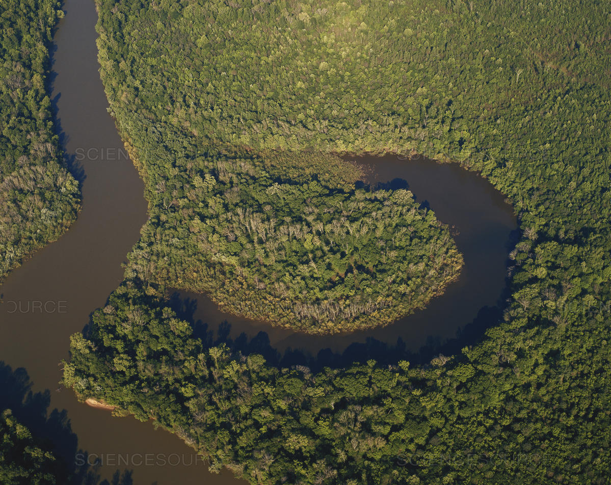
- 48Oxbow lake
- 49SourceThe place where a river starts.
- 50TributarySmall river that joins the main river.
- 51ConfluenceThe point where a tributary joins the main river.
- 52MouthWhere the river goes into the sea.
- 53Flood plain
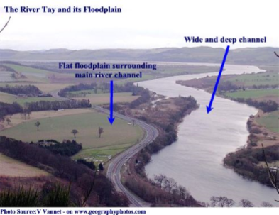
- 54Flood plain
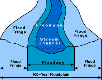
- 55Flood plainThe area around a river that's prone to flooding.
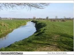
- 56Levee
Informationen
- Beschreibung
- Key words and definitions for LC Geog
- Erstellt von
- Laura O' Sullivan
- Aufrufe
- 40
- Tags
- Bewertung