
Karteikarten
Geography Skills
Karten in diesem Stapel (13)
- 1What are EastingsThe vertical lines are called Eastings on area and grid reference
- 2What are NorthingsHorizontal lines are called northings on area and grid referencings.
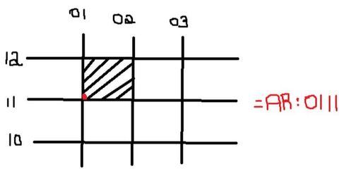
- 3How do you work out Area ReferenceThis is the four digit reference.
The dot is in the bottom left corner - 4How do you work out Grid Reference?has six numbers.
the point is somewhere in the square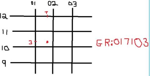
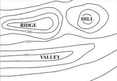
- 5what are contour lines?it is the value between the contour lines. when lines are evenly spaced then it is a constant slop.when the lines are closer together it means that there is a steep slop.when the line are far apart it means that it is a flat area
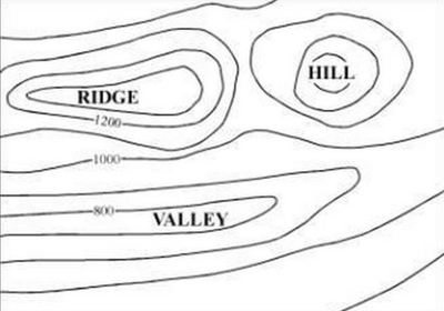
- 6what is Contour interval?
- 7what are some rules for climate statistic charts?find the annual range
annual average rainfall
range
rainfall on the left temperature on the right - 8how do you find the annual range?subtract the smallest value from the largest value from the months
- 9how do you find the annual average rainfall?is the average rainfall for the year. Add up all the average monthly rain together.
- 10how to find the range?t find the range subtract the smallest value from the largest value
- 11where is the temperature mean't to go?temperature on the right, on a line graph. place the points in the middle of all the squares. join the points together in a smooth line
- 12where does rainfall go on a graph?rainfall on the left. Column graph
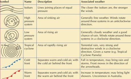
- 13what are troughs and ridges?they are both marked by a dashed line on a synoptic chart. A ridge occurs when a high pressure system is between 2 low pressure systems. A trough occurs when an area of low pressure extends between 2 high pressure systems. often brings rain
Informationen
- Beschreibung
- 9 Geography Karteikarten am Geography Skills , erstellt von Bronte Simpson am 25/05/2015.
- Erstellt von
- Bronte Simpson
- Aufrufe
- 14
- Bewertung