
Karteikarten
JC Geography Plate tectonics flash cards pictures
Karten in diesem Stapel (10)
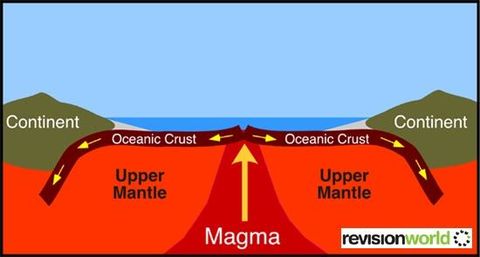
- 1—Constructive Plates
Pull Apart
Creates new crust
Usually underwater
Mid Ocean Ridge
American/Eurasian plate
Magma cools & hardens
Basalt - 2—Destructive Plates
Destroys crust
Plates collide/crash into each other
Ocean trench
Heavier plate pushed into mantle
Volcanic mountain ranges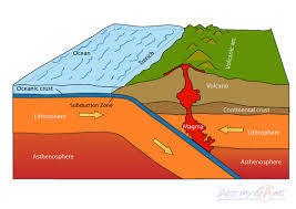
- 3—Mid Atlantic ridge
Underwater mountain range
Constructive plates
American/Eurasian
Volcanic islands (Iceland)
16,000km long
Basalt rock
Taller than Mt Everest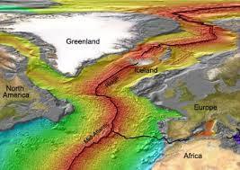
- 4—Earth's Structure
Crust; outside 10-70km thick
Mantle; under crust, semi molten rock called magma
Core; nickel& iron, solid, over 5,000 degrees.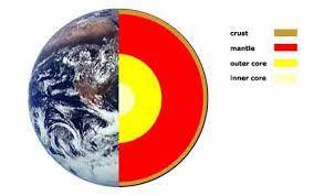
- 5—Plates collide/slip past each other
Release of energy (tremors)
(A)Focus; Point of contact
(C)Epicenter; On surface directly above focus.
(D)Fault line; Boundary between plates.
Aftershocks; small tremors after main quake.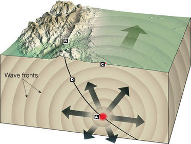
- 6—Volcano
Plates separate
Cone; Shape of mountain
Crater; Lava escapes here
Vent; How magma gets to crater
Magma Reserve: Where magma is stored.
Lava: Magma on surface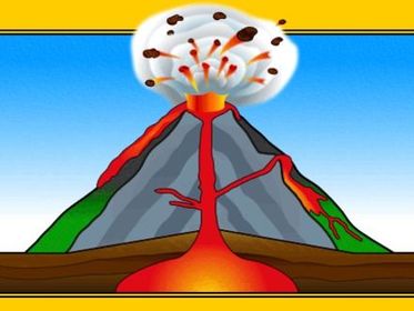
- 7—Fold Mts
Destructive plates (collide).
Light plates buckle up.
Andes, Rockies, Himalayas
Indian & Eurasian plate
Tallest Mts in world
Alpine Fold most recent
Armorican Fold (Ireland)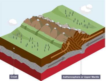
- 8—Tsunami
Earthquake out at sea.
Large wave made by tremors.
Very destructive
Japan 2011
Eurasian/Pacific plates collide
Gets taller near shore
Travels over 800km per hour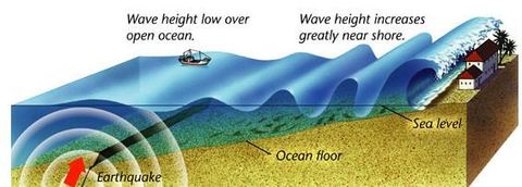
- 9—Pangaea
Large landmass.
Theory of continental drift.
Plates moved by convection currents.
Very slow movement.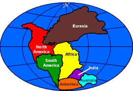
- 10—Seismograph
Machine used to MEASURE tremor strength.
A RICHTER SCALE is a descriptive scale used to describe its force.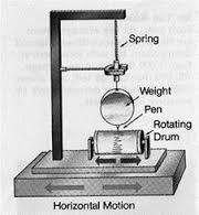
Informationen
- Beschreibung
- JC Geography Plate tectonics
- Erstellt von
- Steven Morgan · Mär 2017
- Aktualisiert
- 31 Mär 2020
- Aufrufe
- 58
- Tags
- Bewertung