
Mindmap
Case Study: Cliff Collapse - Holderness
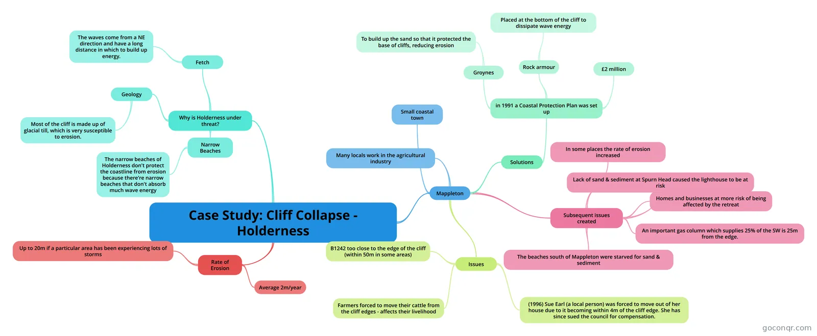
Mind map: case study cliff collapse Holderness
Inhalt der Mindmap
Case Study: Cliff Collapse - Holderness
Why is Holderness under threat?
- Geology
- Most of the cliff is made up of glacial till, which is very susceptible to erosion.
- Fetch
- The waves come from a NE direction and have a long distance in which to build up energy.
- Narrow Beaches
- The narrow beaches of Holderness don't protect the coastline from erosion because there're narrow beaches that don't absorb much wave energy
- Geology
Rate of Erosion
- Average 2m/year
- Up to 20m if a particular area has been experiencing lots of storms
Mappleton
- Small coastal town
- Many locals work in the agricultural industry
- Issues
- B1242 too close to the edge of the cliff (within 50m in some areas)
- Farmers forced to move their cattle from the cliff edges - affects their livelihood
- (1996) Sue Earl (a local person) was forced to move out of her house due to it becoming within 4m of the cliff edge. She has since sued the council for compensation.
- Solutions
- in 1991 a Coastal Protection Plan was set up
- Groynes
- To build up the sand so that it protected the base of cliffs, reducing erosion
- Rock armour
- Placed at the bottom of the cliff to dissipate wave energy
- £2 million
- Groynes
- in 1991 a Coastal Protection Plan was set up
- Subsequent issues created
- In some places the rate of erosion increased
- The beaches south of Mappleton were starved for sand & sediment
- Lack of sand & sediment at Spurn Head caused the lighthouse to be at risk
- Homes and businesses at more risk of being affected by the retreat
- An important gas column which supplies 25% of the SW is 25m from the edge.
Informationen
- Beschreibung
- Geography Mindmap am Case Study: Cliff Collapse - Holderness, erstellt von danthomas1 am 27/05/2013.
- Erstellt von
- danthomas1
- Aufrufe
- 235
- Tags
- Bewertung