
Mindmap
Fluvial deposition
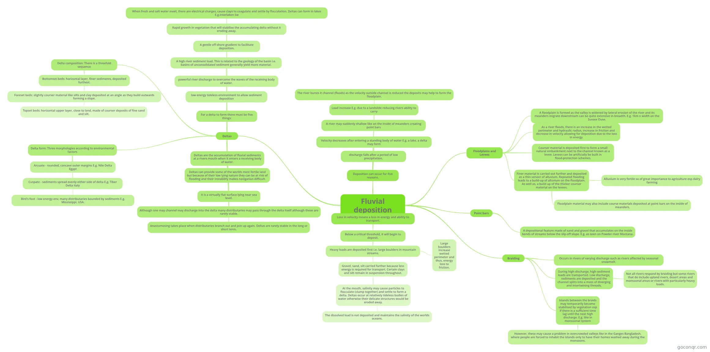
Mind map: Fluvial deposition
Inhalt der Mindmap
Fluvial deposition
Loss in velocity means a loss in energy and ability to transport.
- Below a critical threshold, it will begin to deposit.
- Heavy loads are deposited first i.e. large boulders in mountain streams.
- Large boulders increase wetted perimeter and thus, energy loss to friction.
- Gravel, sand, silt carried further because less energy is required for transport. Certain clays and silt remain in suspension throughout.
- At the mouth, salinity may cause particles to flocculate (clump together) and settle to form a delta. Deltas occur at relatively tideless bodies of water otherwise their delicate structures would be eroded away.
- The dissolved load is not deposited and maintains the salinity of the worlds oceans.
- Heavy loads are deposited first i.e. large boulders in mountain streams.
- Below a critical threshold, it will begin to deposit.
Deposition can occur for five reasons.
- discharge falls after a period of low precipitation.
- Velocity decreases after entering a standing body of water E.g. a lake, a delta may form
- A river may suddenly shallow like on the inside of meanders creating point bars
- Load increase E.g. due to a landslide reducing rivers ability to carry
- The river bursts it channel (floods) as the velocity outside channel is reduced the deposits may help to form the floodplain.
Floodplains and Levees
- A floodplain is formed as the valley is widened by lateral erosion of the river and its meanders migrate downstream can be quite extensive in breadth. E.g. 1km n width on the Sussex Ouse.
- As a river floods, there is an increase in the wetted perimeter and hydraulic radius, increase in friction and decrease in velocity allowing for deposition due to the loss in energy.
- Courser material is deposited first to form a small natural embankment next to the channel known as a levee. Levees can be artificially be built in flood-protection schemes.
- Finer material is carried out further and deposited as a thin veneer of alluvium. Repeated flooding leads to a build-up of alluvium on the floodplain. As well as, a build up of the thicker courser material on the levees.
- Alluvium is very fertile so of great importance to agriculture esp dairy farming
- Floodplain material may also include course materials deposited at point bars on the inside of meanders.
Point bars
- A depositional feature made of sand and gravel that accumulates on the inside bends of streams below the slip-off slope. E.g. as seen on Powder river Montana.
Braiding
- Occurs in rivers of varying discharge such as rivers affected by seasonal snowmelt.
- During high-discharge, high-sediment loads are transported. Low discharge, sediments are deposited and the channel splits into a mass of diverging and intertwining threads.
- Not all rivers respond by braiding but some rivers that do include upland rivers, desert areas and monsoonal areas or rivers with particularly heavy loads.
- Islands between the braids may temporarily become stabilised by vegetation esp if there is a sufficient time lag until the next high discharge. E.g. like in monsoonal system
- However, these may cause a problem in overcrowded valleys like in the Ganges Bangladesh, where people are forced to inhabit the islands only to have their homes washed away during the monsoons.
Deltas
- Deltas are the accumulation of fluvial sediments at a rivers mouth when it enters a receiving body of water.
- Deltas can provide some of the worlds most fertile land but because of their low lying nature they can be at risk of flooding and their instability makes navigation difficult.
- It is a virtually flat surface lying near sea level.
- Although one may channel may discharge into the delta many distributaries may pass through the delta itself although these are rarely stable.
- Anastomosing takes place when distributaries branch out and join up again. Deltas are rarely stable in the long or short term.
- For a delta to form there must be five things:
- low energy tideless environment to allow sediment deposition
- powerful river discharge to overcome the waves of the receiving body of water.
- A high river sediment load. This is related to the geology of the basin i.e. basins of unconsolidated sediment generally yield more material.
- A gentle off-shore gradient to facilitate deposition.
- Rapid growth in vegetation that will stabilise the accumulating delta without it eroding away.
- When fresh and salt water meet, there are electrical charges, cause clays to coagulate and settle by flocculation. Deltas can form in lakes E.g.Interlaken Sw
- Delta composition: There is a threefold sequence
- Bottomset beds: horizontal layer, finer sediments, deposited furthest.
- Foreset beds: slightly courser material like silts and clay deposited at an angle as they build outwards forming a slope.
- Topset beds: horizontal upper layer, close to land, made of courser deposits of fine sand and silt.
- Foreset beds: slightly courser material like silts and clay deposited at an angle as they build outwards forming a slope.
- Bottomset beds: horizontal layer, finer sediments, deposited furthest.
- Delta form: Three morphologies according to environmental factors
- Arcuate - rounded, concave outer margins E.g. Nile Delta Egypt
- Cuspate - sediments spread evenly either side of delta E.g. Tiber Delta Italy
- Bird's foot - low energy env, many distributaries bounded by sediments E.g. Mississippi, USA.
Informationen
- Beschreibung
- Undergraduate Physical Geography (Hydrosphere) Mindmap am Fluvial deposition, erstellt von Sharondeep am 09/04/2014.
- Erstellt von
- Sharondeep
- Aufrufe
- 31
- Tags
- Bewertung
Mehr zu River Erosion, Transportation and Deposition