
Mindmap
Rivers
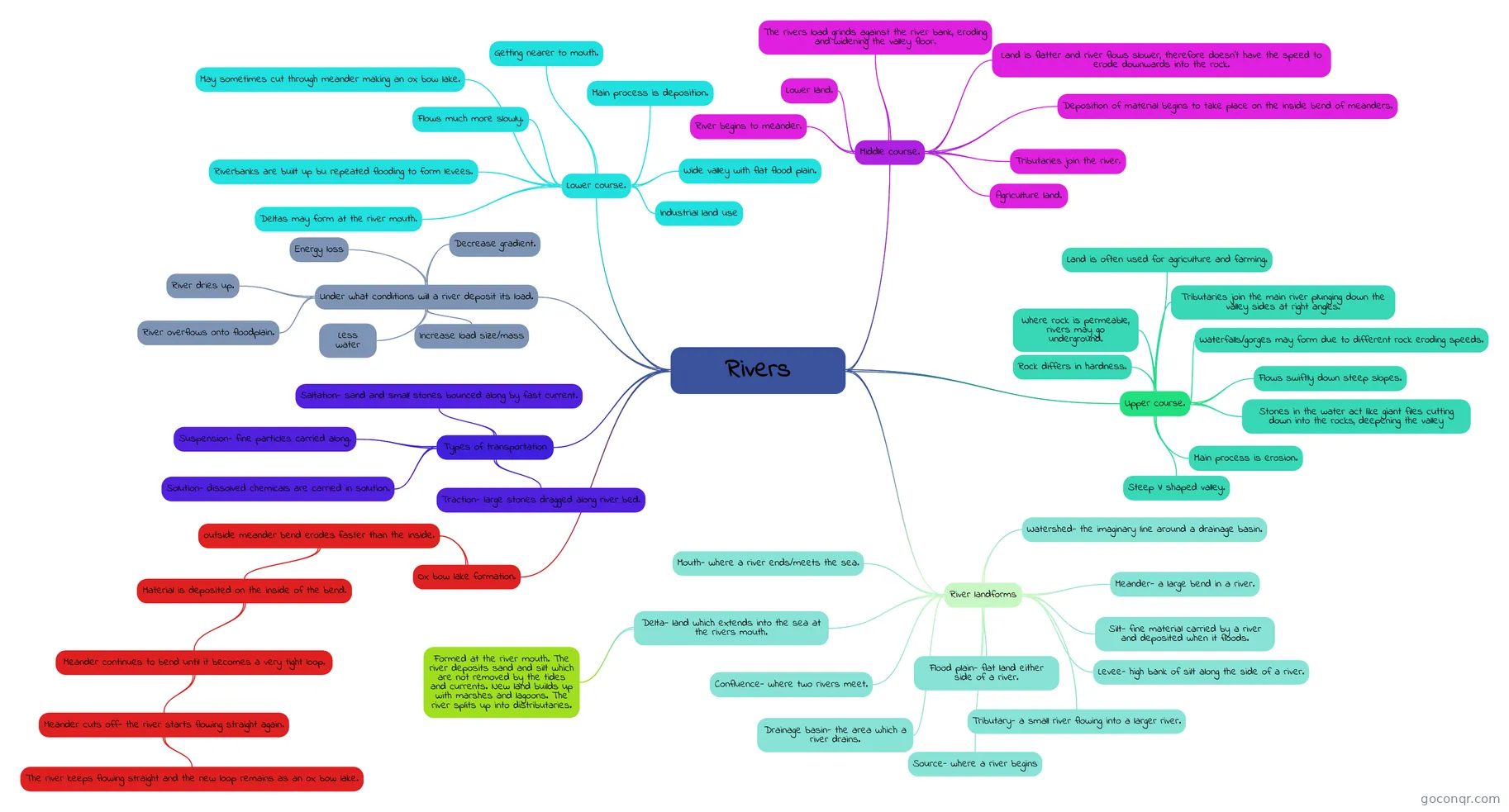
Mind map: Rivers
Inhalt der Mindmap
Rivers
River landforms
- Meander- a large bend in a river.
- Levee- high bank of silt along the side of a river.
- Silt- fine material carried by a river and deposited when it floods.
- Flood plain- flat land either side of a river.
- Delta- land which extends into the sea at the rivers mouth.
- Formed at the river mouth. The river deposits sand and silt which are not removed by the tides and currents. New land builds up with marshes and lagoons. The river splits up into distributaries.
- Confluence- where two rivers meet.
- Tributary- a small river flowing into a larger river.
- Drainage basin- the area which a river drains.
- Watershed- the imaginary line around a drainage basin.
- Source- where a river begins
- Mouth- where a river ends/meets the sea.
Upper course.
- Main process is erosion.
- Flows swiftly down steep slopes.
- Stones in the water act like giant files cutting down into the rocks, deepening the valley
- Tributaries join the main river plunging down the valley sides at right angles.
- Steep V shaped valley.
- Rock differs in hardness.
- Waterfalls/gorges may form due to different rock eroding speeds.
- Where rock is permeable, rivers may go underground.
- Land is often used for agriculture and farming.
Middle course.
- Land is flatter and river flows slower, therefore doesn't have the speed to erode downwards into the rock.
- The rivers load grinds against the river bank, eroding and widening the valley floor.
- Deposition of material begins to take place on the inside bend of meanders.
- Lower land.
- Tributaries join the river.
- River begins to meander.
- Agriculture land.
Lower course.
- Getting nearer to mouth.
- Flows much more slowly.
- Main process is deposition.
- Wide valley with flat flood plain.
- Riverbanks are built up bu repeated flooding to form levees.
- May sometimes cut through meander making an ox bow lake.
- Deltas may form at the river mouth.
- Industrial land use
Types of transportation
- Traction- large stones dragged along river bed.
- Saltation- sand and small stones bounced along by fast current.
- Suspension- fine particles carried along.
- Solution- dissolved chemicals are carried in solution.
Ox bow lake formation.
- outside meander bend erodes faster than the inside.
- Material is deposited on the inside of the bend.
- Meander continues to bend until it becomes a very tight loop.
- Meander cuts off- the river starts flowing straight again.
- The river keeps flowing straight and the new loop remains as an ox bow lake.
- Meander cuts off- the river starts flowing straight again.
- Meander continues to bend until it becomes a very tight loop.
- Material is deposited on the inside of the bend.
- outside meander bend erodes faster than the inside.
Under what conditions will a river deposit its load.
- Decrease gradient.
- Increase load size/mass
- Energy loss
- River dries up.
- River overflows onto floodplain.
- Less water
Informationen
- Beschreibung
- Mindmap am Rivers, erstellt von Emily Witherington am 30/05/2017.
- Erstellt von
- Emily Witherington
- Aufrufe
- 0
- Bewertung