
Karteikarten
The Philippines case study - World at risk

Karten in diesem Stapel (7)
- 1The Philippines - general/background informationThe Philippines is an island arc (a curved chain of volcanic islands located at a tectonic plate margin, typically with a deep ocean trench) in southern Asia consisting of over 7,000 islands. It is situated on a tropical storm belt and sits on a destructive plate boundary ( Eurasian plate sub-ducting under The Philippines plate). it is considered a poor country with most of the population living on the coast of the islands. It is a hazard hotspot as it is prone to more than 6 hazards.
- 2Typhoons/cyclones/tropical storms/hurricanesThe Philippines receives on average about 10 cyclones a year. They develop over the Pacific Ocean and move westwards over the islands.
Typhoon Xangsane in 2006 was a type 4 typhoon in Manila. It left the city without power for 2 weeks, distorted homes and buildings. Triggered landslides and caused flooding.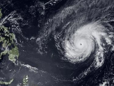
- 3VolcanoesSince the Philippines sits on a destructive plate boundary. the Philippines has one famous volcano- Mount Pinatubo.
Mount Pinatubo erupted in June 1991 which was considers one of the worlds largest volcano eruptions. People were evacuated, it killed 350, 77 of which died in lahars as a result from the eruption, it also triggered landslides. Damages were considered to cost about $710 million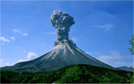
- 4EarthquakesWhen the Eurasian plate and the Philippines plate 'lock' together building pressure. Once this pressure becomes too much the plates jerk past each other causing earthquakes. The philippines receives on average about 10-21 earthquakes a year.
In July 1990 in Luzan island had a 7.7 earthquake which killed 1,621 people, more than 3,000 people were injured. Impacts included landslides, liquefaction(strength and stiffness of a soil is reduced by earthquake shaking causing it to give the ground to look 'split' open) and infrastructure damages.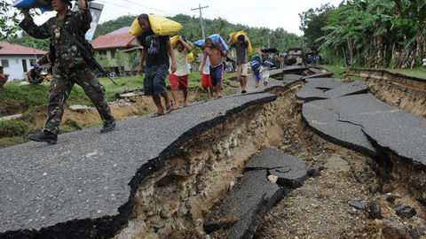
- 5DroughtsDrought occurs during an el Nino year or if the rain season did not provide enough water to last during the dry season
Between 1900-2012 there was 8 drought events, which killed 8 and effected about 6,553,207people. it costed about $64.3 million in damages ( mainly due to crop failure)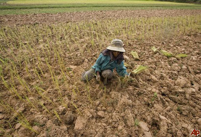
- 6Landslidesdue to lots of rainfall in a short period of time in steep sloped areas landslides can occur.
Physical reasons for landslides: young volcanic soil is not strong and stable which means it is prone to landslides, La Nina brings periods of unseasonal long rainfall
Human Reasons for landslides: An increase in deforestation means there is less roots to hold the soil together. In 50 years logging has increased so dramatically that the amount of trees were originally 5omillion hectares to only 600,000 hectares of trees, people are replacing the trees with short rooted trees such as coconut trees which do not hold the soil together well.
February 2006 in Leyte a landslide was caused by 2 weeks of abnormally large amounts of rain. It managed to destroy a village 9km long and buried a school. more than 100 deaths and more than 1,000 missing.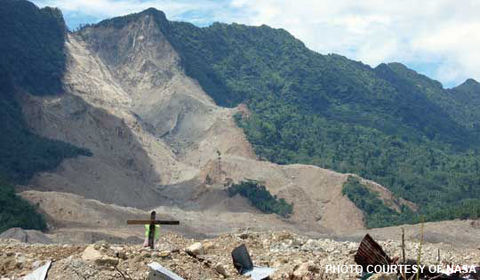
- 7Floodsstorm surges and sea rise create costal flooding.
major floods occurred in lowland areas around Manila in 1970 and in recent years causing crop failure in the major rice growing regions.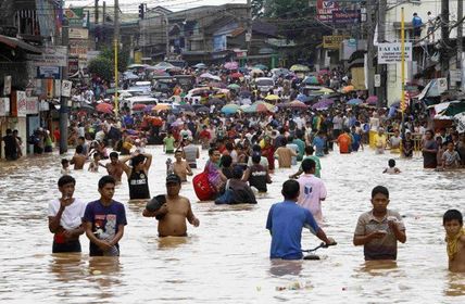
Informationen
- Beschreibung
- The Philippines case study is crucial for AS exam. It is used as an example for a 'Hazard Hotspot' country and is used alongside California case study. The philippines is to be considered one of the most likely case studies to come up in the 2016 AS exam.
- Erstellt von
- Ariel Benson
- Aufrufe
- 76
- Tags
- Bewertung