
Apuntes
Volcanic eruptions case studies
Contenido del apunte (5)
Página 1
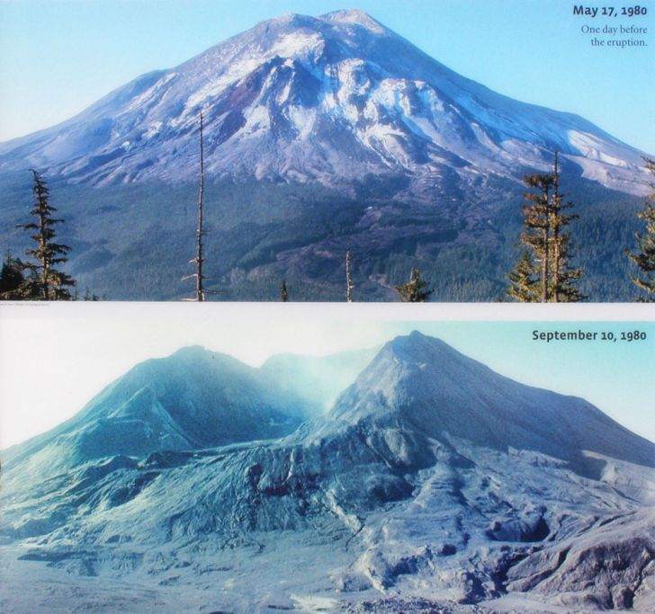
The Mount St. Helens eruption 1980
General info:
May 18th 1980, 8:32 am
Washington State, Cascade Mountain Range
5.1 richter earthquake triggered the eruption
Biggest landslide recorded as North side of the volcano collapsed
Juan de Fuca plate and North American Plate, destructive
Environmental impacts
Lahars covered a huge area, created by melting ice
Ash and lahars blocked rivers killing all fish and water life
Spirit Lake was filled with mud which killed 12 million salmon
Sediment carried in the Columbia river
400m blown off the top of the mountain
One mile 500m deep horse-shoe shaped crater was created
Every plant and animal within 25km North was killed, 7,000 animals die
Every tree within 30km was flattened
Economic Impacts
Ash destroyed crops and roads
Nuée ardente destroyed forests and logging camps, timber industry was destroyed costing $300 million
250 homes, 47 bridges, 15 miles of railways and 185 miles of highway destroyed
Ash damage to farmers crops and machinery totalled £100 million
15cm of ash fell, traffic chaos and flights cancelled
Tourists no longer visited the area
Removing ash cost over $1 million in the town of Yakima
Social Impacts
63 people killed by poisonous gas, 90% outside of evacuation zones
Telephone and electricity cut
Removing ash took 10 weeks
Immediate response
National guard helicopter saved 130 people
Overall 198 people saved
National guard provided clean water, food and medicine
The federal government provided gas masks
Ash was cleared from towns such as Yakima in 3 days
Long term responses
10 million trees were replanted
1 million tonnes of ash was removed from roads
The Toulte, Columbia and Coulitz rivers were dredged
Warning plans were improved
Bridges were rebuilt with wider spans
Predication and management
There were warnings
From March onwards there had been minor earthquakes
Small ash and steam eruptions during 2 month prior to the eruption
Bulge on the North side of the volcano showed magma was moving up into the chamber
Tilt meters used to monitor changing size
Used past eruptions to identify danger zones
Emergency helicopters and aeroplanes were on hand
Landscape had changed so much so maps were no longer accurate
Compensation given to farmers worth $70 million
Página 2
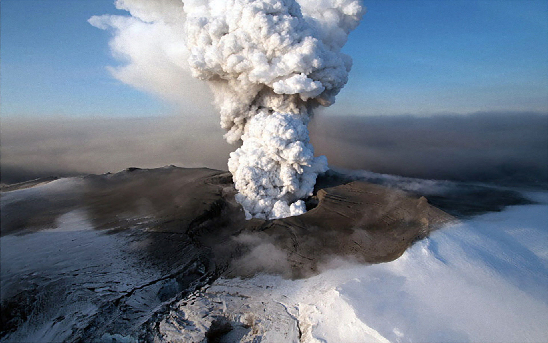
Eyjafjoll (Icelandic) volcanic eruption 2010
General info:
South of the Arctic Circle
North American Plate (West) and Eurasian Plate (East)
Divergent plate boundary
Mid-Atlantic Ridge runs through
Eruption:
20th March begun eruption, main eruption occurred 19th April
Fissure eruption, lava flow more dominant of the West and East side
Ash plume rose to 11,000m
Ash was fine grained, 24% is under 10um, the same as aerosol
Ash distributed by high velocity jet streams
150km thick ice cap melted which caused flooding to Iceland
700 people evacuated
Destroyed main Route 1 road
Roads bulldozed to allow the flash flood water to reach the sea
Fine ash silted rivers, blockages a year on
Government paid to dredge rivers or allow them to flood to c
Página 3
Mount Pinatubo eruption 1991 Philippians
General info:
•Island of Luzon,
South East Asia
•Eurasian and Philippine Plate
•Luzon volcanic arch
About the eruption:
•April 2nd 1991, hypothermal explosion, this caused steam
and small ash clouds reaching up to 800m and rumbling
•Temporary seismic station at Sitto Yamut placed three days
after steam, recorded 223 high frequency volcanic earthquakes during operation
of the first 24 hours
•April 6th-June 6th, 26 to 178 HFVQ's a day
•Earthquakes caused by fracturing rocks and moving fault
structures
•June 7th, daily incidence of earthquakes 1,500-2,000, and
low frequency earthquakes begun to occur indicating magma rising to the surface
•Earthquakes became shallower
•June 9th, harmonic tremors recorded indicating intensified
seismic activities
•7:30am June 3rd first ash ejection which lasted for 30
minutes
•June 4th, more ash ejections at short intervals
•9th June, eruption occurred at 6am
•Pyroclastic flows reached 4-5km away from the volcano
•Philvolcs issued Level 5 alert at 3:15pm
•Eruption lasted for a week
•5 billion cubic meters of ash and debris ejected
Environmental
•Water contaminated
•Volcanic ash blown in all directions over hundreds of miles, reaching Russia and North America
•Lahars causes severe river bank erosion
•Global cooling caused by the ash in the atmosphere of 0.5 degrees
Economic
•650,000 workers lost jobs
•$700 million damages
•Houses and bridges destroyed needed replacing and Manila airport had to close
•Farmland destroyed by falling ash and pumice making it unusable for years
•1991 harvest was destroyed; this caused jobs to be lost
•Provinces of Zambales, Pampanga and Tarlac worst hit, 86,000 hectare of agricultural lands damaged
•Ninoy Aquino airport closed for four days
•Heavy rainfall from Typhoon Yunga causes buildings to collapse
•Road links were destroyed
Social
•847 killed, 300 killed by collapsing roofs, 100 killed from lahars, the rest killed from disease
•58,000 people had to be evacuated from a 30km radius of the volcano to shanty towns in Manila
•1.2 million people lost their homes
•No electricity and telephone
•Metro Manila, dust blanketed the metropolises suspending classes for a few days
•Americans forced to evacuate Clark Air Base, ash rendered runways useless
Response- Prediction, before eruption (Seismology prediction management case study)
•No monitoring until the 3rd April, but seismometers put in place
•75,000 people evacuated due to accurate predictions
•United states geological service helped predict the disaster
•Warning signs such as gas and steam looked for
•Evacuation camps prepared for refugees
Response-Prevention, during eruption
•Alert systems put in place to warn of eruption
•USA air force helicopters helped in evacuation
Response- After eruption
• By December 1991, 61 municipalities and two cities declared as calamity areas
•Government shelters
•Placed strategies for long term aid and disease control in
evacuations prepared for
•Long term and short term aid organised especially from the
Red Cross and the United States
Página 4
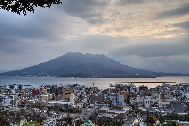
Mt Sakurajima mangement
Kagoshima government has put several measures in place to manage the risks of the volcano
Japan sets and adopts the international standard of Volcanic Hazard mangement
Law and enforcement
Laws enacted to allow all phases of prevention, mitigation, preparedness, emergency response, recovery and rehabilitation to be enacted.
Disaster Countermeasures Basic Act (1961)
Erosion Control Act (1897)
Disaster relief Act (1947)
Building Standard Law (1950)
Landslide Prevention Act (1958)
River Act (1964)
Act on Special Measures for Large-Scale Earthquakes 1978)
Public Information
Television and radio channels, newspapers and public education campaigns
Evacuation routes
Do's and don'ts
Information helpline
Assures the public that they are in control of the situation
Government holds widely publicised annual disaster properness drills
Prior to the 5th February eruption, 16th January excursus was held
Preparing
Japanese Meteorological Agency and Kyoto University Sakurajima monitors the volcanoes activity
Information is widely available to the public
Managing the effects
Yet to cause damage to Kagoshima city due to the preventative measures in place, but preparations are in place just in case
The Basic Disaster Management Plan prepared by the Central Disaster Management Council in accordance with the Disaster Countermeasures Basic Act
Duties assigned to the Government, public corporation and local government
Describes the sequence of disaster counter measures
Página 5
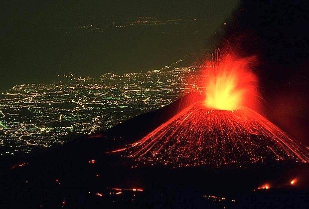
Mount Etna eruptions
Most active volcano in Europe
25% of Sicily's population live on the slopes of Mt Etna
Decade volcano
Since 2001 Mt Etna has had an eruption every year
Destructive plate boundary, seduction of African plate beneath the Eurasian plate
About the eruptions
Wide range of eruptions, minor to major
Strato volcano
Basaltic lava, low viscosity so can travel large distances
Fissures open up in the volcano releasing lava from a variety of locations
Seismic activity can pose a threat
Eruptive columns of ash, significant problems to settlements and agriculture
Risk of flank collapse which can cause a landslide
Risk of phreatic eruptions
Impacts
77 confirmed deaths, recently there have been few fatalities
2002 eruption destroyed the tourist station at Piana Provenzana and Rifugio Sapienza
29th July 2002, Catania airport closed for 4 days causing winter tourist industry to be affected
Ash reached as far as Libya
magma thrown over 100m into the air
Linguaglossa was evacuated , over 100 people had to leave there homes
Skiining areas wee damaged by lava flow, a restruant was destroyed and ski lifts
Hundreds of hectres of forest was destroyed
300 family businesses losrt earnings
Responses
Tried to divert lava flow when it threatened the scientific monitoring area
Taramac cracked to try and create a channel to direct lava flow away from Linguaglossa
A medical clinic ship was sent to Catina
Tax breaks were given to the people affected
£5.6 million was given in immediate inacial assistance
Management
Catina section of the institiuto Nazionale di Geofisica e Vulcanoliga has monitored the volcaneo for 20 years with permantant remote sensors
Data is continuously recorded
Geochemical monitoring programmes test gas/fluid emmisions to help predict new eruptions
Información
- Descripción
- A level (Earth Hazards) Geography Apunte sobre Volcanic eruptions case studies , creado por Megan Stacey-Edwards el 04/12/2016.
- Creado por
- Megan Stacey-Edwards · dic 2016
- Actualizado
- 18 ene 2017
- Visitas
- 2
- Valoración