
Apuntes
Earthquake case studies
Contenido del apunte (6)
Página 1
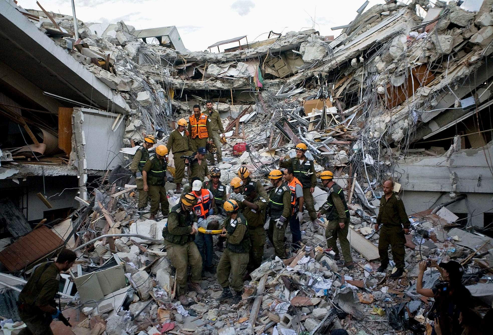
The Haiti Earthquake 2010
General info
Occurred on January 12th 2010
The earthquake measured 7 richter
Haiti is a Small island
Capital: Port-au-Prince
Plate tectonics:North America plate and Caribbean plate, conservative boundary
HDI: 145th of 169
More than 70% of people in Haiti were living on less than per day
90% homes are built with cheap materials such as cement, earth, clisse, bricks or stone
Primary Impacts
316,000 killed
1 million homeless
3 million people affected
250,000 homes destroyed
Transport links damaged
60% of government buildings damaged and the presidential palace collapsed
19 million cubic metres of rubble and debris
80% of schools in Port-au-Prince destroyed or damaged
96 UN peacekeepers died in the earthquake
Main road linking Port-au-Prince with Jacmel remained blocked ten days after the earthquake
Control tower at Toussaint L'Ouverture International Airport suffered major damage
Secondary Impacts
1/5 of Haitians lost jobs
Hospitals and morgues became full vey quickly
Cholera outbreak: sickened one out of every 15 people in the country
People were living in the streets or shanty towns
Short Term Responses
$100 million in aid from the U.S.
$ 330 million in aid from the EU
810,000 people placed in camps
115,000 tents provided
1 million tarpaulin provided
Long Term Responses
Temporary schools in place
New teachers were trained
Water and sanitation was provided for 1.7 million people
Cash/food for work scheme to help the unemployed
Página 2
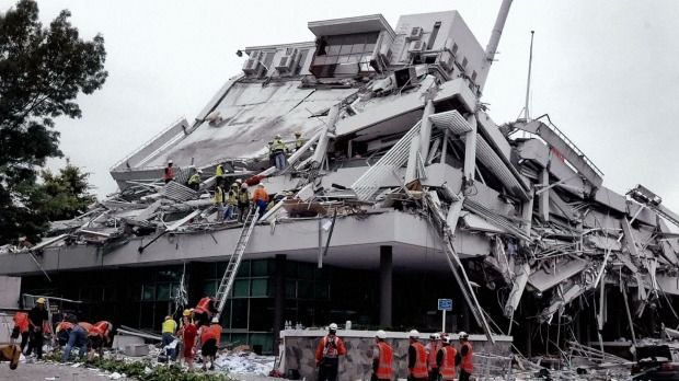
Christchurch earthquake 2011
General info
12:51, 22nd February
6.3 magnitude earthquake
Epicentre 6 miles South East of Christchurch
Shallow at 3.1 miles
Earthquake lasted for 10 seconds
Conservative plate margin, Australian plate and Pacific plate
Located on the pacific ring of fire making it vulnerable to tectonic hazards
Population of 4.4 million
Aftershock of the 2010 earthquake, however its impacts were more severe
GDP per capita, $27,700
Social impacts
181 people were killed
115 killed in the CTV building collapse
The Pyne Gould Guinness building collapse injured 18 people
2,000 people were injured
80% of the city was without electricity
People were affected mentally
Some blamed country's gay and lesbian community for causing the quake
Environmental impacts
Hundreds of kilometres of water and sewage pipes were damaged
Liquefaction caused lots of damage to roads and buildings
Part of the country longest glacier was broken off creating a large iceberg, the size of 20 football fields
3.5m tsunami waves in Tasman Lake from glacier carving
Economic impacts
50% central city buildings were severely damaged including the city cathedral which lost its spire
Businesses were put out of action for long periods causing losses of incomes
Christchurch could no longer host the Ruby World Cup matches so lost the benefits
Number of guests to hotels in Christchurch fell by 75% after the earthquake hit
Political impacts
Schools had to share classrooms
Closed 419 early childhood education centres, 215 primary schools in Slewyn, Waimakariri and Christchurch
Damage to roads made it difficult for people and emergency services to move around
Responses
Chemical toilets were provided for 30,000 residents
Areas were zoned (green, orange, white, red) to classify damage of repairs
International aid was given in the form of $6-7 million and aid workers
Overall $898 million was paid in building claims
Temporary housing and ensured all damaged housing was kept water tight
Water and sewage was restored for all residents by august
Roads and houses cleared of silt by August and 80% of roads and 50% of footpaths were repaired
Inquiry into the collapse of buildings that were deemed safe after the 2010 earthquake
Since February 2015 there have been 1240 demolitions
Management
Development of earthquake prediction systems, Geo net detects and monitors earthquakes can provide emergency services with information of an earthquake
Geo net is funded by the earthquake commission set up by the government to provide insurance and education on quake safeing
Building codes, implemented as early as 1935 and updated to the present time
Building that are older have to be reinforced, however only in the North as it was not seen as necessary in the south
National crisis management centre
Página 3
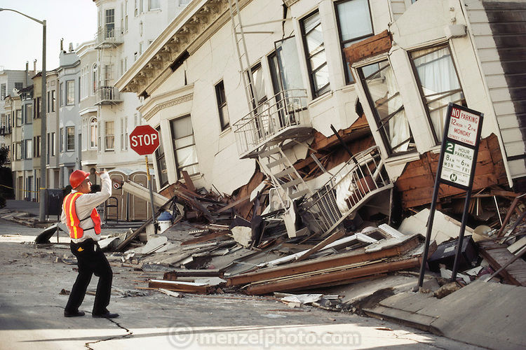
Californian earthquake 1989
General info
Northern California
October 17th at 5:04 pm
Part of the San Andreas fault system
Magnitude of 6.9
Aftershocks continued 36 hours later
Social impact
63 deaths
3,757 injuries
Sports coverage of the 1989 world series meant the earthquake was broadcast live on TV
1.4 million lost power
10,000 people were made homeless
Environmental impact
A four-year drought limited the potential of landslides
Steep terrain near the epicentre resulted in 4,000 landslides
Economic impact
12,000 homes and 2,600 businesses were damaged
Caused an estimated $6 billion in property damage
Many soft story buildings collapsed in the Marina District
59 water mains burst
Over 100 gas mains were ruptured
Political impact
Highway 17 was blocked for several weeks sue to a large landslide
Response
All but 12,000 customers had their power restored within 2 days
President George H.W. Bush signed a $1.1 billion earthquake relief package for California
Relief efforts for the bay area were a national response
Management
Building regulations passed 24 years late on soft story buildings
Cyprus freeway was rebuilt using new aseismic design and reopened 10 years later
In 1972 the state begun an earthquake strengthening programme but following budget cuts 5000 engineers were fired and the scheme was halted
Página 4
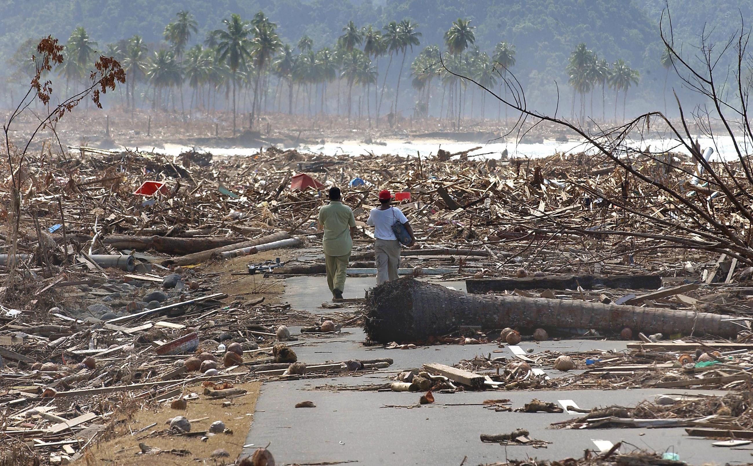
Indonesia Earthquake (Boxing Day tsunami) 2004
General info
26 December 2004
Magnitude of 9.3, 100myears worth of pressure
Earthquake lasted 3-4 minutes
Indio-Australian Plate subducting below the Eurasian Plate
Tsunami travelled at speeds up to 800km per hour
Wave increased to 15 metres in some areas.
Social impact
Overall 1.69 billion people displaced overall
Killed people in 14 different countries
Death toll over 280,000 but not all bodies recovered
Sumatra 130,000 were killed, over 30,000 missing swept out to sea
500,000 made homeless (Sumatra)
Environmental impact
Volume and nature of debris was beyond the coping capacities of the cities and towns that were affected
Salination of water bodies e.g groundwater aquifers has occurred in many of the affected countries (dead fish)
Affected the soil fertility of agricultural lands, due to salination and debris contamination, which will affect yields in the medium and long term
8 million litres of oil escaped from oil plants in Indonesia
Economic impact
80,000 houses destroyed and other infrastructure 1km away from shore (sumatra)
Lost of foreign currency through tourism especially in Thailand
Foreign visitors to Phuket dropped 80% in 2005.
An estimated 60% of Sri Lanka’s fishing fleet destroyed.
Political impact
Problems with aid distribution, not given to the right places and not the same amount given as pledged
The Thai Prime Minister Thaksin Shinawatra did so well in organising aid that he got re-elected in a landslide
Response
Over $7billion provided by governments and NGO's
5 million relocated into refugee camps
The USGS got a warning to Africa which saved lives
Red cross built 466 new homes across five islands in the maldives, provided boats and nets to fishing communities in Batticaloa and cash hand outs
The World Food Programme led these efforts and delivered 110,000 tonnes of food to the tsunami zone in the first five months of the response, enough to feed more than 2 million people.
Mangement
Warning
The tsunami early warning system now installed for the indian ocean with the help of the UN and has three operational Regional Tsunami Watch Centres (India, Indonesia and Australia)
they system cost $20 million
The pacific ocean has had a warning system for 50 year prior, with a magnitude six earthquake and over triggering warnings to scientists to investigate a tsunami threat
Education
Asian Broadcasting Union collaborated with the United Nations to run workshops on disaster risk for journalists.
Countries conducted training courses for teachers and communities on natural hazards, covering both tsunamis and tropical cyclones, and on disaster risk reduction, Indonesia has made it part of the school curriculum
Mitigation and building
Re-planting of mangroves as a buffer zone between the sea and human dwellings has commenced in several coastal areas
“Mangroves in front of settlements resulted in 8 per cent fewer casualties during the tsunami”
Close to 2 million trees have been planted around 70 villages in Aceh (province of Indonesia)
Many buildings remain close to shoreline due to tourist factors, although built taller to allow for vertical evacuation
Página 5
Japanese Tsuanmi 2011
General info
Off the Pacific coast of Tōhoku
Magnitude of 9.1
14:46 pm local time
Earthquake lasted 6 minutes
The oceanic Pacific Plate subducting under the Eurasian Plate.
Japan has a huge GDP; it was $34,000 per capita in 2011, which allows it huge leeway ion terms of planning for Earthquakes and tsunami
Social impacts
15,894 deaths
6,152 injured
2,562 people missing
Over 340,000 displaced people
4.4 million households in northeastern Japan were left without electricity and 1.5 million without water
Environmental impacts
Radiation from Fukushima
Economic Impacts
127,290 buildings totally collapsed, with a further 272,788 buildings "half collapsed", and another 747,989 buildings partially damaged
losses from the earthquake alone at US$14.5 to $34.6 billion
The World Bank's estimated economic cost was US$235 billion, making it the costliest natural disaster in world history
The yen fell sharply but recouped most of its decline several hours later
Tokyo stocks fell
10% of the fishing ports were damaged.
Political impacts
At Fukushima the subsequent tsunami disabled emergency generators required to cool the reactors
Evidence of a partial nuclear meltdown in units 1, 2 and 3
Radiation releases caused large evacuations, concern over food and water supplies
Response
A tsunami warning issued 3 minutes after the quake extended to at least 50 nations and territories, as far away as South America.
News on live television, and messages went out on Japan’s mobile network
100,000 Japanese soldiers sent out to search and rescue
Fifty-nine search and rescue experts, four medics and two sniffer dogs flew out on a private charter plane with 11 tonnes of equipment on board.
Mangement
Japan has a hazards agency, the Japanese Meteorological Agency
The Japanese government is among the best prepared in the world for disasters and has so far only made specific requests for help, such as calling for search and rescue teams.
Buildings are earthquake proof and people in Japan are trained YEARLY on the 1st of September in how to survive earthquakes
40% of Japan’s coastline has sea walls of up to 10m high to withstand incoming tsunami waves
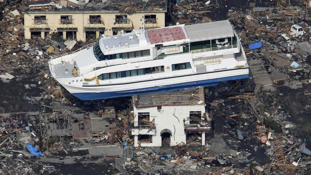
Página 6
Nepal Earthquake 2015
General info
Magnitude of 7.8
subducting India plate and the overriding Eurasia plate
11th most at risk in terms of vulnerability to an earthquake
Social impacts
8,632 dead
19,009 injured
2.8 million people were
displacedAvalanche on Mount Everest, killing 17 people, the deadliest day recorded.
More than 75,000 households saw their cooking
technology damaged or destroyed, leading to an inability
to prepare nutritious meals for their families.
40% of electricity lines and all sub stations not functional for a month
Environmental impacts
Economic Impacts
Loss equated to 25% of Nepal's GDP
700,000 homes damed
50% of bridges and narrow roads unusable due to damage and debris
Political impacts
Centuries-old buildings were destroyed at UNESCO World Heritage sites in the Kathmandu Valley, including some at the Changu Narayan Temple and the Dharahara Tower.
Response
90 percent of soldiers from the Nepalese army mobilised to worst hit areas
The Asian Development Bank (ADB) provided a USD$3 million grant to Nepal for immediate relief efforts; and up to USD$200 million for the first phase of rehabilitation.
UK gave £73 million, of which £23 million was donated by the government and £50 million was donated by the public.
UK also provided 30 tonnes of humanitarian aid and 8 tonnes of equipment
Inflatable hospitals set up by doctors without borders
Mangement
Información
- Descripción
- A level (Earth Hazards) Geography Apunte sobre Earthquake case studies, creado por Megan Stacey-Edwards el 04/12/2016.
- Creado por
- Megan Stacey-Edwards · dic 2016
- Actualizado
- 6 abr 2018
- Visitas
- 16
- Valoración