
Mind map
GEOGRAPHY PAPER 2
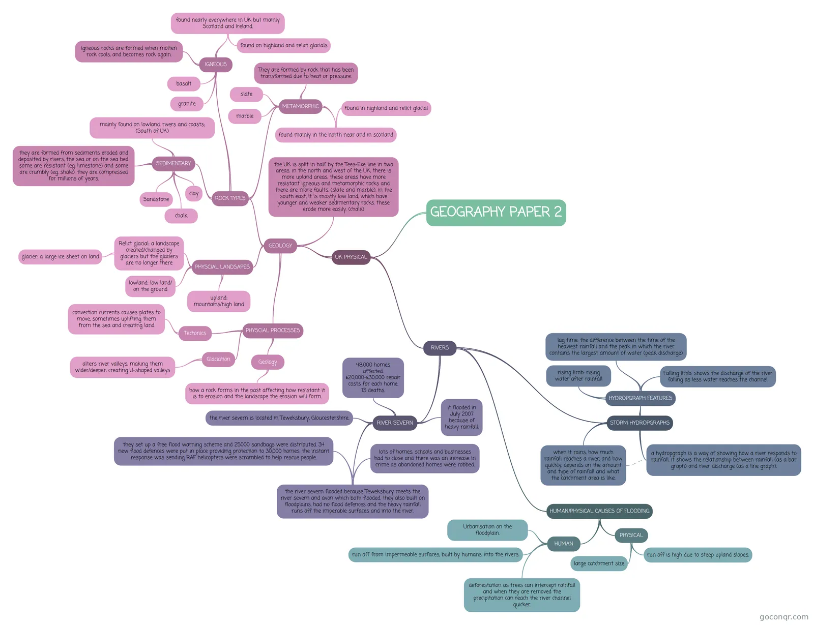
Mind map: Geography paper 2
Map content
GEOGRAPHY PAPER 2
UK PHYSICAL
- GEOLOGY
- PHYSCIAL LANDSAPES
- Relict glacial: a landscape created/changed by glaciers but the glaciers are no longer there
- glacier: a large ice sheet on land
- upland: mountains/high land
- lowland: low land/ on the ground
- Relict glacial: a landscape created/changed by glaciers but the glaciers are no longer there
- ROCK TYPES
- SEDIMENTARY
- Sandstone
- clay
- chalk
- they are formed from sediments eroded and deposited by rivers, the sea or on the sea bed. some are resistant (eg. limestone) and some are crumbly (eg. shale). they are compressed for millions of years.
- mainly found on lowland. rivers and coasts; (South of UK)
- IGNEOUS
- found nearly everywhere in UK but mainly Scotland and Ireland.
- found on highland and relict glacials
- granite
- basalt
- igneous rocks are formed when molten rock cools, and becomes rock again.
- found nearly everywhere in UK but mainly Scotland and Ireland.
- METAMORPHIC
- They are formed by rock that has been transformed due to heat or pressure.
- slate
- marble
- found mainly in the north near and in scotland
- found in highland and relict glacial
- SEDIMENTARY
- the UK is split in half by the Tees-Exe line in two areas. in the north and west of the UK, there is more upland areas, these areas have more resistant igneous and metamorphic rocks and there are more faults. (slate and marble). in the south east, it is mostly low land, which have younger and weaker sedimentary rocks. these erode more easily. (chalk)
- PHYSCIAL PROCESSES
- Tectonics
- convection currents causes plates to move, sometimes uplifting them from the sea and creating land
- Glaciation
- alters river valleys, making them wider/deeper, creating U-shaped valleys
- Geology
- how a rock forms in the past affecting how resistant it is to erosion and the landscape the erosion will form.
- Tectonics
- PHYSCIAL LANDSAPES
- RIVERS
- RIVER SEVERN
- the river severn is located in Teweksbury, Gloucestershire.
- it flooded in July 2007 because of heavy rainfall.
- the river severn flooded because Teweksbury meets the river severn and avon which both flooded. they also built on floodplains, had no flood defences and the heavy rainfall runs off the imperable surfaces and into the river.
- lots of homes, schools and businesses had to close and there was an increase in crime as abandoned homes were robbed.
- they set up a free flood warning scheme and 25000 sandbags were distributed. 34 new flood defences were put in place providing protection to 30,000 homes. the instant response was sending RAF helicopters were scrambled to help rescue people.
- 48,000 homes affected. £20,000-£30,000 repair costs for each home. 13 deaths.
- STORM HYDROPGRAPHS
- when it rains, how much rainfall reaches a river, and how quickly, depends on the amount and type of rainfall and what the catchment area is like.
- a hydropgraph is a way of showing how a river responds to rainfall. it shows the relationship between rainfall (as a bar graph) and river discharge (as a line graph).
- HYDROPGRAPH FEATURES
- rising limb: rising water after rainfall
- lag time: the difference between the time of the heaviest rainfall and the peak in which the river contains the largest amount of water (peak discharge)
- Falling limb: shows the discharge of the river falling as less water reaches the channel.
- HUMAN/PHYSICAL CAUSES OF FLOODING
- HUMAN
- Urbanisation on the floodplain.
- run off from impermeable surfaces, built by humans, into the rivers.
- deforestation as trees can intercept rainfall and when they are removed the precipitation can reach the river channel quicker.
- PHYSICAL
- run off is high due to steep upland slopes.
- large catchment size
- HUMAN
- RIVER SEVERN
- GEOLOGY
Information
- Description
- GCSE Geography Mind Map on GEOGRAPHY PAPER 2, created by Emma Whiteford on 22/11/2018.
- Created by
- Emma Whiteford
- Views
- 759
- Rating