
Mapa mental
Rivers
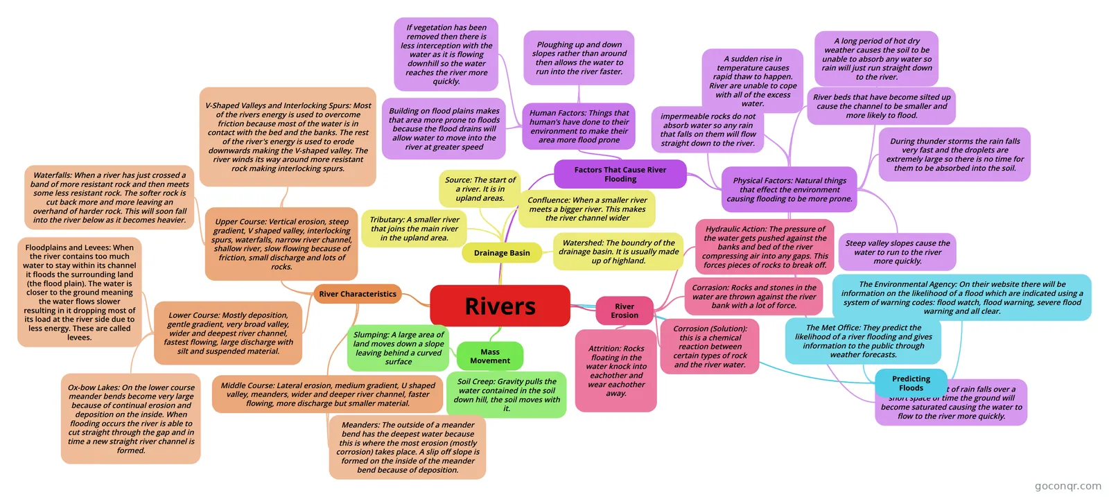
Mind map: Rivers
Conteúdo do mapa
Rivers
Drainage Basin
- Source: The start of a river. It is in upland areas.
- Confluence: When a smaller river meets a bigger river. This makes the river channel wider
- Watershed: The boundry of the drainage basin. It is usually made up of highland.
- Tributary: A smaller river that joins the main river in the upland area.
River Erosion
- Hydraulic Action: The pressure of the water gets pushed against the banks and bed of the river compressing air into any gaps. This forces pieces of rocks to break off.
- Corrasion: Rocks and stones in the water are thrown against the river bank with a lot of force.
- Corrosion (Solution): this is a chemical reaction between certain types of rock and the river water.
- Attrition: Rocks floating in the water knock into eachother and wear eachother away.
Mass Movement
- Soil Creep: Gravity pulls the water contained in the soil down hill, the soil moves with it.
- Slumping: A large area of land moves down a slope leaving behind a curved surface
River Characteristics
- Upper Course: Vertical erosion, steep gradient, V shaped valley, interlocking spurs, waterfalls, narrow river channel, shallow river, slow flowing because of friction, small discharge and lots of rocks.
- V-Shaped Valleys and Interlocking Spurs: Most of the rivers energy is used to overcome friction because most of the water is in contact with the bed and the banks. The rest of the river's energy is used to erode downwards making the V-shaped valley. The river winds its way around more resistant rock making interlocking spurs.
- Waterfalls: When a river has just crossed a band of more resistant rock and then meets some less resistant rock. The softer rock is cut back more and more leaving an overhand of harder rock. This will soon fall into the river below as it becomes heavier.
- Middle Course: Lateral erosion, medium gradient, U shaped valley, meanders, wider and deeper river channel, faster flowing, more discharge but smaller material.
- Meanders: The outside of a meander bend has the deepest water because this is where the most erosion (mostly corrosion) takes place. A slip off slope is formed on the inside of the meander bend because of deposition.
- Lower Course: Mostly deposition, gentle gradient, very broad valley, wider and deepest river channel, fastest flowing, large discharge with silt and suspended material.
- Ox-bow Lakes: On the lower course meander bends become very large because of continual erosion and deposition on the inside. When flooding occurs the river is able to cut straight through the gap and in time a new straight river channel is formed.
- Floodplains and Levees: When the river contains too much water to stay within its channel it floods the surrounding land (the flood plain). The water is closer to the ground meaning the water flows slower resulting in it dropping most of its load at the river side due to less energy. These are called levees.
- Upper Course: Vertical erosion, steep gradient, V shaped valley, interlocking spurs, waterfalls, narrow river channel, shallow river, slow flowing because of friction, small discharge and lots of rocks.
Factors That Cause River Flooding
- Human Factors: Things that human's have done to their environment to make their area more flood prone
- Building on flood plains makes that area more prone to floods because the flood drains will allow water to move into the river at greater speed
- If vegetation has been removed then there is less interception with the water as it is flowing downhill so the water reaches the river more quickly.
- Ploughing up and down slopes rather than around then allows the water to run into the river faster.
- Physical Factors: Natural things that effect the environment causing flooding to be more prone.
- impermeable rocks do not absorb water so any rain that falls on them will flow straight down to the river.
- A sudden rise in temperature causes rapid thaw to happen. River are unable to cope with all of the excess water.
- A long period of hot dry weather causes the soil to be unable to absorb any water so rain will just run straight down to the river.
- River beds that have become silted up cause the channel to be smaller and more likely to flood.
- During thunder storms the rain falls very fast and the droplets are extremely large so there is no time for them to be absorbed into the soil.
- If a large amount of rain falls over a short space of time the ground will become saturated causing the water to flow to the river more quickly.
- Steep valley slopes cause the water to run to the river more quickly.
- Human Factors: Things that human's have done to their environment to make their area more flood prone
Predicting Floods
- The Met Office: They predict the likelihood of a river flooding and gives information to the public through weather forecasts.
- The Environmental Agency: On their website there will be information on the likelihood of a flood which are indicated using a system of warning codes: flood watch, flood warning, severe flood warning and all clear.
Informações
- Descrição
- Mapa Mental sobre Rivers, criado por kelly.howell em 16-01-2014.
- Criado por
- kelly.howell
- Visualizações
- 14
- Avaliação