
Mapa mental
Rivers
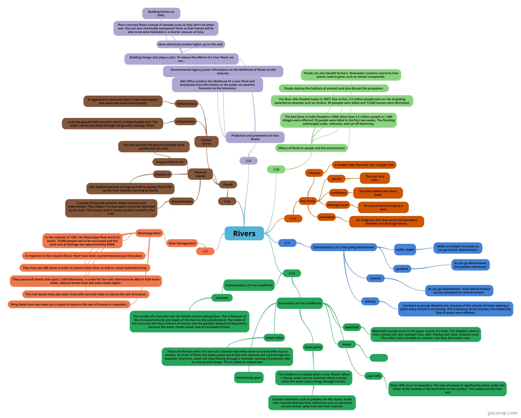
Mind map: Rivers
Conteúdo do mapa
Rivers
2.1a
- Key terms
- confluence
- The point where two rivers meet.
- drainage basin
- An area of land drained by a river.
- watershed
- An imaginary line that marks the boundary between two drainage basins.
- tributary
- a smaller river that runs into a larger river
- source
- The start of a river.
- confluence
- Key terms
2.1c
- Characteristics of a river going downstream
- width, depth
- Width and depth increases as you go further downstream.
- gradient
- As you go downstream, the gradient decreases.
- erosion
- As you go downstream, more lateral erosion occurs compared to vertical erosion.
- velocity
- Increases as you go downstream, because of the volume of water passing a point every second is increasing. This is because of less friction; this makes the flow of water more efficient.
- width, depth
- Characteristics of a river going downstream
2.1d
- Formations of river landforms
- interlocking spurs
- waterfalls
- Waterfalls usually occur in the upper course of a river. This happens when a river crosses soft, less resistant rock, after flowing over hard, resistant rock. The softer rock is eroded at a quicker rate than the harder rock.
- river cliffs
- River cliffs occur in meanders. The rate of erosion is significantly faster under the water at the outside of the bend than on the surface. This undercuts the river and
- oxbow lakes
- These are formed when the neck of a meander becomes closer to one another due to erosion. At times of flood, the water jumps out of the river channel and cuts through the meander. Overtime, water will stop flowing through a meander, leaving a freshwater lake in a horse shoe shape. This is called an oxbow lake.
- flood plains
- This landform is created when a river floods. When it floods, water carries sediment which it drops when the water loses energy through friction.
- Coarser sediments such as pebbles are left nearer to the river channel whereas finer sediments such as sand and silt are further away from the river channel.
- This landform is created when a river floods. When it floods, water carries sediment which it drops when the water loses energy through friction.
- levees
- Characteristics of river landforms
- meander
- The outside of a meander has the fastest erosion taking place. This is because of the increased velocity and depth of the river on the outside bend. The inside of the curve has the least amount of erosion and the greatest amount of deposition, because the water moves slower due to increased friction.
- meander
- Formations of river landforms
2.2a
- Floods
- Physical causes
- long periods of rain
- this will saturate the ground and flow more quickly into the river.
- cloudburst
- rain droplets become so large and fall so quickly that it fills up the river channel, bursting its banks.
- desertification
- A period of long hot weather makes soil hard and impermeable. This makes it so that water cannot be absorbed by the roots. This means that it causes surface runooff to the river.
- long periods of rain
- Human causes
- Urbanisation
- Lines the ground with concrete, which is impermeable rock. The water cannot percolate through the ground, causing a flood.
- Deforestation
- If vegetation is removed, there is less interception and water will move more quickly.
- Urbanisation
- Physical causes
- Floods
2.3
- River Management
- Mississippi River
- In the summer of 1993, the Mississippi River burst its banks. 70,000 people had to be evacuated and the total cost of damage was approximately $50M.
- In response to this massive flood, there have been countermeasures put into place.
- They have put 300 dams in order to control water flow, as well as create hydroelectricity.
- They have built levees that spans 1,600 kilometres, in order for the river channel to be able to hold more water. Natural levees have also been made higher.
- The river banks have also been lined with concrete slabs to reduce the rate of erosion.
- Wing dykes have also been put in place to balance the rate of erosion in meanders.
- Mississippi River
- River Management
2.2b
- Effects of flood on people and the environment
- The Kosi River in India flooded in 2008. More than 2.5 million people in 1,600 villages were affected. 55 people were killed in the first two weeks. The flooding submerged roads, railtracks, and cut off electricity.
- Floods destroy the habitats of animals and also disrupt the ecosystem.
- The River Nile flooded Sudan in 2007. Due to this, 3.5 million people were at risk of getting waterborne diseases such as cholera. 89 peeople were killed and 73,000 houses were destroyed.
- Floods can also benefit farmers. Riverwater contains nutrients that plants need to grow, such as nitrate compounds.
- Effects of flood on people and the environment
2.2c
- Prediction and prevention of river floods
- Met Office predicts the likelihood of a river flood and broadcasts this information to the public via weather forecasts on the television.
- Environmental Agency posts information on the likelihood of floods on the Internet.
- Building Design also plays a part. To reduce the effects of a river flood, we can...
- Move electricity sockets higher up on the wall.
- Place concrete floors instead of wooden ones so they don't rot when wet. You can also chemically waterproof them so that homes will be able to become habitable in a shorter amount of time.
- Building homes on stilts.
- Prediction and prevention of river floods
Informações
- Descrição
- GCSE Geography (Unit 2) Mapa Mental sobre Rivers, criado por Aaron . em 22-02-2017.
- Criado por
- Aaron .
- Visualizações
- 3
- Avaliação