
Mapa mental
Tweed Heads Mind Map
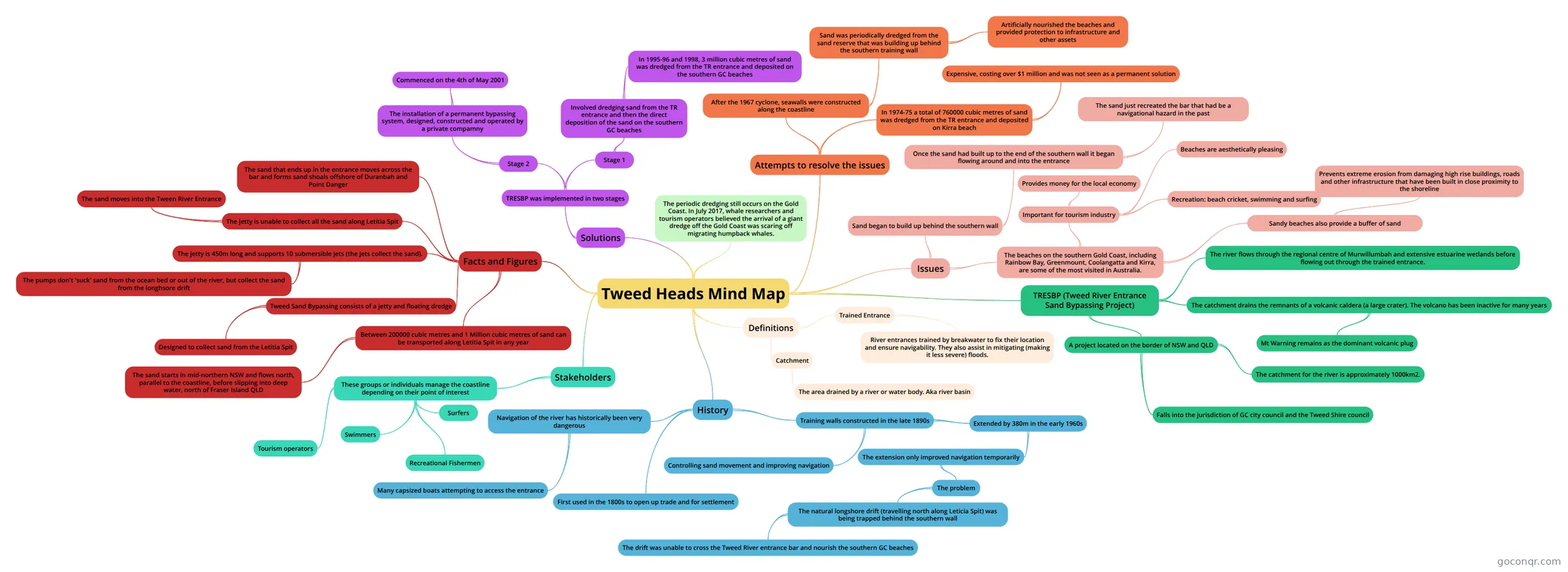
Mind map: Tweed Heads
Conteúdo do mapa
Tweed Heads Mind Map
History
- First used in the 1800s to open up trade and for settlement
- Navigation of the river has historically been very dangerous
- Many capsized boats attempting to access the entrance
- Training walls constructed in the late 1890s
- Controlling sand movement and improving navigation
- Extended by 380m in the early 1960s
- The extension only improved navigation temporarily
- The problem
- The natural longshore drift (travelling north along Leticia Spit) was being trapped behind the southern wall
- The drift was unable to cross the Tweed River entrance bar and nourish the southern GC beaches
- The natural longshore drift (travelling north along Leticia Spit) was being trapped behind the southern wall
- The problem
- The extension only improved navigation temporarily
TRESBP (Tweed River Entrance Sand Bypassing Project)
- A project located on the border of NSW and QLD
- Falls into the jurisdiction of GC city council and the Tweed Shire council
- The catchment for the river is approximately 1000km2.
- The river flows through the regional centre of Murwillumbah and extensive estuarine wetlands before flowing out through the trained entrance.
- The catchment drains the remnants of a volcanic caldera (a large crater). The volcano has been inactive for many years
- Mt Warning remains as the dominant volcanic plug
- A project located on the border of NSW and QLD
Issues
- Sand began to build up behind the southern wall
- Once the sand had built up to the end of the southern wall it began flowing around and into the entrance
- The sand just recreated the bar that had be a navigational hazard in the past
- Once the sand had built up to the end of the southern wall it began flowing around and into the entrance
- The beaches on the southern Gold Coast, including Rainbow Bay, Greenmount, Coolangatta and Kirra, are some of the most visited in Australia.
- Important for tourism industry
- Beaches are aesthetically pleasing
- Recreation: beach cricket, swimming and surfing
- Provides money for the local economy
- Sandy beaches also provide a buffer of sand
- Prevents extreme erosion from damaging high rise buildings, roads and other infrastructure that have been built in close proximity to the shoreline
- Important for tourism industry
- Sand began to build up behind the southern wall
Attempts to resolve the issues
- After the 1967 cyclone, seawalls were constructed along the coastline
- Sand was periodically dredged from the sand reserve that was building up behind the southern training wall
- Artificially nourished the beaches and provided protection to infrastructure and other assets
- Sand was periodically dredged from the sand reserve that was building up behind the southern training wall
- In 1974-75 a total of 760000 cubic metres of sand was dredged from the TR entrance and deposited on Kirra beach
- Expensive, costing over $1 million and was not seen as a permanent solution
- After the 1967 cyclone, seawalls were constructed along the coastline
Solutions
- TRESBP was implemented in two stages
- Stage 1
- Involved dredging sand from the TR entrance and then the direct deposition of the sand on the southern GC beaches
- In 1995-96 and 1998, 3 million cubic metres of sand was dredged from the TR entrance and deposited on the southern GC beaches
- Involved dredging sand from the TR entrance and then the direct deposition of the sand on the southern GC beaches
- Stage 2
- The installation of a permanent bypassing system, designed, constructed and operated by a private compamny
- Commenced on the 4th of May 2001
- The installation of a permanent bypassing system, designed, constructed and operated by a private compamny
- Stage 1
- TRESBP was implemented in two stages
Facts and Figures
- Between 200000 cubic metres and 1 Million cubic metres of sand can be transported along Letitia Spit in any year
- The sand starts in mid-northern NSW and flows north, parallel to the coastline, before slipping into deep water, north of Fraser Island QLD
- Tweed Sand Bypassing consists of a jetty and floating dredge
- Designed to collect sand from the Letitia Spit
- The jetty is 450m long and supports 10 submersible jets (the jets collect the sand).
- The pumps don't 'suck' sand from the ocean bed or out of the river, but collect the sand from the longhsore drift
- The jetty is unable to collect all the sand along Letitia Spit
- The sand moves into the Tween River Entrance
- The sand that ends up in the entrance moves across the bar and forms sand shoals offshore of Duranbah and Point Danger
- Between 200000 cubic metres and 1 Million cubic metres of sand can be transported along Letitia Spit in any year
Stakeholders
- These groups or individuals manage the coastline depending on their point of interest
- Recreational Fishermen
- Tourism operators
- Swimmers
- Surfers
- These groups or individuals manage the coastline depending on their point of interest
Definitions
- Trained Entrance
- River entrances trained by breakwater to fix their location and ensure navigability. They also assist in mitigating (making it less severe) floods.
- Catchment
- The area drained by a river or water body. Aka river basin
- Trained Entrance
The periodic dredging still occurs on the Gold Coast. In July 2017, whale researchers and tourism operators believed the arrival of a giant dredge off the Gold Coast was scaring off migrating humpback whales.
Informações
- Descrição
- A mindmap encapsulating the history and issues of the Tweed Head River Entrance
- Criado por
- Natasha Nguyen
- Visualizações
- 81
- Tags
- Avaliação