
Mapa mental
River Landscapes Case Studies
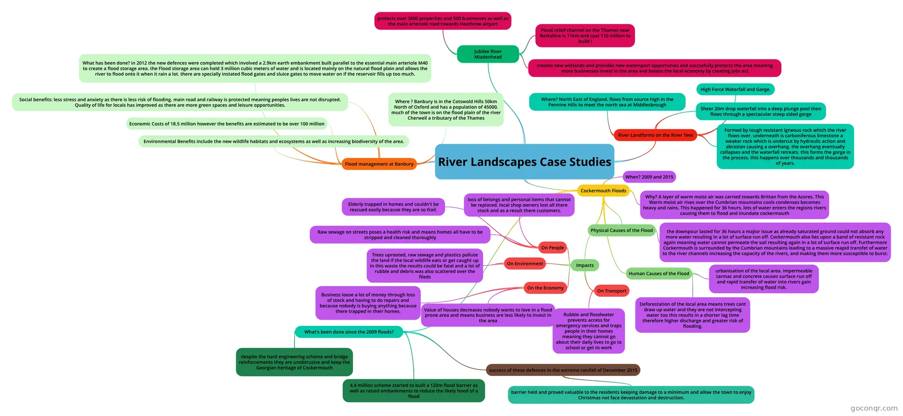
Mind map: River landscapes case studies
Conteúdo do mapa
River Landscapes Case Studies
River Landforms on the River Tees
- Where? North East of England. flows from source high in the Pennine Hills to meet the north sea at Middlesbrough
- High Force Waterfall and Gorge.
- Sheer 20m drop waterfall into a deep plunge pool then flows through a spectacular steep sided gorge
- Formed by tough resistant igneous rock which the river flows over. underneath is carboniferous limestone a weaker rock which is undercut by hydraulic action and abrasion causing a overhang. the overhang eventually collapses and the waterfall retreats. this forms the gorge in the process. this happens over thousands and thousands of years.
Cockermouth Floods
- When? 2009 and 2015
- Why? A layer of warm moist air was carried towards Brittan from the Azores. This Warm moist air rises over the Cumbrian mountains cools condenses becomes heavy and rains. This happened for 36 hours. lots of water enters the regions rivers causing them to flood and inundate cockermouth
- Human Causes of the Flood
- urbanisation of the local area. impermeable tarmac and concrete causes surface run off and rapid transfer of water into rivers gain increasing flood risk.
- Deforestation of the local area means trees cant draw up water and they are not intercepting water too this results in a shorter lag time therefore higher discharge and greater risk of flooding.
- Physical Causes of the Flood
- the downpour lasted for 36 hours a majior issue as already saturated ground could not absorb any more water resulting in a lot of surface run off. Cockermouth also lies upon a band of resistant rock again meaning water cannot permeate the soil resulting again in a lot of surface run off. Furthermore Cockermouth is surrounded by the Cumbrian mountains leading to a massive reapid transfet of water to the river channels increasing the capacity of the rivers, and making them more susceptible to burst.
- Impacts
- On Environment
- Trees uprooted, raw sewage and plastics pollute the land if the local wildlife eats or get caught up in this waste the results could be fatal and a lot of rubble and debris was also scattered over the fileds
- On People
- loss of belongs and personal items that cannot be replaced. local shop owners lost all there stock and as a result there customers.
- Elderly trapped in homes and couldn't be rescued easily because they are so frail.
- Raw sewage on streets poses a health risk and means homes all have to be stripped and cleaned thoroughly
- On Transport
- Rubble and floodwater prevents access for emergency services and traps people in their homes meaning they cannot go about their daily lives to go to school or get to work
- On the Economy
- Business loose a lot of money through loss of stock and having to do repairs and because nobody is buying anything because there trapped in their homes.
- Value of houses decreases nobody wants to love in a flood prone area and means business are less likely to invest in the area
- On Environment
- What's been done since the 2009 floods?
- 4,4 million scheme started to built a 120m flood barrier as well as raised embankments to reduce the likely hood of a flood
- despite the hard engineering scheme and bridge reinforcements they are unobtrusive and keep the Georgian heritage of Cockermouth
- success of these defences in the extreme rainfall of December 2015
- barrier held and proved valuable to the residents keeping damage to a minimum and allow the town to enjoy Christmas not face devastation and destruction.
Jubilee River Miadenhead
- Flood relief channel on the Thames near Berkshire is 11km and coat 110 million to build !
- protects over 3000 properties and 500 businesses as well as the main arteriole road towards Heathrow airport
- creates new wetlands and provides new watersport opportunies and succsefully protects the area meaning more businesses invest in the area and boosts the local economy by creating jobs ect
Flood management at Banbury
- Where ? Banbury is in the Cotswold Hills 50km North of Oxford and has a population of 45000. much of the town is on the flood plain of the river Cherwell a tributary of the Thames
- What has been done? in 2012 the new defences were completed which involved a 2.9km earth embankment built parallel to the essential main arteriole M40 to create a flood storage area. the Flood storage area can hold 3 million cubic meters of water and is located mainly on the natural flood plain and allows the river to flood onto it when it rain a lot. there are specially instated flood gates and sluice gates to move water on if the reservoir fills up too much.
- Social benefits: less stress and anxiety as there is less risk of flooding. main road and railway is protected meaning peoples lives are not disrupted. Quality of life for locals has improved as there are more green spaces and leisure opportunities.
- Economic Costs of 18.5 million however the benefits are estimated to be over 100 million
- Environmental Benefits include the new wildlife habitats and ecosystems as well as increasing biodiversity of the area.
Informações
- Descrição
- GCSE Geography Mapa Mental sobre River Landscapes Case Studies, criado por Matthew Vaughan em 26-03-2018.
- Criado por
- Matthew Vaughan
- Visualizações
- 1
- Avaliação