
Mapa mental
Kobe Earthquake MEDC 17/01/1995
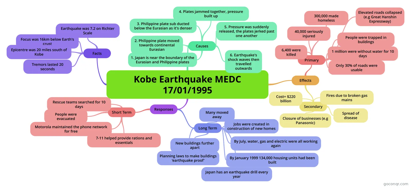
Mind map: Kobe earthquake MEDC 1995
Conteúdo do mapa
Kobe Earthquake MEDC 17/01/1995
Facts
- Earthquake was 7.2 on Richter Scale
- Focus was 16km below Earth's crust
- Epicentre was 20 miles south of Kobe
- Tremors lasted 20 seconds
Causes
- 1. Japan is near the boundary of the Eurasian and Philippine plates
- 2. Philippine plate moved towards continental Eurasian
- 3. Philippine plate sub ducted below the Eurasian as it's denser
- 4. Plates jammed together, pressure built up
- 5. Pressure was suddenly released, the plates jerked past one another
- 6. Earthquake's shock waves then travelled outwards
Responses
- Short Term
- Rescue teams searched for 10 days
- People were evacuated
- Motorola maintained the phone network for free
- 7-11 helped provide rations and essentials
- Long Term
- Planning laws to make buildings 'earthquake proof'
- New buildings further apart
- Many moved away
- Japan has an earthquake drill every year
- Jobs were created in construction of new homes
- By July, water, gas and electric were all working again
- By January 1999 134,000 housing units had been built
- Short Term
Effects
- Primary
- 6,400 were killed
- 40,000 seriously injured
- 300,000 made homeless
- People were trapped in buildings
- 1 million were without water for 10 days
- Only 30% of roads were usable
- Elevated roads collapsed (e.g Great Hanshin Expressway)
- Secondary
- Fires due to broken gas mains
- Spread of disease
- Cost= $220 billion
- Closure of businesses (e.g Panasonic)
- Primary
Informações
- Descrição
- GCSE GCSEs (Geography) Mapa Mental sobre Kobe Earthquake MEDC 17/01/1995, criado por a a em 10-04-2014.
- Criado por
- a a
- Visualizações
- 102
- Tags
- Avaliação