
Mapa mental
Rivers, Floods and Management: Valley Profiles
Conteúdo do mapa
Rivers, Floods and Management: Valley Profiles
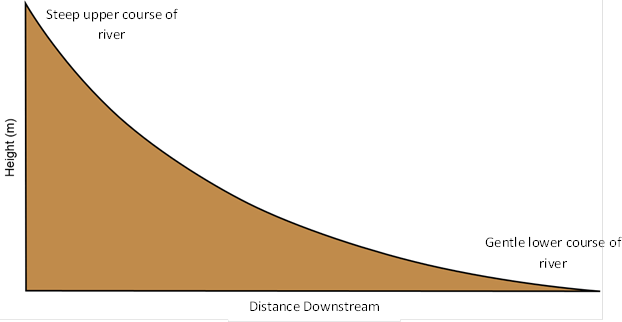
Valley Long Profiles
- High in the mountains there is a steep gradient. This results in the river tumbling over rapids and waterfalls.
- On reaching the lowlands, the gradient becomes gentler.
- Graded Profile: Smooth concave long profile of a river that has achieved a state of equilibrium with its environment.
- Changes in sea level may affect the long profile.
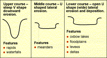
Valley Cross Profiles
- The cross profile of a valley also changes with distance downstream.
- Close to its source, a river usually flows through a narrow, steep-sided valley.
- With increasing distance downstream, the valley becomes wider and less steep.
- The river also tends to increase in size - both in width and depth - because it is carrying more water and more energy.
Imagens e arquivos do mapa
Informações
- Descrição
- A Levels Geography (Physical Geography-AS) Mapa Mental sobre Rivers, Floods and Management: Valley Profiles, criado por Andrew_Ellinas em 25-04-2014.
- Criado por
- Andrew_Ellinas
- Visualizações
- 21
- Avaliação