
Diagrama de flujo
Types of satellite image resolution explained
Contenido del diagrama
Resolution types
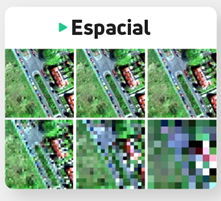
spatial resolution
Refers to the clarity and precision with which an image or map shows the details of the earth's surface. A high spatial resolution means that small, sharp details can be seen, while a low spatial resolution means that details are fuzzy or cannot be seen clearly
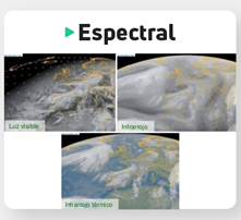
Spectral Resolution
It is the satellite's ability to capture images in different spectral bands of the electromagnetic spectrum.
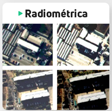
radiometric resolution
Refers to the precision with which a satellite can measure the amount of light reflected or emitted by the earth's surface.
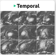
Temporary resolution.
It refers to the frequency with which a satellite captures images of a certain area of the Earth.
It is used to determine the suitability of an image for a certain application, such as identifying specific geographic features on a map or identifying objects in an image.
Detect changes in the earth's surface and to monitor the health of ecosystems and climatic conditions. applications such as the identification of minerals, the evaluation of agricultural production and the identification of areas of deforestation.
allows users to analyze the amount of light that is reflected or emitted from different objects and features on the Earth's surface.
allows monitoring changes in the earth's surface over time. changes in vegetation, urban expansion, erosion and other changes in the land surface.
Información
- Descripción
- Diagrama sobre Sin título, creado por Angie Borja el 21/09/2020.
- Creado por
- Angie Borja
- Visitas
- 2
- Valoración