
Map Skills and GIS
777 resources created by 658 users
This Map Skills and GIS page on GoConqr gathers community-made quizzes, mind maps, flashcards, notes and slide sets, from compass points and grid references to topographic maps, remote sensing and GIS. It's built for school students revising map work, primary pupils learning the basics, and teachers after ready-made material. There are over 700 resources here, including more than 70 quizzes, over 350 mind maps and more than 220 flashcard decks. Pick a topic, try a quiz to find your gaps, then revise with the decks.
Select topic
- Five Themes of Geography23
- Geographic Tools10
- Types of Maps73
- Map Elements and Symbols82
- Map Projections25
- Latitude and Longitude57
- Compass Directions and Bearings12
- Map Scale11
- Grid References14
- Topographic Maps and Contour Lines28
- Map Reading and Interpretation17
- Geographic Information Systems10
- Aerial Photographs and Remote Sensing5
- Geographical Enquiry and Fieldwork11
- Geographical Data Presentation8
Top Map Skills and GIS resources
-
36 cardsAS level geography- Geographical Skills
-
35 cardsUnit 1 - Mapping and Geotechnologies - Key Terms Key Terms for our First Unit.
-
15 questionsGeography map reading Aerial photos, different types of map, information a map gives, longitude, latitude and continents
-
10 questionsSocial Studies, 5th grade unit 1 The Equator divides the Earth into two hemispheres, North and South.
-
25 cardsMaps and Globes They represent the world as flat
-
25 cardsGeo Exam The compass rose has how many cardinal and intermediate directions? (each.)
-
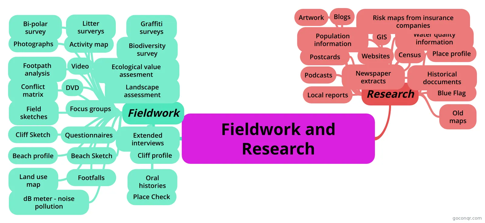 Mind map Fieldwork and Research
-
8 questionsGoogle Earth Scavenger Hunt
Quizzes
See all 97 quizzes-
15 questionsGeography map reading Aerial photos, different types of map, information a map gives, longitude, latitude and continents
-
10 questionsSocial Studies, 5th grade unit 1 The Equator divides the Earth into two hemispheres, North and South.
-
8 questionsGoogle Earth Scavenger Hunt
-
5 questionsMap Quiz for Year 7 What does GIS on a map mean?
-
75 questionsMaps!
-
93 questionsgeography what is the definition of contour lines and other info
-
35 questionsGeographic information system chapter 1 and 2 First training in ESRI what were the 3 components
-
29 questionsGEOG 3500 midterm is known as GIS system
Mind maps
See all 392 mind mapsFlashcards
See all 242 flashcards-
36 cardsAS level geography- Geographical Skills
-
35 cardsUnit 1 - Mapping and Geotechnologies - Key Terms Key Terms for our First Unit.
-
25 cardsMaps and Globes They represent the world as flat
-
25 cardsGeo Exam The compass rose has how many cardinal and intermediate directions? (each.)
-
137 cardsGIS Flashcards What are spatial data?
-
108 cardsRS 1 Definition of Remote Sensing
-
70 cardsForensic Applications of Remote Sensing
-
41 cardsRemote Sensing Flashcards (2) What is an additive color system?
Flowcharts
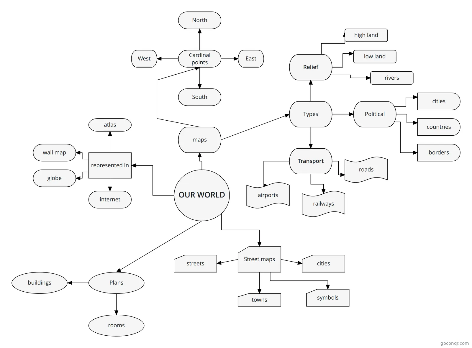
Notes
See all 28 notes-
Geography Unit 1 Test Geographers's Toolkit A map represents earth's features drawn on a flat surface Maps use symbols and colours to represent different things Components of a Map Title - What area is shown? What is the topic? Legend - Wh...
-
Revision Booklet (Ironmonger) Revision Booklet – Unit 1 section A (skills) Section A – Geographical Skills How to describe the pattern of physical or human features on an atlas map: Typical question: describe the link between the population densit...
-
Geog Theory "Discuss how your investigation helped your understanding of geographical theory."MSreference to the conclusions and/or the underpinning theory set out in the aim.In addition, there may be reference to the candidate’s...
-
C.1 Geography, Skill #4- Notes C.1 Geography, Skill #4- Notes Analyze geographic information from maps, charts, and graphs. Maps
-
Untitled 3. Image classification. The objective of these operations is to replace visual analysis of the image data with quantitative techniques for automating the identification of features in a scene. This normally involves ...
-
Transport on OSi Maps - Essay Guidelines Transport on Maps Notes: 1. Start with oldest form of transport and work towards the newest2. Give map evidence for each case coupled with theory3. If you cannot find a form of transport on the map do not include it i...
-
Geography Revision Maps Measuring Distance Scale- eg. 1:25000 means 1CM is equivalent to 25000CM on the map. This is 250M You can measure distances by: Using the squares on the map. Each side is 1KM and each diagonal is 1.5KM Using a string ...
-
Rules and Terms for Using Contour Lines Rules for Using Contour Lines Connects all points of equal elevation Separate points of higher elevation (uphill) from points of lower elevation (downhill) Contour interval: Index contours are printed as heavier and d...
Slides
See all 14 slidesTopics in Map Skills and GIS
More Geography topics
About Map Skills and GIS
GoConqr OriginalWhat the page covers
The resources here run from first steps with maps to mapping technology. Early material covers hemispheres, oceans, the Equator, plans and maps seen from above. Further on you will find compass bearings, grid references, map scale, contour lines, projections, latitude and longitude, aerial photographs, remote sensing and GIS.
Where to start
If map work is new, begin with the quiz Geography map reading, which asks about plans, maps and bird's-eye views. The Maps and Globes flashcards then check how globes and flat maps differ, and what longitude and latitude lines do.
For a bit more challenge, work through these in order:
- The Map Quiz for Year 7, which asks what GIS means, what a map key is and why coordinates matter.
- The deck Unit 1 - Mapping and Geotechnologies - Key Terms, covering topographic maps, easting, northing and digital mapping.
- The note Geography Unit 1 Test, which lists the compass rose points 22.5 degrees apart.
Using quizzes and maps together
Take a quiz first and note what you missed. Then open a mind map on that topic, such as Grid References, Map Elements, Topographic Maps or Projection, and read the branches slowly. Return to the quiz afterwards and see what has stuck.
The mind maps Fieldwork and Research and Key Skills in Geography cover data collection and presentation, which is useful for exam-style skills questions in GCSE Geography, IGCSE Geography, A-level Geography or AP Human Geography.
Where it fits
This unit sits in the strand Geographical Foundations and Skills within Geography. It is the place for the tools you use before and during every other geography topic. Most resources suit secondary school, with some primary material and a little at university level.
Next step
Choose one topic that feels shaky, try a quiz on it, and then make your own flashcards from what you got wrong.
Frequently asked questions
Which quiz should I try first?
Start with Geography map reading if you are new to maps, as it covers plans, maps and views from above. Once that feels comfortable, try the Map Quiz for Year 7, which moves on to map keys, coordinates, grid lines and what GIS means.
What do the mind maps cover?
There are over 350 mind maps. They cover map elements, types of maps, grid references, topographic maps, projections, map scale, GIS map design, sampling, fieldwork techniques and ways of presenting data. They work well for a quick read before or after a quiz.
Are the resources free to use?
Yes. Every resource on this page is free to open, study and take, with no account needed. A free account also saves your quiz scores and lets you make your own quizzes, mind maps, flashcards and notes.
Which exams and levels do they suit?
Most resources are for secondary school, and some suit primary pupils. The listed material mentions GCSE Geography, IGCSE Geography, A-level Geography and AP Human Geography. Check each resource's content against your own course, since they were made by users.
Who made these resources?
They were made by GoConqr users, including students and teachers, not by GoConqr itself. Over 500 contributors have added material here, so styles and depth vary. Look at a resource's contents before relying on it for your course.
What if I cannot find a topic I need?
Try nearby topics first. Remote sensing, aerial photographs, cartography and spatial interpolation each have their own flashcards or quizzes. If something is still missing, you can build your own flashcards or mind map from your class notes.