
Mapa mental
Coastal erosion
Contenido del mapa
Coastal erosion
The geology of the area
- Litology of the rock
- Diferential eroision
- Holderness - Glacial till - 2 metres per year eroded
- Chalk - South East - 0.3 metres per year eroded
- Granite - South West - 0.001 metres per year eroded
- Diferential eroision
- Rock type
- E.g less reistant is Limestone
- Litology of the rock
Human Activity
- Sea defence
- Managed retreat
- Hold the line
- Advance retreat
- Coastal settlements
- This would cause the cliff matrial to be pull down on more
- Sea defence
Location
- Techtonic Issues
- How the rock is angled
- Formation of Tsunamies
- How exposed the area is
- Headlands tend to be exposed
- Can be concordent or discordent
- Formation of storms
- Headlands tend to be exposed
- Techtonic Issues
Aeolian Processes
Waves
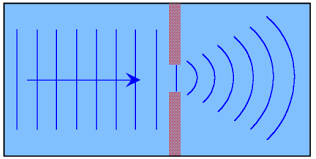
- Wave Diffraction
- Types
- Destructive
- Constructive
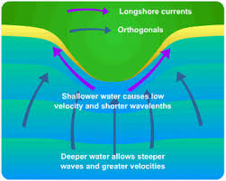
- Wave refraction
Weathering
- Physical
- Thermal expansion
- Freeze Thaw weathering
- More likely to happen in the north
- Biological
- Piddock fish dig into the rock
- Vegetation force cracks open
- Physical
Longshore drift
- No material to prevent erosion
Acid rain
Coastal Landforms
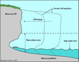
- Shore platforms
- Wave-cut platforms
- High-tide platforms
- Low tide platforms
- Most frequently found in high energy environments
- Steep cliffs are replaced by lengthening platforms and a lower angle cliff
- Having been subjected to marine processes
- Wave-cut platforms
- Coves
- Form because there is a weakness in the rock, and the sea takes advantage of this
- Example; Lulworth cove
- Created when the limestone wall was breached during the periglacial period
- The Chalk has not been eroded because of wave refraction on the bay
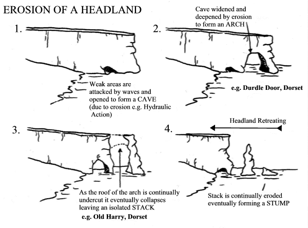
- Headlands
- Example of a stump:Old Harry, Dorset
- Example of an Arch; Green Bridge of Wales
- Shore platforms
Imágenes y archivos del mapa
Información
- Descripción
- Coastal erosion for AQA AS level geography
- Creado por
- Phoebe Fletcher
- Visitas
- 173
- Etiquetas
- Valoración