
Mapa mental
How is Canada Diverse?
Contenido del mapa
How is Canada Diverse?
STUDY OF POPULATION
- IMMIGRATION
- Immigration makes a large part of Canada
- Canadian culture today has been influenced by many other religions and beliefs.
- Immigration helps increase the economy with more jobs and workers. There will be more businesses
- Immigration Point System allows immigrants who are skilled
- Immigration makes a large part of Canada
- BABY BOOMERS
- Baby boomers impact the economy
- More susceptible to illness and disease, increasing the demand for healthcare services. Further research to treat and or cure certain diseases as well
- Baby boomers make a large portion of Canada's work force. With most of them retiring, this will impact the Canadian economy
- Baby boomers impact the economy
- CULTURE AND DIVERSITY
- There is a large variety of languages, culture and background
- Canada's official languages are English and French. Despite this, there are many other langauges being spoken across Canada
- There is a large variety of languages, culture and background
- IMMIGRATION
MANAGING RESOURCES
- INDUSTRIES
- There are different industries across Canada
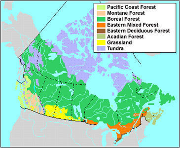
- The Boreal forest covers a large portion of Canada, making it a huge part of the forestry industry which can be used as trade
- Provinces in the maritimes are usually where the fishing industries are since they are near bodies of water
- Canadian Shield is mainly comprised of rocks, where a lot of minerals can be found. Diamond mining is more likely to be found in large areas of clear land scattered across the Northwest Territories.
- There are different industries across Canada
- SUSTAINABILITY
- We use both non renewable and renewable resources but it's important to maintain them sustainably
- Rely on renewable resources such as wind and solar energy instead of fossil fuels which will eventually run out
- We use a lot of our land to build houses, schools and hospitals which increases traffic and pollution increasing ecological footprint
- We use both non renewable and renewable resources but it's important to maintain them sustainably
- TRADE
- Trade agreements such as NAFTA and CETA help import things we don't have much of and export things we have plenty of
- INDUSTRIES
LIVEABLE COMMUNITIES
- URBANIZATION
- Some places are more urbanized than others
- Places up north have a very low population and as a result, the quality of life is not as good. Services such as health care, transportation and education are not well funded and are low quality
- Most people live in urban areas because the climate tends to be nicer, there is more infrastructure and the quality of services is much better
- Some places are more urbanized than others
- LIVEABILITY
- Social, environmental, political and economic factors impact liveability
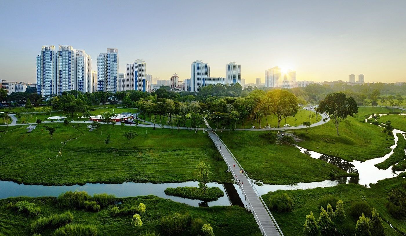
- A city with more green space attracts people since it benefits the environment and also prvoides a space for recreational needs
- Cities with high levels of pollution are bad for the environment making it less liveable
- Social, environmental, political and economic factors impact liveability
- URBANIZATION
PHYSICAL SYSTEMS
- GEOLOGICAL HISTORY
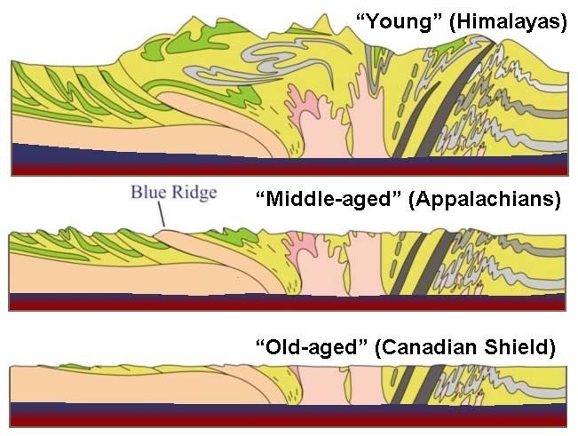
- Plate movement, volcano eruptions all helped form each of the landforms
- Each landform region was created during different geological times. The Canadian Shield was formed about 6 billion years ago during the Neoarchean era through processes of tectonic plates.
- Plate movement, volcano eruptions all helped form each of the landforms
- LANDFORM REGIONS
- Each of the Landform regions are different from each other
- The 7 landform regions are Arctic, Interior Plains, Canadian Shield, Hudson Bay Lowlands, Appalachian Mountains, Western Cordillera, and the St Lawrence Lowlands
- Each of these landform regions have climate factors that affect them. For example, the appalachian mountains are affected by elevation causing more precipitation on the windward side
- Depending on the landform region, it can be a push/pull factor. Someone who skies a lot would prefer to live in the mountain regions
- The 7 landform regions are Arctic, Interior Plains, Canadian Shield, Hudson Bay Lowlands, Appalachian Mountains, Western Cordillera, and the St Lawrence Lowlands
- Each of the Landform regions are different from each other
- SOIL AND VEGETATION
- Soil and Vegetation are greatly affected by climate regions
- In the Arctic climate region, the soil is frozen and most plants are not able to grow in such harsh conditions.
- The Boreal forest is the largest vegetation region in Canada covering 14% of Earth's land
- Soil and Vegetation are greatly affected by climate regions
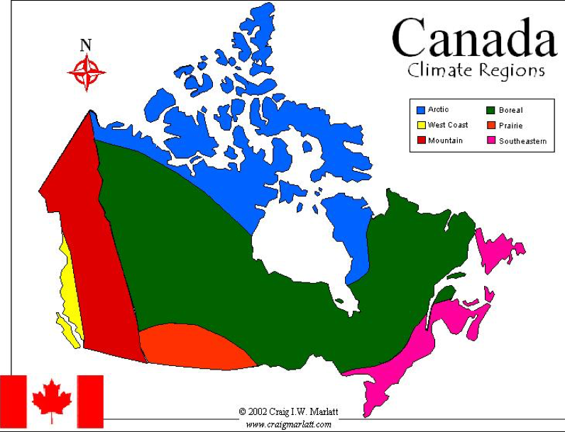
- CLIMATE REGIONS
- Each Climate Region has different characteristics
- The Arctic climate region is extremely cold, only a small portion of Canada's population is situated there.
- The Southeastern climate region is the most dense and populated. It is located near the U.S. border
- Each Climate Region has different characteristics
- GEOLOGICAL HISTORY
MAPPING
- TYPES OF MAPS
- Different types of landforms show different maps
- Mountainous and rocky areas will have more contour lines to show the changes in elevation in a topographic map
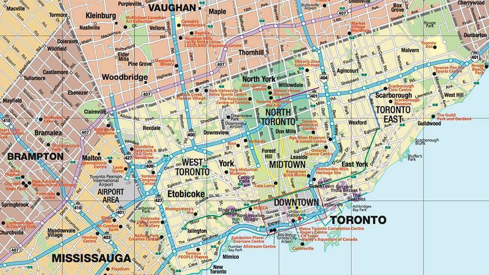
- Cities with water will be evident in a map, hinted by the blue
- Areas where there is flatter land and a denser population will not have as many contour lines but more roads and buildings
- Different types of landforms show different maps
- TYPES OF MAPS
Imágenes y archivos del mapa
Información
- Descripción
- Mapa Mental sobre How is Canada Diverse?, creado por Ethan Prod. el 18/01/2020.
- Creado por
- Ethan Prod.
- Visitas
- 12
- Valoración
Más sobre Canadian Geography and Regions