
Mapa mental
Rivers
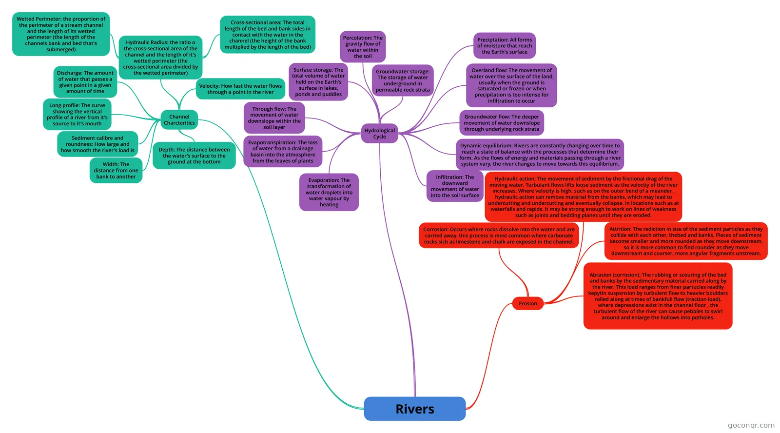
Mind map: Rivers geography
Contenido del mapa
Rivers
Hydrological Cycle
- Preciptation: All forms of moisture that reach the Earth's surface
- Evaporation: The transformation of water droplets into water vapour by heating
- Evapotranspiration: The loss of water from a drainage basin into the atmosphere from the leaves of plants
- Surface storage: The total volume of water held on the Earth's surface in lakes, ponds and puddles
- Groundwater storage: The storage of water underground in permeable rock strata
- Infiltration: The downward movement of water into the soil surface
- Percolation: The gravity flow of water within the soil
- Overland flow: The movement of water over the surface of the land, usually when the ground is saturated or frozen or when precipitation is too intense for infiltration to occur
- Through flow: The movement of water downslope within the soil layer
- Groundwater flow: The deeper movement of water downslope through underlying rock strata
- Dynamic equilibrium: Rivers are constantly changing over time to reach a state of balance with the processes that determine their form. As the flows of energy and materials passing through a river system vary, the river changes to move towards this equilibrium.
Channel Charcteritics
- Hydraulic Radius: the ratio o the cross-sectional area of the channel and the length of it's wetted perimeter (the cross-sectional area divided by the wetted perimeter)
- Wetted Perimeter: the proportion of the perimeter of a stream channel and the length of its wetted perimeter (the length of the channels bank and bed that's submerged)
- Cross-sectional area: The total length of the bed and bank sides in contact with the water in the channel (the height of the bank multiplied by the length of the bed)
- Velocity: How fast the water flows through a point in the river
- Depth: The distance between the water's surface to the ground at the bottom
- Width: The distance from one bank to another
- Discharge: The amount of water that passes a given point in a given amount of time
- Sediment calibre and roundness: How large and how smooth the river's load is
- Long profile: The curve showing the vertical profile of a river from it's source to it's mouth
- Hydraulic Radius: the ratio o the cross-sectional area of the channel and the length of it's wetted perimeter (the cross-sectional area divided by the wetted perimeter)
Erosion
- Hydraulic action: The movement of sediment by the frictional drag of the moving water. Turbulant flows lifts loose sediment as the veloctiy of the river increases. Where velocity is high, such as on the outer bend of a meander , hydraulic action can remove material from the banks, which may lead to undercutting and undercutting and eventually collapse. In locations such as at waterfalls and rapids, it may be strong enough to work on lines of weakness such as joints and bedding planes until they are eroded.
- Corrosion: Occurs where rocks dissolve into the water and are carried away. this process is most common where carbonate rocks sich as limestone and chalk are exposed in the channel.
- Attrition: The rediction in size of the sediment particles as they collide with each other, thebed and banks. Pieces of sediment become smaller and more rounded as they move downstream, so it is more common to find rounder as they move downstream and coarser, more angular fragments unstream.
- Abrasion (corrosion): The rubbing or scouring of the bed and banks by the sedimentary material carried along by the river. This load ranges from finer partucles readily kepytin suspension by turbulent flow to heavier boulders rolled along at times of bankfull flow (traction load). where depressions exist in the channel floor , the turbulent flow of the river can cause pebbles to swirl around and enlarge the hollows into potholes.
Información
- Descripción
- Mapa Mental sobre Rivers, creado por billy.brend el 06/05/2015.
- Creado por
- billy.brend
- Visitas
- 0
- Valoración
Más sobre Water Cycle and Drainage Basins