
Mapa mental
Rivers
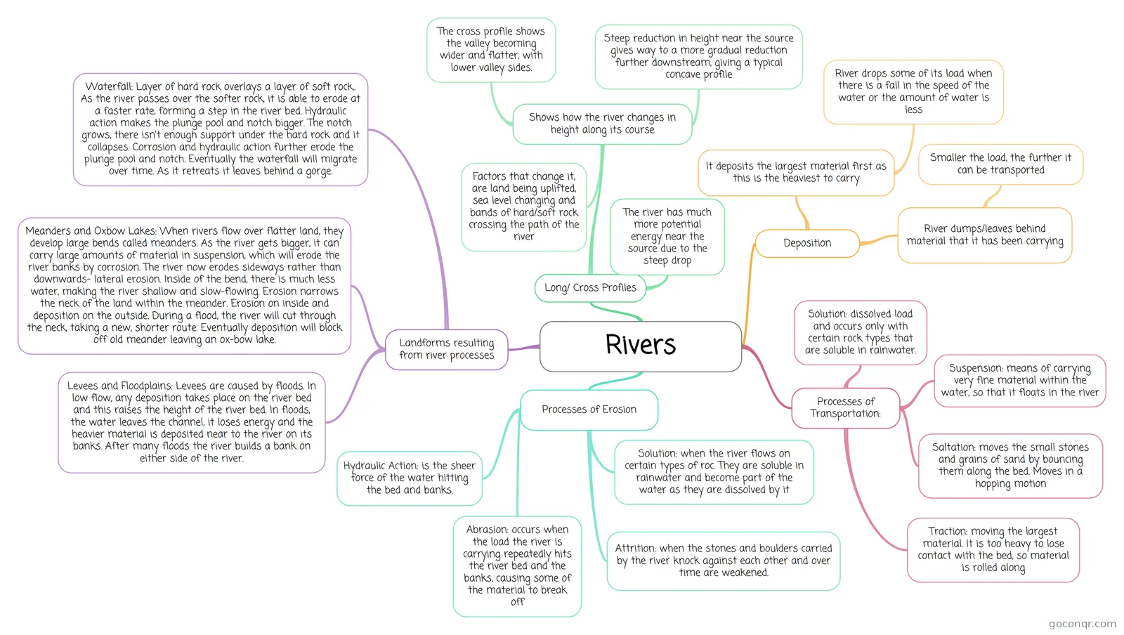
Mind map: Rivers
Contenido del mapa
Rivers
Processes of Erosion
- Hydraulic Action: is the sheer force of the water hitting the bed and banks.
- Abrasion: occurs when the load the river is carrying repeatedly hits the river bed and the banks, causing some of the material to break off
- Attrition: when the stones and boulders carried by the river knock against each other and over time are weakened.
- Solution: when the river flows on certain types of roc. They are soluble in rainwater and become part of the water as they are dissolved by it
Processes of Transportation:
- Traction: moving the largest material. It is too heavy to lose contact with the bed, so material is rolled along
- Saltation: moves the small stones and grains of sand by bouncing them along the bed. Moves in a hopping motion
- Suspension: means of carrying very fine material within the water, so that it floats in the river
- Solution: dissolved load and occurs only with certain rock types that are soluble in rainwater.
Deposition
- River dumps/leaves behind material that it has been carrying
- Smaller the load, the further it can be transported
- It deposits the largest material first as this is the heaviest to carry
- River drops some of its load when there is a fall in the speed of the water or the amount of water is less
- River dumps/leaves behind material that it has been carrying
Long/ Cross Profiles
- Shows how the river changes in height along its course
- Steep reduction in height near the source gives way to a more gradual reduction further downstream, giving a typical concave profile
- Factors that change it, are land being uplifted, sea level changing and bands of hard/soft rock crossing the path of the river
- The cross profile shows the valley becoming wider and flatter, with lower valley sides.
- The river has much more potential energy near the source due to the steep drop
- Shows how the river changes in height along its course
Landforms resulting from river processes
- Waterfall: Layer of hard rock overlays a layer of soft rock.. As the river passes over the softer rock, it is able to erode at a faster rate, forming a step in the river bed. Hydraulic action makes the plunge pool and notch bigger. The notch grows, there isn't enough support under the hard rock and it collapses. Corrosion and hydraulic action further erode the plunge pool and notch. Eventually the waterfall will migrate over time. As it retreats it leaves behind a gorge.
- Meanders and Oxbow Lakes: When rivers flow over flatter land, they develop large bends called meanders. As the river gets bigger, it can carry large amounts of material in suspension, which will erode the river banks by corrosion. The river now erodes sideways rather than downwards- lateral erosion. Inside of the bend, there is much less water, making the river shallow and slow-flowing. Erosion narrows the neck of the land within the meander. Erosion on inside and deposition on the outside. During a flood, the river will cut through the neck, taking a new, shorter route. Eventually deposition will block off old meander leaving an ox-bow lake.
- Levees and Floodplains: Levees are caused by floods. In low flow, any deposition takes place on the river bed and this raises the height of the river bed. In floods, the water leaves the channel, it loses energy and the heavier material is deposited near to the river on its banks. After many floods the river builds a bank on either side of the river.
Información
- Descripción
- Mapa Mental sobre Rivers, creado por booe4221 el 17/05/2015.
- Creado por
- booe4221
- Visitas
- 4
- Valoración
Más sobre River Erosion, Transportation and Deposition