
Mapa mental
Rivers- Key Terms
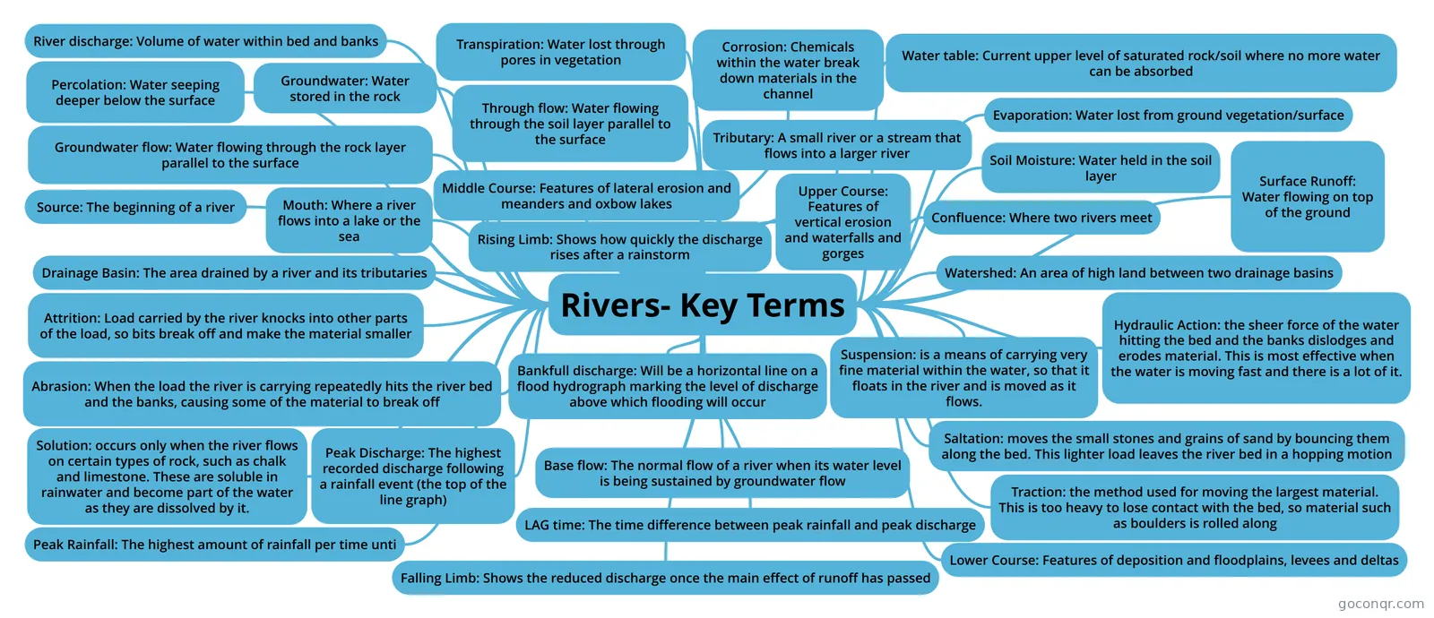
Mind map: Rivers Key Terms
Contenido del mapa
Rivers- Key Terms
River discharge: Volume of water within bed and banks
Transpiration: Water lost through pores in vegetation
Water table: Current upper level of saturated rock/soil where no more water can be absorbed
Percolation: Water seeping deeper below the surface
Evaporation: Water lost from ground vegetation/surface
Soil Moisture: Water held in the soil layer
Groundwater: Water stored in the rock
Groundwater flow: Water flowing through the rock layer parallel to the surface
Through flow: Water flowing through the soil layer parallel to the surface
Surface Runoff: Water flowing on top of the ground
Source: The beginning of a river
Confluence: Where two rivers meet
Watershed: An area of high land between two drainage basins
Mouth: Where a river flows into a lake or the sea
Tributary: A small river or a stream that flows into a larger river
Drainage Basin: The area drained by a river and its tributaries
Attrition: Load carried by the river knocks into other parts of the load, so bits break off and make the material smaller
Abrasion: When the load the river is carrying repeatedly hits the river bed and the banks, causing some of the material to break off
Solution: occurs only when the river flows on certain types of rock, such as chalk and limestone. These are soluble in rainwater and become part of the water as they are dissolved by it.
Corrosion: Chemicals within the water break down materials in the channel
Hydraulic Action: the sheer force of the water hitting the bed and the banks dislodges and erodes material. This is most effective when the water is moving fast and there is a lot of it.
Suspension: is a means of carrying very fine material within the water, so that it floats in the river and is moved as it flows.
Saltation: moves the small stones and grains of sand by bouncing them along the bed. This lighter load leaves the river bed in a hopping motion
Traction: the method used for moving the largest material. This is too heavy to lose contact with the bed, so material such as boulders is rolled along
Upper Course: Features of vertical erosion and waterfalls and gorges
Middle Course: Features of lateral erosion and meanders and oxbow lakes
Lower Course: Features of deposition and floodplains, levees and deltas
Peak Rainfall: The highest amount of rainfall per time unti
Rising Limb: Shows how quickly the discharge rises after a rainstorm
Peak Discharge: The highest recorded discharge following a rainfall event (the top of the line graph)
LAG time: The time difference between peak rainfall and peak discharge
Falling Limb: Shows the reduced discharge once the main effect of runoff has passed
Base flow: The normal flow of a river when its water level is being sustained by groundwater flow
Bankfull discharge: Will be a horizontal line on a flood hydrograph marking the level of discharge above which flooding will occur
Información
- Descripción
- Geography Mapa Mental sobre Rivers- Key Terms, creado por Fran Bradshaw-Sole el 30/05/2017.
- Creado por
- Fran Bradshaw-Sole
- Visitas
- 0
- Valoración