
Mapa mental
River Quaggy (C.S)
Contenido del mapa
River Quaggy (C.S)
Background
- Small river in London, UK
- 17km long
- Source: Locksbottom, Farnborough
- Lower area it becomes an urban river
- Flows in-between houses
- Upstream it is more natural and not urbanised
- One of the Thames smaller tributries
- The mouth of the river meets at River Ravensbourne
- Part of the Ravensbourne catchment area
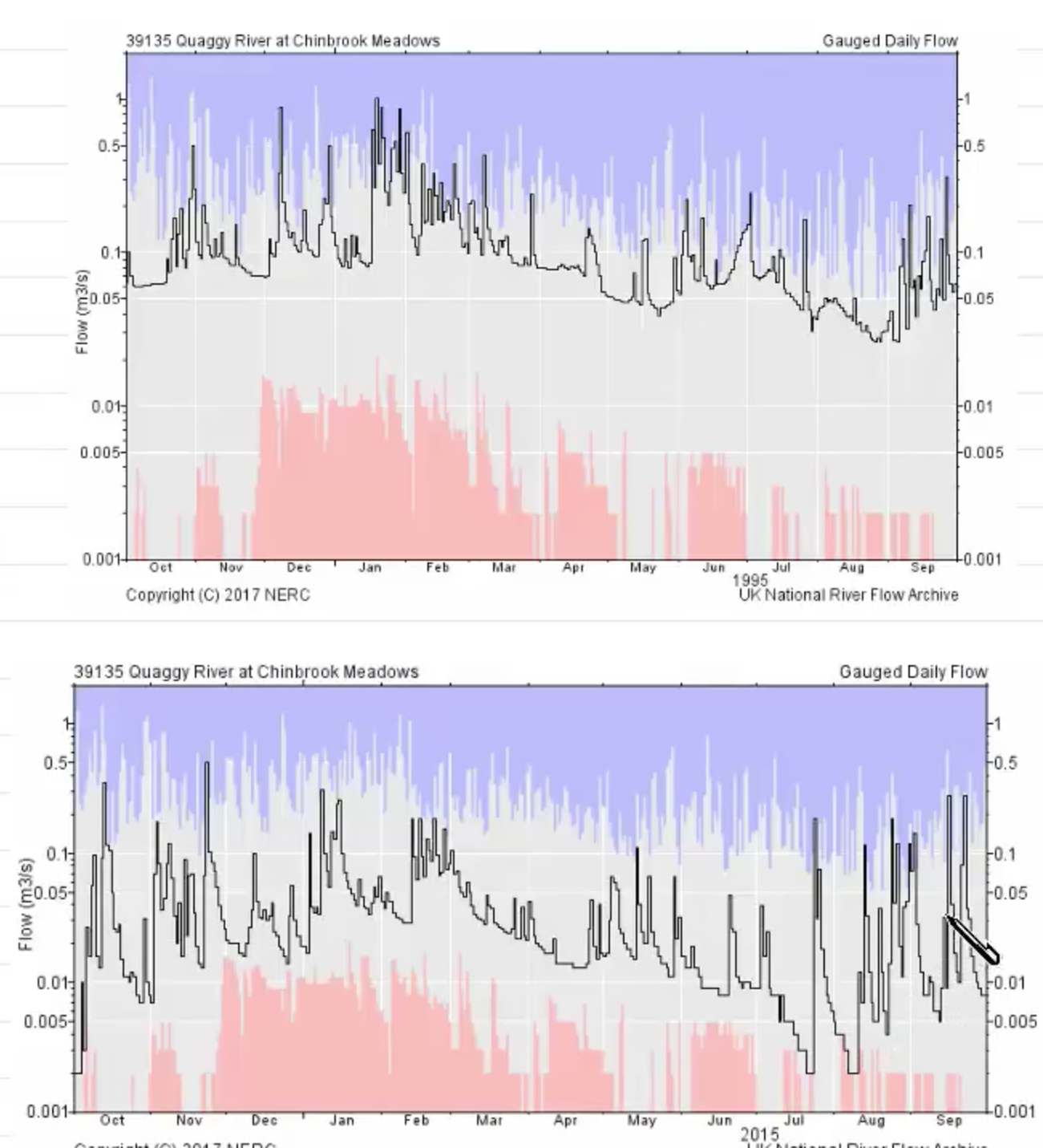
Regime of River Quaggy
- Changes in the discharge over a period of time at a particular point
- V responsive regime
- When it heavily rains the discharge in the river quickly increases
- No significant artificial influences
- No dams etc
- 1995: significantly high flow all year round
- 2005: lower annual discharge, peak flow in Nov
- Average daily flow has fallen since 1995
Flood Event
- Worst event was Christmas Eve 2014
- Was London's worst winter flood event
- Quaggy burst its banks , inundating 22 homes
- Another 20 homes had flooded gardens
- Allotments and sports ground flooded
- A month's worth of rain in 24hrs
- 50mm in 25hrs
- High winds blew branches and trees into the river causing to block the trash gate ∴ it bursts its banks
Flood control (Mitigation)
- Attempts in the past to mitigate flood events
- Between 2003+2006, Environmental Agency (EA) installed trash gate as part of £11.8 Mil flood mitigation scheme to stop debris collecting @ culvert's entrance
- EA built two small reservoirs to collect flood water + protect homes
Imágenes y archivos del mapa
Información
- Descripción
- A level (Water and Carbon Cycle) Geography Mapa Mental sobre River Quaggy (C.S), creado por Charlotte Willis el 08/04/2018.
- Creado por
- Charlotte Willis
- Visitas
- 23
- Etiquetas
- Valoración