
Mapa mental
Geography Theme 2: Rivers
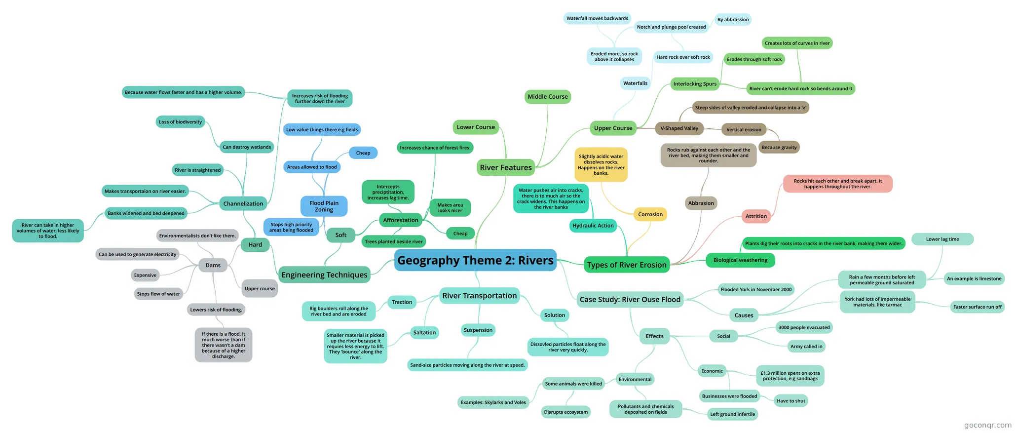
Mind map: Geography theme 2: rivers
Contenido del mapa
Geography Theme 2: Rivers
River Transportation
- Traction
- Big boulders roll along the river bed and are eroded
- Saltation
- Smaller material is picked up the river because it requies less energy to lift. They 'bounce' along the river.
- Suspension
- Sand-size particles moving along the river at speed.
- Solution
- Dissovled particles float along the river very quickly.
- Traction
Types of River Erosion
- Hydraulic Action
- Water pushes air into cracks. there is to much air so the crack widens. This happens on the river banks
- Corrosion
- Slightly acidic water dissolves rocks. Happens on the river banks.
- Abbrasion
- Rocks rub against each other and the river bed, making them smaller and rounder.
- Attrition
- Rocks hit each other and break apart. It happens throughout the river.
- Biological weathering
- Plants dig their roots into cracks in the river bank, making them wider.
- Hydraulic Action
Engineering Techniques
- Hard
- Dams
- Upper course
- Stops flow of water
- Can be used to generate electricity
- Lowers risk of flooding.
- If there is a flood, it much worse than if there wasn't a dam because of a higher discharge.
- Environmentalists don't like them.
- Expensive
- Channelization
- Banks widened and bed deepened
- River can take in higher volumes of water, less likely to flood.
- Makes transportaion on river easier.
- River is straightened
- Can destroy wetlands
- Loss of biodiversity
- Increases risk of flooding further down the river
- Because water flows faster and has a higher volume.
- Banks widened and bed deepened
- Dams
- Soft
- Afforestation
- Trees planted beside river
- Intercepts preciptitation, increases lag time.
- Cheap
- Makes area looks nicer
- Increases chance of forest fires.
- Flood Plain Zoning
- Areas allowed to flood
- Low value things there e.g fields
- Cheap
- Stops high priority areas being flooded
- Areas allowed to flood
- Afforestation
- Hard
Case Study: River Ouse Flood
- Flooded York in November 2000
- Causes
- Rain a few months before left permeable ground saturated
- Lower lag time
- An example is limestone
- York had lots of impermeable materials, like tarmac
- Faster surface run off
- Rain a few months before left permeable ground saturated
- Effects
- Social
- 3000 people evacuated
- Army called in
- Economic
- £1.3 million spent on extra protection, e.g sandbags
- Businesses were flooded
- Have to shut
- Environmental
- Some animals were killed
- Disrupts ecosystem
- Examples: Skylarks and Voles
- Pollutants and chemicals deposited on fields
- Left ground infertile
- Some animals were killed
- Social
River Features
- Upper Course
- V-Shaped Valley
- Vertical erosion
- Because gravity
- Steep sides of valley eroded and collapse into a 'v'
- Vertical erosion
- Interlocking Spurs
- River can't erode hard rock so bends around it
- Creates lots of curves in river
- Erodes through soft rock
- River can't erode hard rock so bends around it
- Waterfalls
- Hard rock over soft rock
- Notch and plunge pool created
- By abbrassion
- Eroded more, so rock above it collapses
- Waterfall moves backwards
- Notch and plunge pool created
- Hard rock over soft rock
- V-Shaped Valley
- Middle Course
- Lower Course
- Upper Course
Información
- Descripción
- GCSE Geography Mapa Mental sobre Geography Theme 2: Rivers, creado por James Westwood el 20/02/2016.
- Creado por
- James Westwood
- Visitas
- 2
- Valoración
Más sobre Flood and River Management