805439
Description
Flashcards by Chima Power, updated more than 1 year ago
|
|
Created by Chima Power
over 11 years ago
|
|
| Question | Answer |
| Label | Simple descriptive point |
| Annotation | Explanatory label |
| How to draw, label and annotate sketches | 1. Draw frame size want sketch to be 2. Lightly draw lines dividing frame into four quarters, lines can be erased when the sketch is completed 3. Draw most important lines like rivers, coastline and outline of the hills 4. Draw less important features like woodland, settlements and communication lines doesn't have to be too detailed 5. Add appropriate labels and annotations |
| Aerial photographs | These are taken from directly above called bird's eye view photos like view of flying bird. |
| Oblique photograph | Taken from an angle hence show more detail like sides of the buildings. |
| Satellite images | Pictures of the earth from space, can show patterns on a large scale like urban lights or can show small details like cars on streets when zoomed. Show evidence of landscape not on Ordnance Survey maps like types of crops grown and different uses of buildings. |
| Atlas Maps | Contain maps showing where places are, physical patterns like land height and human patterns like population density. Must be able to recognise and describe distributions and patterns of both human and physical features. Need to be able to relate patterns of human geography to patterns of physical geography. |
| Ordnance Survey maps: Symbols | You don't need to memorise symbols that are used on OS maps as they are provided in exam. Though Obs you're you so you probably will. |
| Ordnance Survey maps: Grid references | Must locate features using four and six figure grid references. Four figure grid references locate a square on the map and are usually used for large features like areas of a settlement or woodland. Six figure grid references locate a particular point on a map like a church. |
| Ordnance survey maps: Measuring distances | Could be asked to measure distance as straight or curved line. On OS map grid lines always 2cm apart representing 1 kilometre on the ground. To measure a straight line distance between two points like two churches in different villages: - use a ruler or edge of a piece of paper - Mark on paper the location of the points or take the measurement with the ruler - Measure this distance against the scale line on the map To measure the distance along any curved line like a road or river, curve should be split into straight sections. The straight sections can then be measured and converted into kilometres using the scale. The more straight sections the curves are broken into the more accurate the final measurement will be. Another way of measuring curved distances is with a piece of string which should be laid on the route to be measured, length of the string can then be measured against the scale. |
| Site | Site of a settlement is the land on which a settlement is built. |
| Situation | The situation of a settlement is where a settlement is located in relation to the other physical and human features in the area. |
| Shape | Shape of the settlement is the form that the settlement takes. Can be dispersed where individual buildings are spread out over an area and there is no obvious centre to the village. Linear settlements have buildings on either side of a road. nucleated settlements have buildings grouped closely together they form at crossroads or around a village green. Places along the beach are linear settlement. |
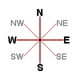
| Compass directions | Map directions given using eight point compass N, NE, E, SE, S, SW, W, NW N. In ordnance survey north will be taken following the grid lines vertically. |
| Cross sections | How to construct a cross section along a line: 1- Place edge of piece of paper along the cross section 2- Mark the heights on the paper where the paper crosses the contour lines, mark the spot height which shows the top of the hill. 3- Remove the piece of paper with the heights marked on it and place it on some graph paper, draw a vertical scale and mark points on the graph at the correct height. 4- Join up the crosses to show the shape of the land. You can be asked to identify certain physical or human features and locate them on the cross section you've drawn or been given, in some instances you may be asked to explain your labels - may have to annotate |
| Patterns of human and physical features | Human and physical features include patterns of vegetation ex. woodland, land use ex. urban or rural and communication networks ex. road and railways. To describe these: 1- Begin with general statement about where the settlement is located on the map like in the south-east. 2- Then go into greater detail like 'the settlement is along the lines of communication at the bottom of a steep slope'. Example mentions both physical and human feature which must do. 3- You should then be more specific and include in the answer the name of the road and heigh of the land. |
| Graphical skills: Bar charts | One of the simplest form of displaying data, each bar same width but with varying length dependant on figure plotted (Why are you typing this you know it already) - Simple bar charts drawn with bars at an equal distance apart and portray distinct data, each bar represents a distinct piece of information they should each be a separate colour. - histograms used to portray more continuous data like rainfall on a climate graph, these portray continuous data they should be coloured the same. - In compound bar charts bar is subdivided on basis of information being displayed - sectors of industry in different countries ex. - Another form of histogram is the population pyramid, constructed in a number different ways usually a five or ten year age groups with males on one side and females on the other. lines are drawn horizontally are are the same width, length of the bars is determined by the number of people in that age group or the percentage of the total population that age group represents. |
| Graphical skills: Isolines | These join places of equal value special ones are: - Contours which join places on a map of equal height - Isobars which are used on weather maps to join places of equal atmospheric pressure - Isohyets which join places of equal rainfall. Points to consider when drawing: 1- Isolines join up places of equal value 2- Isolines cannot cross each other 3- Interval between isolines must be the same ex. isochrone lines on the map drawn at five minute intervals. Contours on OS maps shown every 10m. |
| Graphical lines: Flow line maps | These show movement between places, the direction of the line shows the direction of the flow. The thickness of the line shows the amount of the flow it's essential when drawing flow lines the appropriate scale is used to keep the background as plain as possible to avoid clutter. |
| Geographical enquiry skills | Skiss used in controlled assessment, geographical enquiry skills may be tested in this unit by this unit by evidence provided on the exam paper which will then have to describe, explain or interpret. may also be asked about the appropriateness of data collection techniques that you have used to complete fieldwork. |
| ICT skills | Can appear in a written form, won't have access to computer but could show your skills in ICT, questions could be asked on how to extract info from the internet. Ex. info could be supplied and you could be asked how you would research further details. Can be asked about databases like the Census, Census data could be given to be interpreted or compare one ward within an urban area with another. Other questions could require you to complete data presentation like the annotation of photos, could also be questions which use satellite imagery and hence you should be familiar with use of ICT. |
| Geographical Information System (GIS) skills | Now major parts of our lives ex. satnav (satellite navigating system), a geographical information system has a map as a base and layers of other information on top of it. Can be done using tracing paper or clear acetate sheets, clear paper bur now commonly done using computer databases. Ex. Census data can be plotted onto a base map of an urban area to show characteristics like crime rates and population structure. Exam questions could be asked about how the map was compiled and why it is a good way of displaying information. Hence examination question are about the principles of GIS could be asked about the uses of GIS. |
| Advantages of GIS | Lot of information can be seen on one map, information can be linked easily in layers to show patterns that can be analysed, GIS is now readily available on smartphones, great benefit to many public services like the police and utilities, GPS has made travel between places much easier. |
| Disadvantages of GIS | Information can become to see if too much is put onto one map - too condensed, computer or other ICT equipment required as maps are digital, equipment is expensive to buy and keep up to date, certain amount of training is need to use the more sophisticated systems. |
| Uses of GIS | Supermarkets use GIS when deciding where to locate new stores, will find info on population density, land for sale, transport routes and info about the local residents. All info will be put in layers onto a base map of an area. Operations team of the supermarket will then decide by looking at the mpas where the best place is to locate the store. First brigade use GIS to decide where crew will be sent out as the first response t a fire, call will come to the fire brigade central control, will use GIS to quickly locate where the fire is occurring, next layer will have all the available fire stations, there is then a layer which shows any traffic problems in that area at the time of the call, the central control will then use all this info to decide which crew will have the fastest response time, all this can be done in seconds. |
Want to create your own Flashcards for free with GoConqr? Learn more.