
Mind map
Ganges River, Bangladesh
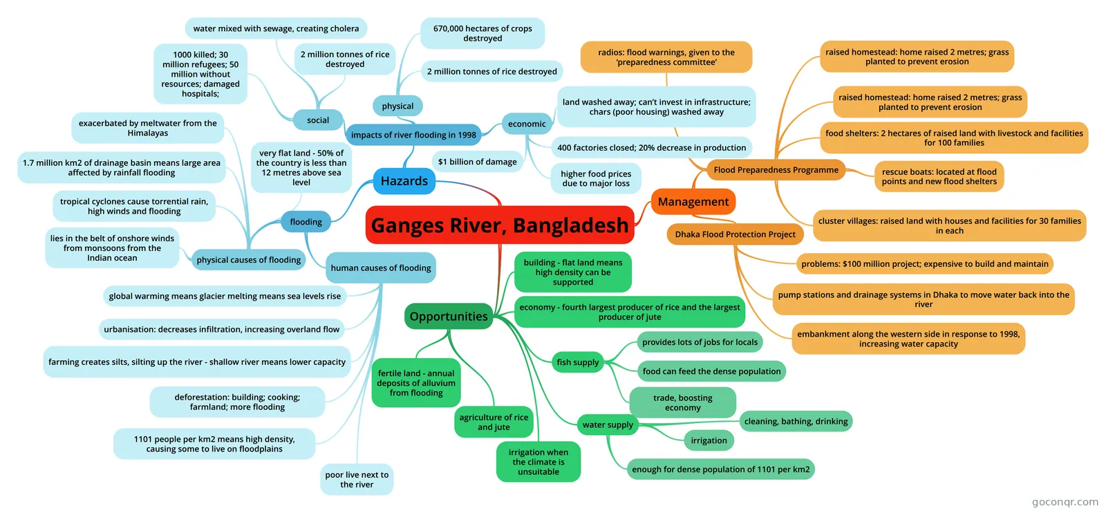
Mind map: Ganges River, Bangladesh
Map content
Ganges River, Bangladesh
Opportunities
- fertile land - annual deposits of alluvium from flooding
- agriculture of rice and jute
- irrigation when the climate is unsuitable
- water supply
- enough for dense population of 1101 per km2
- irrigation
- cleaning, bathing, drinking
- fish supply
- trade, boosting economy
- food can feed the dense population
- provides lots of jobs for locals
- building - flat land means high density can be supported
- economy - fourth largest producer of rice and the largest producer of jute
Hazards
- flooding
- human causes of flooding
- poor live next to the river
- 1101 people per km2 means high density, causing some to live on floodplains
- deforestation: building; cooking; farmland; more flooding
- farming creates silts, silting up the river - shallow river means lower capacity
- urbanisation: decreases infiltration, increasing overland flow
- global warming means glacier melting means sea levels rise
- physical causes of flooding
- lies in the belt of onshore winds from monsoons from the Indian ocean
- tropical cyclones cause torrential rain, high winds and flooding
- 1.7 million km2 of drainage basin means large area affected by rainfall flooding
- exacerbated by meltwater from the Himalayas
- very flat land - 50% of the country is less than 12 metres above sea level
- human causes of flooding
- impacts of river flooding in 1998
- social
- 1000 killed; 30 million refugees; 50 million without resources; damaged hospitals;
- water mixed with sewage, creating cholera
- 2 million tonnes of rice destroyed
- physical
- 670,000 hectares of crops destroyed
- 2 million tonnes of rice destroyed
- economic
- $1 billion of damage
- higher food prices due to major loss
- 400 factories closed; 20% decrease in production
- land washed away; can’t invest in infrastructure; chars (poor housing) washed away
- social
- flooding
Management
- Dhaka Flood Protection Project
- embankment along the western side in response to 1998, increasing water capacity
- pump stations and drainage systems in Dhaka to move water back into the river
- problems: $100 million project; expensive to build and maintain
- Flood Preparedness Programme
- cluster villages: raised land with houses and facilities for 30 families in each
- rescue boats: located at flood points and new flood shelters
- food shelters: 2 hectares of raised land with livestock and facilities for 100 families
- raised homestead: home raised 2 metres; grass planted to prevent erosion
- raised homestead: home raised 2 metres; grass planted to prevent erosion
- radios: flood warnings, given to the ‘preparedness committee’
- Dhaka Flood Protection Project
Information
- Description
- Mind Map on Ganges River, Bangladesh, created by I Goh on 19/08/2019.
- Created by
- I Goh
- Views
- 2
- Rating