
Mapa mental
New rivers mindmap gcse geo
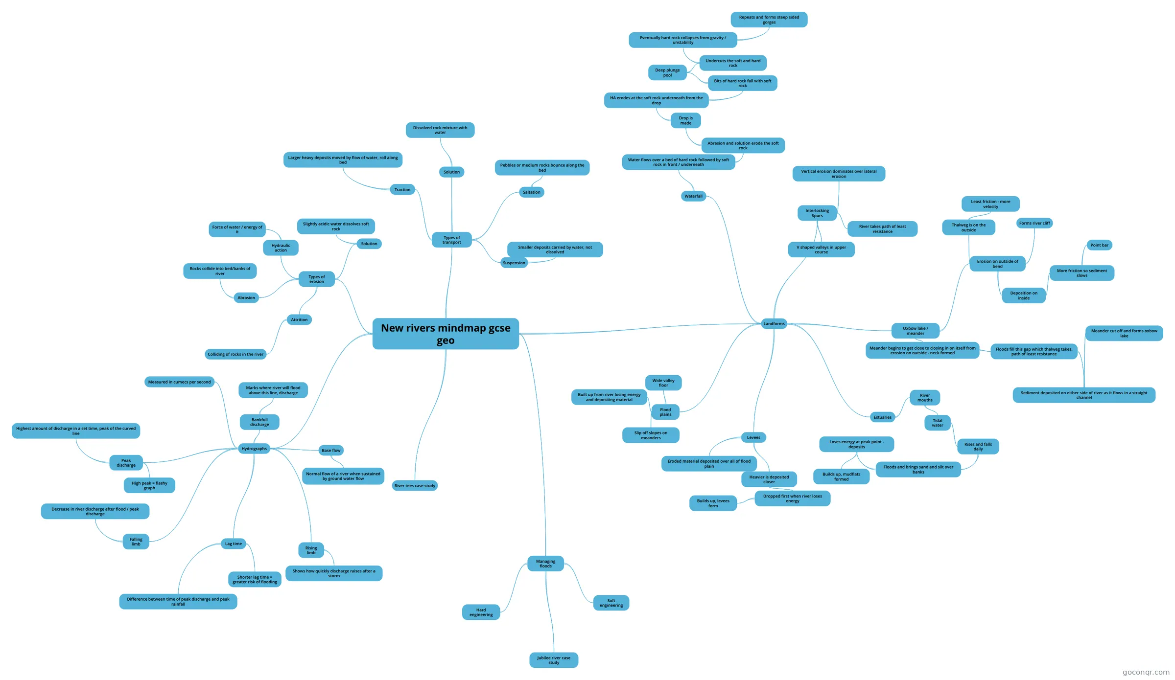
Mind map: Rivers GCSE geography
Conteúdo do mapa
New rivers mindmap gcse geo
Types of erosion
- Hydraulic action
- Force of water / energy of it
- Abrasion
- Rocks collide into bed/banks of river
- Solution
- Slightly acidic water dissolves soft rock
- Attrition
- Colliding of rocks in the river
- Hydraulic action
Types of transport
- Traction
- Larger heavy deposits moved by flow of water, roll along bed
- Saltation
- Pebbles or medium rocks bounce along the bed
- Suspension
- Smaller deposits carried by water, not dissolved
- Solution
- Dissolved rock mixture with water
- Traction
Landforms
- Waterfall
- Water flows over a bed of hard rock followed by soft rock in front / underneath
- Abrasion and solution erode the soft rock
- Drop is made
- HA erodes at the soft rock underneath from the drop
- Bits of hard rock fall with soft rock
- Deep plunge pool
- Undercuts the soft and hard rock
- Eventually hard rock collapses from gravity / unstability
- Repeats and forms steep sided gorges
- Eventually hard rock collapses from gravity / unstability
- Undercuts the soft and hard rock
- Deep plunge pool
- Bits of hard rock fall with soft rock
- HA erodes at the soft rock underneath from the drop
- Drop is made
- Abrasion and solution erode the soft rock
- Water flows over a bed of hard rock followed by soft rock in front / underneath
- Oxbow lake / meander
- Erosion on outside of bend
- Thalweg is on the outside
- Least friction - more velocity
- Deposition on inside
- More friction so sediment slows
- Point bar
- More friction so sediment slows
- Forms river cliff
- Thalweg is on the outside
- Meander begins to get close to closing in on itself from erosion on outside - neck formed
- Floods fill this gap which thalweg takes, path of least resistance
- Sediment deposited on either side of river as it flows in a straight channel
- Meander cut off and forms oxbow lake
- Sediment deposited on either side of river as it flows in a straight channel
- Floods fill this gap which thalweg takes, path of least resistance
- Erosion on outside of bend
- Levees
- Eroded material deposited over all of flood plain
- Heavier is deposited closer
- Dropped first when river loses energy
- Builds up, levees form
- Dropped first when river loses energy
- Interlocking Spurs
- Vertical erosion dominates over lateral erosion
- V shaped valleys in upper course
- River takes path of least resistance
- Flood plains
- Wide valley floor
- Built up from river losing energy and depositing material
- Slip off slopes on meanders
- Estuaries
- River mouths
- Tidal water
- Rises and falls daily
- Floods and brings sand and silt over banks
- Loses energy at peak point - deposits
- Builds up, mudflats formed
- Loses energy at peak point - deposits
- Floods and brings sand and silt over banks
- Rises and falls daily
- Tidal water
- River mouths
- Waterfall
Hydrographs
- Measured in cumecs per second
- Peak discharge
- Highest amount of discharge in a set time, peak of the curved line
- High peak = flashy graph
- Lag time
- Difference between time of peak discharge and peak rainfall
- Shorter lag time = greater risk of flooding
- Rising limb
- Shows how quickly discharge raises after a storm
- Falling limb
- Decrease in river discharge after flood / peak discharge
- Base flow
- Normal flow of a river when sustained by ground water flow
- Bankfull discharge
- Marks where river will flood above this line, discharge
River tees case study
Managing floods
- Hard engineering
- Soft engineering
- Jubilee river case study
Informações
- Descrição
- GCSE Chemistry Mapa Mental sobre New rivers mindmap gcse geo, criado por Owen . em 08-05-2026.
- Criado por
- Owen .
- Visualizações
- 2
- Avaliação