
Mind map
River Conwy Investigation
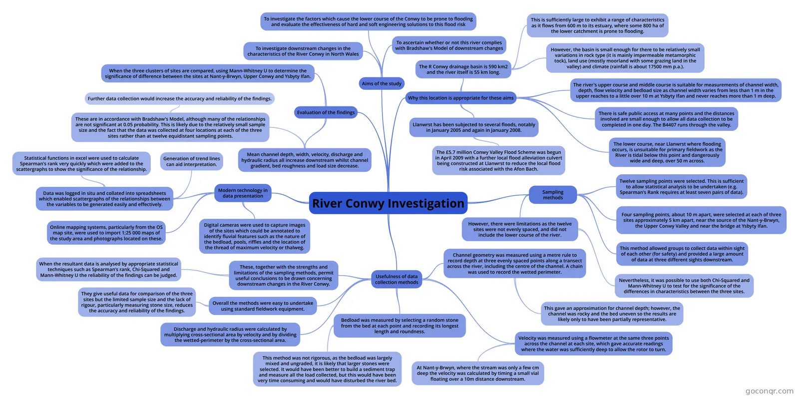
Mind map: River Conwy investigation
Map content
River Conwy Investigation
Aims of the study
- To investigate downstream changes in the characteristics of the River Conwy in North Wales
- To ascertain whether or not this river complies with Bradshaw's Model of downstream changes
- To investigate the factors which cause the lower course of the Conwy to be prone to flooding and evaluate the effectiveness of hard and soft engineering solutions to this flood risk
Why this location is appropriate for these aims
- The R Conwy drainage basin is 590 km2 and the river itself is 55 km long.
- This is sufficiently large to exhibit a range of characteristics as it flows from 600 m to its estuary, where some 800 ha of the lower catchment is prone to flooding.
- However, the basin is small enough for there to be relatively small variations in rock type (it is mainly impermeable metamorphic tock), land use (mostly moorland with some grazing land in the valley) and climate (rainfall is about 17500 mm p.a.).
- The river's upper course and middle course is suitable for measurements of channel width, depth, flow velocity and bedload size as channel width varies from less than 1 m in the upper reaches to a little over 10 m at Ysbyty Ifan and never reaches more than 1 m deep.
- There is safe public access at many points and the distances involved are small enough to allow all data collection to be completed in one day. The B4407 runs through the valley.
- The lower course, near Llanwrst where flooding occurs, is unsuitable for primary fieldwork as the River is tidal below this point and dangerously wide and deep, over 50 m across.
- Llanwrst has been subjected to several floods, notably in January 2005 and again in January 2008.
- The £5.7 million Conwy Valley Flood Scheme was begun in April 2009 with a further local flood alleviation culvert being constructed at Llanwrst to reduce the local flood risk associated with the Afon Bach.
- The R Conwy drainage basin is 590 km2 and the river itself is 55 km long.
Sampling methods
- Twelve sampling points were selected. This is sufficient to allow statistical analysis to be undertaken (e.g. Spearman's Rank requires at least seven pairs of data).
- Four sampling points, about 10 m apart, were selected at each of three sites approximately 5 km apart, near the source of the Nant-y-Brwyn, the Upper Conwy Valley and near the bridge at Ysbyty Ifan.
- This method allowed groups to collect data within sight of each other (for safety) and provided a large amount of data at three different sights downstream.
- However, there were limitations as the twelve sites were not evenly spaced, and did not include the lower course of the river.
- Nevertheless, it was possible to use both Chi-Squared and Mann-Whitney U to test for the significance of the differences in characteristics between the three sites.
Usefulness of data collection methods
- Channel geometry was measured using a metre rule to record depth at three evenly spaced points along a transect across the river, including the centre of the channel. A chain was used to record the wetted perimeter.
- This gave an approximation for channel depth; however, the channel was rocky and the bed uneven so the results are likely only to have been partially representative.
- Velocity was measured using a flowmeter at the same three points across the channel at each site, which gave accurate readings where the water was sufficiently deep to allow the rotor to turn.
- At Nant-y-Brwyn, where the stream was only a few cm deep the velocity was calculated by timing a small vial floating over a 10m distance downstream.
- Bedload was measured by selecting a random stone from the bed at each point and recording its longest length and roundness.
- This method was not rigorous, as the bedload was largely mixed and ungraded, it is likely that larger stones were selected. It would have been better to build a sediment trap and measure all the load collected, but this would have been very time consuming and would have disturbed the river bed.
- Discharge and hydraulic radius were calculated by multiplying cross-sectional area by velocity and by dividing the wetted-perimeter by the cross-sectional area.
- Overall the methods were easy to undertake using standard fieldwork equipment.
- They give useful data for comparison of the three sites but the limited sample size and the lack of rigour, particularly measuring stone size, reduces the accuracy and reliability of the findings.
- These, together with the strengths and limitations of the sampling methods, permit useful conclusions to be drawn concerning downstream changes in the River Conwy.
- When the resultant data is analysed by appropriate statistical techniques such as Spearman's rank, Chi-Squared and Mann-Whitney U the reliability of the findings can be judged.
- Channel geometry was measured using a metre rule to record depth at three evenly spaced points along a transect across the river, including the centre of the channel. A chain was used to record the wetted perimeter.
Modern technology in data presentation
- Digital cameras were used to capture images of the sites which could be annotated to identify fluvial features such as the nature of the bedload, pools, riffles and the location of the thread of maximum velocity or thalweg.
- Online mapping systems, particularly from the OS map site, were used to import 1;25 000 maps of the study area and photographs located on these.
- Data was logged in situ and collated into spreadsheets which enabled scattergraphs of the relationships between the variables to be generated easily and effectively.
- Generation of trend lines can aid interpretation.
- Statistical functions in excel were used to calculate Spearman's rank very quickly which were added to the scattergraphs to show the significance of the relationship.
Evaluation of the findings
- Mean channel depth, width, velocity, discharge and hydraulic radius all increase downstream whilst channel gradient, bed roughness and load size decrease.
- These are in accordance with Bradshaw's Model, although many of the relationships are not significant at 0.05 probability. This is likely due to the relatively small sample size and the fact that the data was collected at four locations at each of the three sites rather than at twelve equidistant sampling points.
- Further data collection would increase the accuracy and reliability of the findings.
- These are in accordance with Bradshaw's Model, although many of the relationships are not significant at 0.05 probability. This is likely due to the relatively small sample size and the fact that the data was collected at four locations at each of the three sites rather than at twelve equidistant sampling points.
- When the three clusters of sites are compared, using Mann-Whitney U to determine the significance of difference between the sites at Nant-y-Brwyn, Upper Conwy and Ysbyty Ifan.
- Mean channel depth, width, velocity, discharge and hydraulic radius all increase downstream whilst channel gradient, bed roughness and load size decrease.
Information
- Description
- Mind Map on River Conwy Investigation, created by l3wis.t on 09/05/2016.
- Created by
- l3wis.t
- Views
- 1
- Rating