
Mapa mental
Depositional Landforms
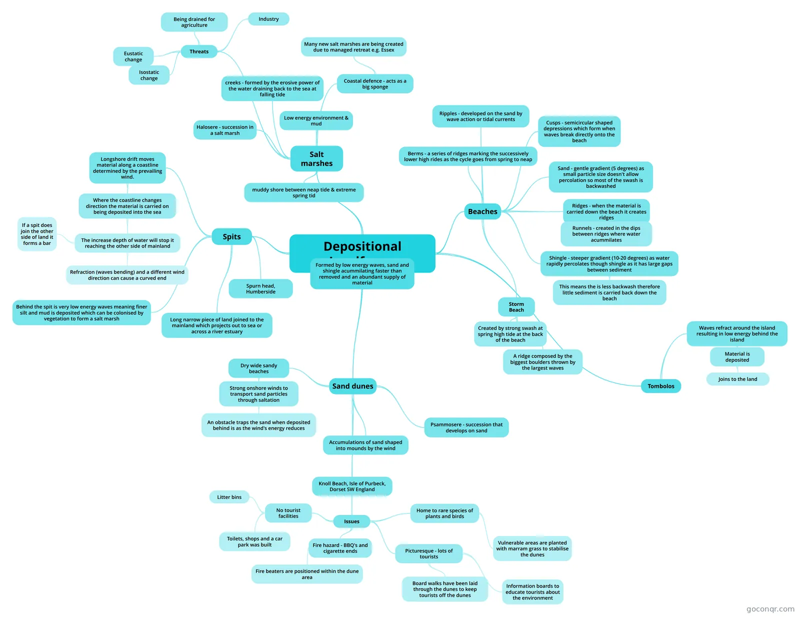
Mind map: Depositional landforms
Contenido del mapa
Depositional Landforms
Formed by low energy waves, sand and shingle acummilating faster than removed and an abundant supply of material
Beaches
- Sand - gentle gradient (5 degrees) as small particle size doesn't allow percolation so most of the swash is backwashed
- Ridges - when the material is carried down the beach it creates ridges
- Runnels - created in the dips between ridges where water acummilates
- Storm Beach
- Created by strong swash at spring high tide at the back of the beach
- A ridge composed by the biggest boulders thrown by the largest waves
- Berms - a series of ridges marking the successively lower high rides as the cycle goes from spring to neap
- Shingle - steeper gradient (10-20 degrees) as water rapidly percolates though shingle as it has large gaps between sediment
- This means the is less backwash therefore little sediment is carried back down the beach
- Cusps - semicircular shaped depressions which form when waves break directly onto the beach
- Ripples - developed on the sand by wave action or tidal currents
Spits
- Long narrow piece of land joined to the mainland which projects out to sea or across a river estuary
- Longshore drift moves material along a coastline determined by the prevailing wind.
- Where the coastline changes direction the material is carried on being deposited into the sea
- The increase depth of water will stop it reaching the other side of mainland
- Refraction (waves bending) and a different wind direction can cause a curved end
- If a spit does join the other side of land it forms a bar
- The increase depth of water will stop it reaching the other side of mainland
- Where the coastline changes direction the material is carried on being deposited into the sea
- Behind the spit is very low energy waves meaning finer silt and mud is deposited which can be colonised by vegetation to form a salt marsh
- Spurn head, Humberside
Sand dunes
- Psammosere - succession that develops on sand
- Accumulations of sand shaped into mounds by the wind
- Dry wide sandy beaches
- Strong onshore winds to transport sand particles through saltation
- An obstacle traps the sand when deposited behind is as the wind's energy reduces
- Strong onshore winds to transport sand particles through saltation
- Knoll Beach, Isle of Purbeck, Dorset SW England
- Issues
- Home to rare species of plants and birds
- Vulnerable areas are planted with marram grass to stabilise the dunes
- Fire hazard - BBQ's and cigarette ends
- Fire beaters are positioned within the dune area
- No tourist facilities
- Toilets, shops and a car park was built
- Litter bins
- Picturesque - lots of tourists
- Board walks have been laid through the dunes to keep tourists off the dunes
- Information boards to educate tourists about the environment
- Home to rare species of plants and birds
Salt marshes
- muddy shore between neap tide & extreme spring tid
- Halosere - succession in a salt marsh
- Low energy environment & mud
- creeks - formed by the erosive power of the water draining back to the sea at falling tide
- Coastal defence - acts as a big sponge
- Many new salt marshes are being created due to managed retreat e.g. Essex
- Threats
- Industry
- Being drained for agriculture
- Eustatic change
- Isostatic change
Tombolos
- Waves refract around the island resulting in low energy behind the island
- Material is deposited
- Joins to the land
- Material is deposited
- Waves refract around the island resulting in low energy behind the island
Información
- Descripción
- (Coasts) Geography Mapa Mental sobre Depositional Landforms, creado por maddiemurchie23 el 16/04/2013.
- Creado por
- maddiemurchie23
- Visitas
- 121
- Etiquetas
- Valoración
Más sobre Coastal Depositional Landforms