2441239
Description
Flashcards by Holly Hughes, updated more than 1 year ago
|
|
Created by Holly Hughes
about 9 years ago
|
|
| Question | Answer |
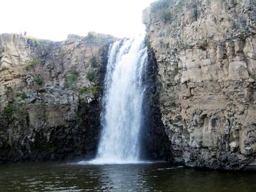
| Formation of a Waterfall | ・hard rock overlays soft rock ・less resistant rock erodes faster (by abrasion and hydraulic action) leaving an elevated platform of hard rock ・the process continues to create an undercutting with a plunge pool at the base ・rocks that fall into pool become erosive tools in the formation of a gorge after continual retreat |
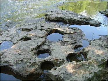
| Formation of Potholes | ・water flows over the bed load ・the sediment erodes the bed by abrasion causing depressions ・rocks get trapped in the depressions and become erosive tools, they swirl with the turbulent flow in eddies to deepen the depressions into potholes ・this is common in plunge pools due to the very turbulent flow |
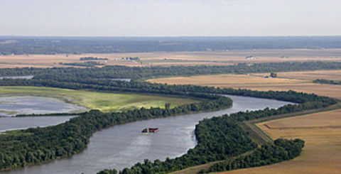
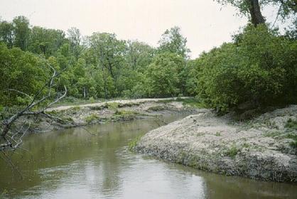
| Formation of Meanders | ・meanders form due to the alternation in shallow riffles and deep pools and lateral erosion ・pools have more energy and therefore greater erosive power whereas energy is lost due to friction at riffles causing more deposition ・this causes irregular, helicoidal flow which follows the thalweg ・when the water is strong by the bank (outer bend) erosion is dominant because the section is deeper and has more energy ・opposite is the inside bend where deposition of material is occurring due to it being shallower and therefore having less energy |
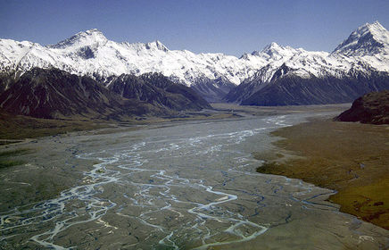
| Formation of Braided Stream | ・Braiding is common in streams with variable discharge and the load is large ・Rivers with a high load and low velocity cause rivers to become clogged ・this is because discharge falls and capacity and competence are reduced ・the sediment which clogs the channel causes it to converge and diverge into sections. ・islands of deposition which the channel moves around are called eyots |
| Formation of a Floodplain | ・large flat areas of land located on either side of the river ・meanders migrate due to lateral erosion which flattens the land ・when the river floods, the friction is large and velocity falls causing deposition ・the sediment deposited is silt and alluvium which is very fertile |
| Formation of Levees | ・water overflows its banks and there is a decrease in velocity due to friction ・Hjulstrom's Curve says large particles are deposited first and smaller particles spread further ・the continual process increases the height of the river and is a natural prevention of river flooding |
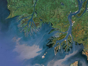
| Formation of Deltas | ・the river velocity and competence decrease as the river reaches the mouth ・they only form when deposition exceeds sediment removal (erosion) ・when the fresh water of the river and the salt water of the sea meet, there is an electrical charge ・this causes clay particles to coagulate in a process called flocculation ・the particles sink clogging the pathway to the sea causing the river to enter in different pathways |
Want to create your own Flashcards for free with GoConqr? Learn more.