
Mind map
RIVERS
Map content
RIVERS
Processes
- Solution
- Small rocks are dissolved by weak acids
- Abrasion
- Rocks wear down the river bed
- Attrition
- Rocks get smaller by hitting each other
- Hydraulic action
- Water traps air in cracks and weakens the bank
- Traction
- Rocks roll along the river bed
- Saltation
- Rocks bounce along the river bed
- Suspension
- Rocks float along the river
- Deposition
- The river drops its load
- Solution
Drainage basin
- Source
- Where the river starts
- Tributary
- A small river
- Confluence
- Where two tributaries meet
- Channel
- Where the water flows
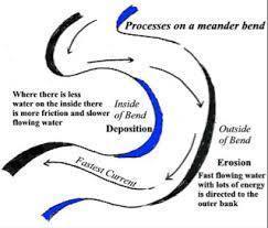
- Meander
- A bend in the river
- Mouth
- Where the river meets the sea
- Floodplain
- The area around a river that can flood
- Watershed
- Where all precipitation that lands in the area flows into the river
- Source
River long and landforms
- Changes downstream
- Upper course
- Steep
- Narrow
- Rockey
- Waterfalls
- Slow
- Shallow
- Middle course
- Wider
- Deeper
- Meanders
- Deposition
- Rapids
- Lower course
- Wide
- Deep
- Ends at the sea
- Upper course
- Landforms
- Meanders
- A bend in the river
- A lateral formation
- Found in the middle course
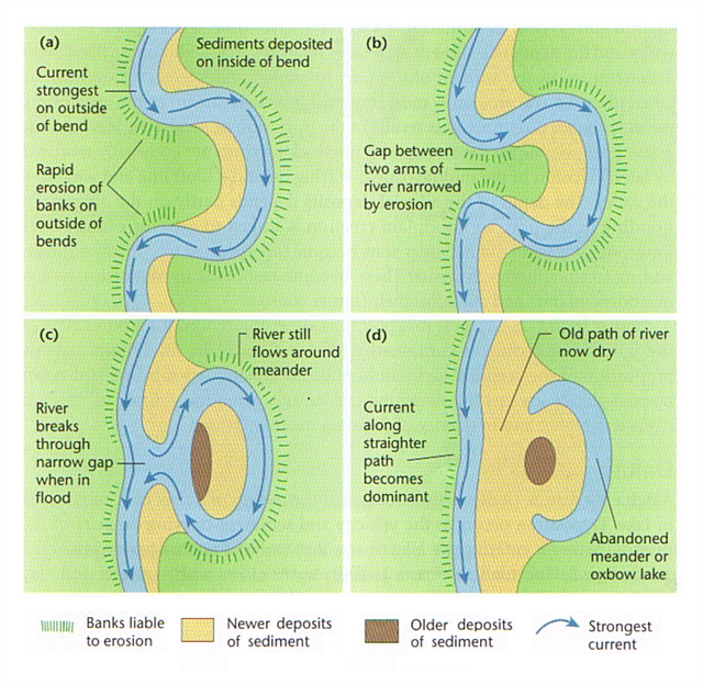
- Oxbow lakes
- Luck mere
- Where a meander joins and leaves a circular trench
- Found in the middle course
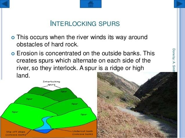
- V-shaped valleys and interlocking spurs
- Resistant rock left behind after erosion
- The V-shaped valley cuts down deep into the rock leaving a V-shaped cross section
- Interlocking spurs are where a V-shaped valley meanders around hard rock leaving interlocking rocks
- Found in the upper course
- The River Severn
- Resistant rock left behind after erosion
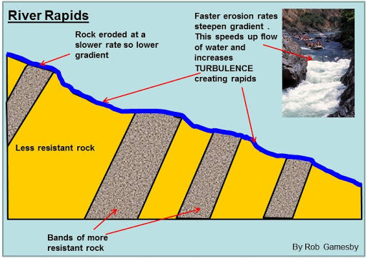
- Rapids
- Found in the upper course and the middle course of the river
- Formed when fast waters move over hard and soft rock
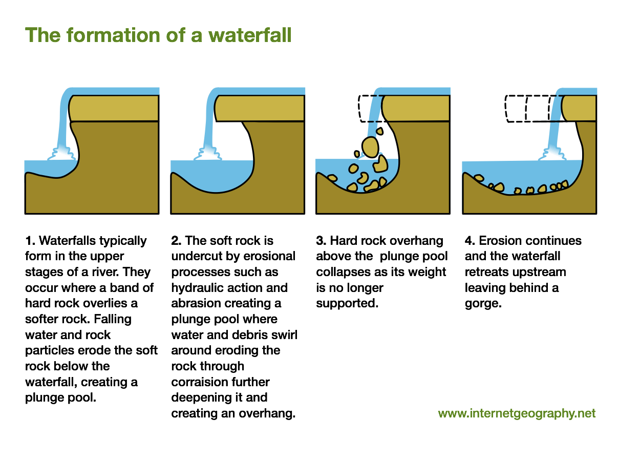
- Waterfalls
- Found in the upper course of the river
- Niagera falls
- Formed by water falling off a cliff and undercutting the cliff to form a platform that falls and retreats
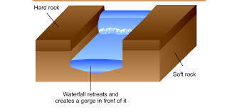
- Gorges
- A narrow and steep shaped valley
- Found in the upper course of the river
- Formed when a waterfall retreats
- Cheddar gorge
- Floodplains
- The area of land where the river floods
- Found in the middle course and the lower course of the river
- Glouster
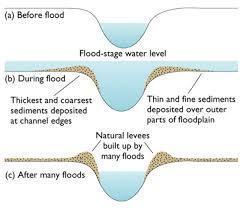
- Levees
- Natural barriers that build over time and help lower the risk of flooding
- Found in the middle course and the lower course of the river
- Glouster
- Meanders
- Changes downstream
River flooding
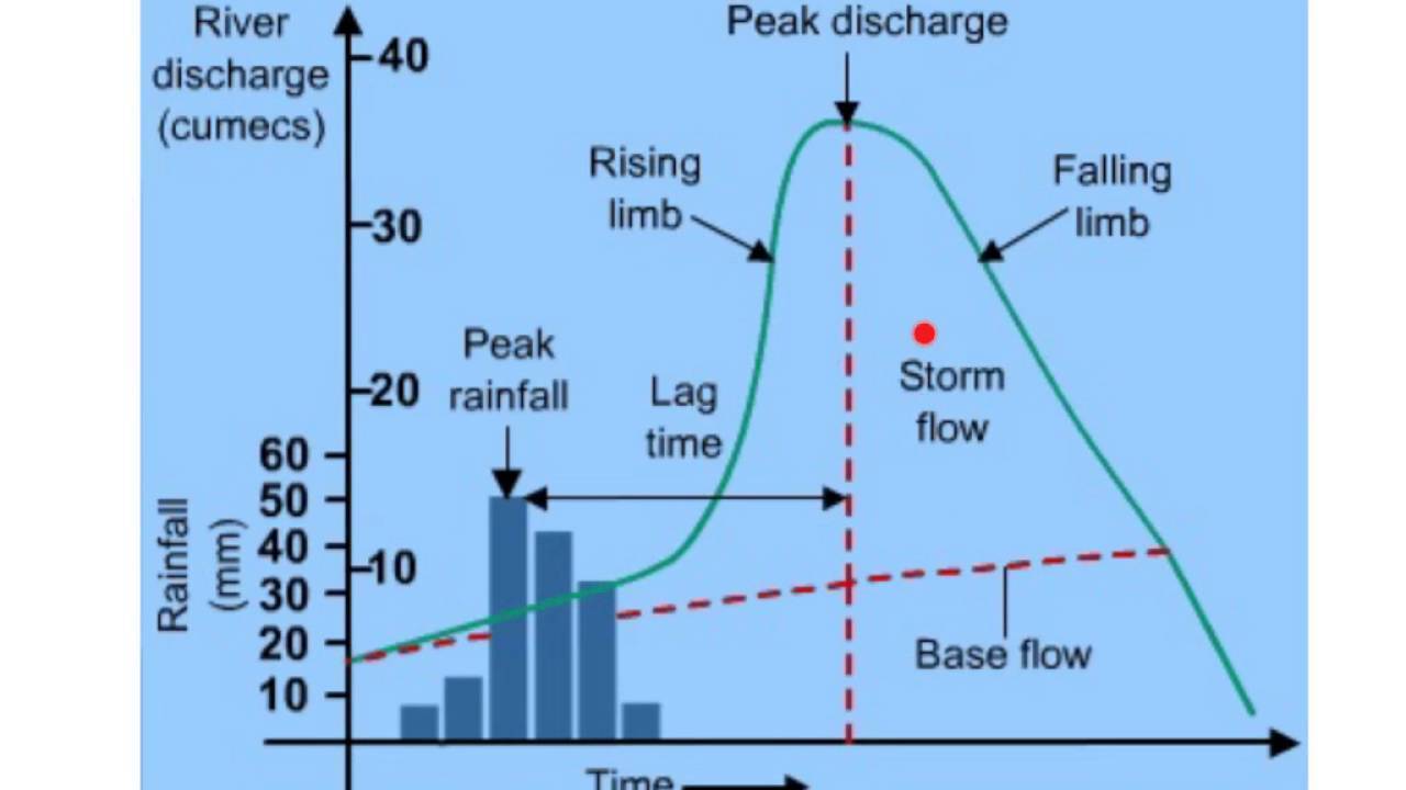
- Flood Hydrographs
- The discharge is the amount of water in the river channel at a certain point along the river
- The lag time is the amount of time between the peak rainfall and the peak discharge
- Flood management stratagies
- Hard engineering
- Flood walls
- Simple walls built around rivers to prevent overflowing
- Man made levee
- Levees form naturally over time and multiple floods. A man made levee just speeds up the process and doesn't need floods to be built
- Sand bags
- Placing sandbags around rivers absorbs both water its energy. They are cheap but only work for small floods
- Re-routing rivers
- Digging a new path to redirect rivers can help by both leading them away form human inhabited areas and making a wider channel for more water to fit in
- Dams
- Dams take a lot of work and money to build but are often effective once they are. They involve creating a reservoir by flooding an area and then building a large wall that slowly allows the water to fall at a rate that the river can hold.
- Flood walls
- Soft engineering
- Tree planting
- Tree planting helps by holding ground together to strengthen the soil (less erosion from the river) and sucking up water so the river can take in more
- Dredging
- Digging out areas to help the river hold more water
- Flood water punping
- Building pipes in areas prone to flooding to pump water away when there is a flood
- Floodplain zoning
- Mapping out areas that are likely to flood and not building settlements in those areas
- Tree planting
- Case study
- Cockermouth
- Location: Cumbria, North-West of England
- On the confluence of the River Cocker as it joins River Derwent
- The area is a Site of Special Scientific Interest (SSSI)
- On the confluence of the River Cocker as it joins River Derwent
- A big flood in November 2009 with water levels at 2.5 meters cost £276 million in damage
- 2013 flood defence scheme
- Self-closing barriers which only close when the river floods
- A 180 meter embankment
- Flood proofing for existing properties
- Eight new flood gates
- Cost £4.4 million to complete
- It has little impact on the environment and preserves the historical surroundings
- The scheme alerts people by text or email when the barriers start to rise so preparations and evacuations can begin
- Location: Cumbria, North-West of England
- Cockermouth
- Hard engineering
- Flood Hydrographs
Images and files in the map
Information
- Description
- GCSE Geography Mind Map on RIVERS, created by Hannah Sargent on 03/03/2020.
- Created by
- Hannah Sargent
- Views
- 1
- History
-
- Created by Amy Taylor · Mar 1, 2020
- Copied by Hannah Sargent · Mar 3, 2020
- Rating