
Mind map
suitable management of rivers
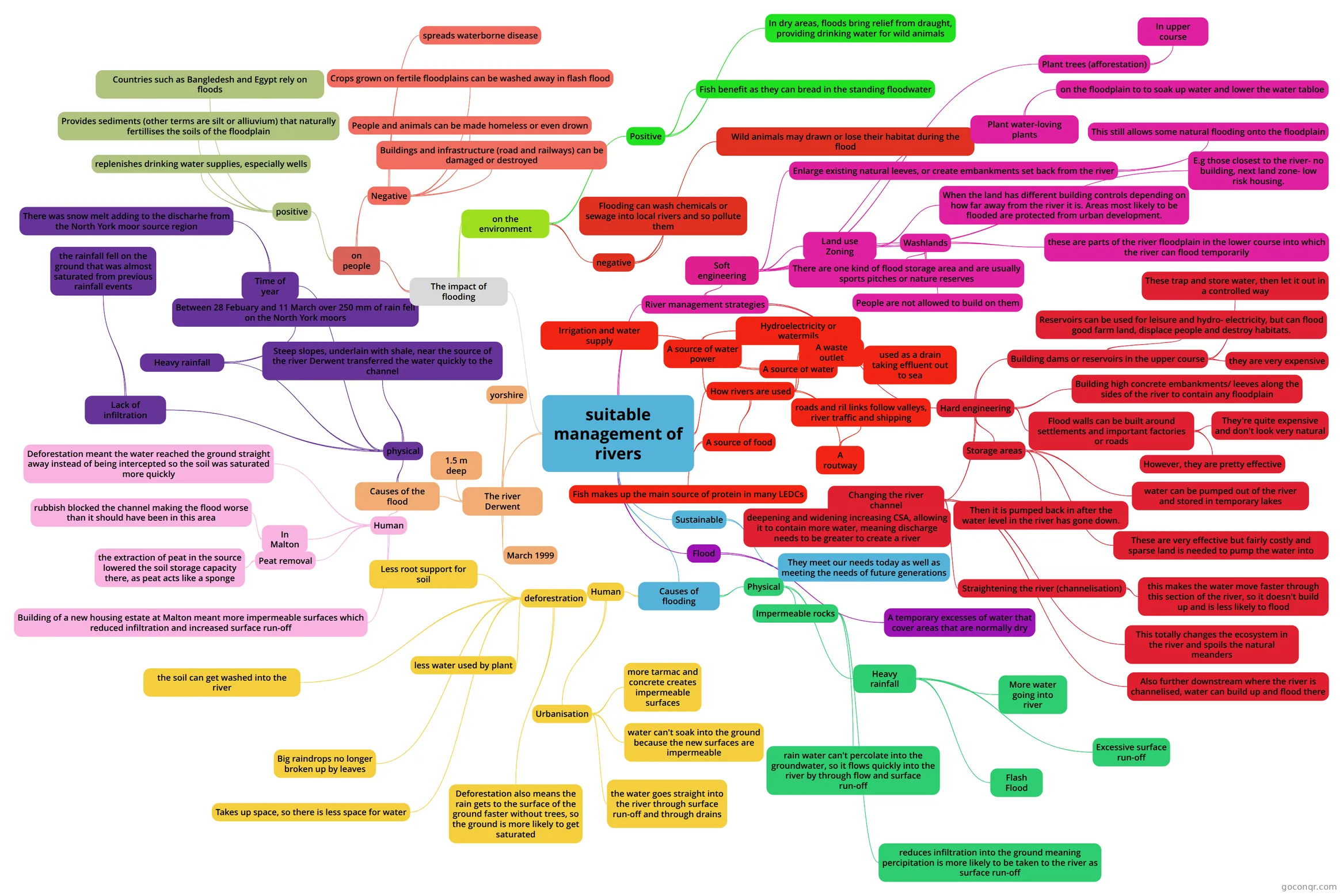
Mind map: suitable management of rivers
Map content
suitable management of rivers
How rivers are used
- A source of water
- Irrigation and water supply
- A source of water power
- Hydroelectricity or watermils
- A waste outlet
- used as a drain taking effluent out to sea
- A routway
- roads and ril links follow valleys, river traffic and shipping
- A source of food
- Fish makes up the main source of protein in many LEDCs
- A source of water
Sustainable
- They meet our needs today as well as meeting the needs of future generations
Flood
- A temporary excesses of water that cover areas that are normally dry
Causes of flooding
- Physical
- Heavy rainfall
- More water going into river
- Excessive surface run-off
- Flash Flood
- Impermeable rocks
- rain water can't percolate into the groundwater, so it flows quickly into the river by through flow and surface run-off
- reduces infiltration into the ground meaning percipitation is more likely to be taken to the river as surface run-off
- Heavy rainfall
- Human
- Urbanisation
- water can't soak into the ground because the new surfaces are impermeable
- the water goes straight into the river through surface run-off and through drains
- more tarmac and concrete creates impermeable surfaces
- deforestration
- Less root support for soil
- less water used by plant
- Big raindrops no longer broken up by leaves
- the soil can get washed into the river
- Takes up space, so there is less space for water
- Deforestation also means the rain gets to the surface of the ground faster without trees, so the ground is more likely to get saturated
- Urbanisation
- Physical
The river Derwent
- yorshire
- March 1999
- 1.5 m deep
- Causes of the flood
- physical
- Steep slopes, underlain with shale, near the source of the river Derwent transferred the water quickly to the channel
- Heavy rainfall
- Between 28 Febuary and 11 March over 250 mm of rain fell on the North York moors
- Lack of infiltration
- the rainfall fell on the ground that was almost saturated from previous rainfall events
- Time of year
- There was snow melt adding to the discharhe from the North York moor source region
- Human
- Deforestation meant the water reached the ground straight away instead of being intercepted so the soil was saturated more quickly
- In Malton
- rubbish blocked the channel making the flood worse than it should have been in this area
- Peat removal
- the extraction of peat in the source lowered the soil storage capacity there, as peat acts like a sponge
- Building of a new housing estate at Malton meant more impermeable surfaces which reduced infiltration and increased surface run-off
- physical
The impact of flooding
- on people
- positive
- replenishes drinking water supplies, especially wells
- Provides sediments (other terms are silt or alliuvium) that naturally fertillises the soils of the floodplain
- Countries such as Bangledesh and Egypt rely on floods
- Negative
- spreads waterborne disease
- People and animals can be made homeless or even drown
- Buildings and infrastructure (road and railways) can be damaged or destroyed
- Crops grown on fertile floodplains can be washed away in flash flood
- positive
- on the environment
- Positive
- Fish benefit as they can bread in the standing floodwater
- In dry areas, floods bring relief from draught, providing drinking water for wild animals
- negative
- Flooding can wash chemicals or sewage into local rivers and so pollute them
- Wild animals may drawn or lose their habitat during the flood
- Positive
- on people
River management strategies
- Soft engineering
- Plant trees (afforestation)
- In upper course
- Plant water-loving plants
- on the floodplain to to soak up water and lower the water tabloe
- Enlarge existing natural leeves, or create embankments set back from the river
- This still allows some natural flooding onto the floodplain
- Land use Zoning
- When the land has different building controls depending on how far away from the river it is. Areas most likely to be flooded are protected from urban development.
- E.g those closest to the river- no building, next land zone- low risk housing.
- Washlands
- these are parts of the river floodplain in the lower course into which the river can flood temporarily
- There are one kind of flood storage area and are usually sports pitches or nature reserves
- People are not allowed to build on them
- Plant trees (afforestation)
- Hard engineering
- Building dams or reservoirs in the upper course
- These trap and store water, then let it out in a controlled way
- Reservoirs can be used for leisure and hydro- electricity, but can flood good farm land, displace people and destroy habitats.
- they are very expensive
- Building high concrete embankments/ leeves along the sides of the river to contain any floodplain
- Flood walls can be built around settlements and important factories or roads
- They're quite expensive and don't look very natural
- However, they are pretty effective
- Storage areas
- water can be pumped out of the river and stored in temporary lakes
- Then it is pumped back in after the water level in the river has gone down.
- These are very effective but fairly costly and sparse land is needed to pump the water into
- Changing the river channel
- deepening and widening increasing CSA, allowing it to contain more water, meaning discharge needs to be greater to create a river
- Straightening the river (channelisation)
- this makes the water move faster through this section of the river, so it doesn't build up and is less likely to flood
- This totally changes the ecosystem in the river and spoils the natural meanders
- Also further downstream where the river is channelised, water can build up and flood there
- Building dams or reservoirs in the upper course
- Soft engineering
Information
- Description
- GCSE Geography Mind Map on suitable management of rivers, created by Hannah Ross8882 on 05/11/2015.
- Created by
- Hannah Ross8882
- Views
- 0
- Rating