
Mind map
Lecture 9: The hydrosphere and cryosphere
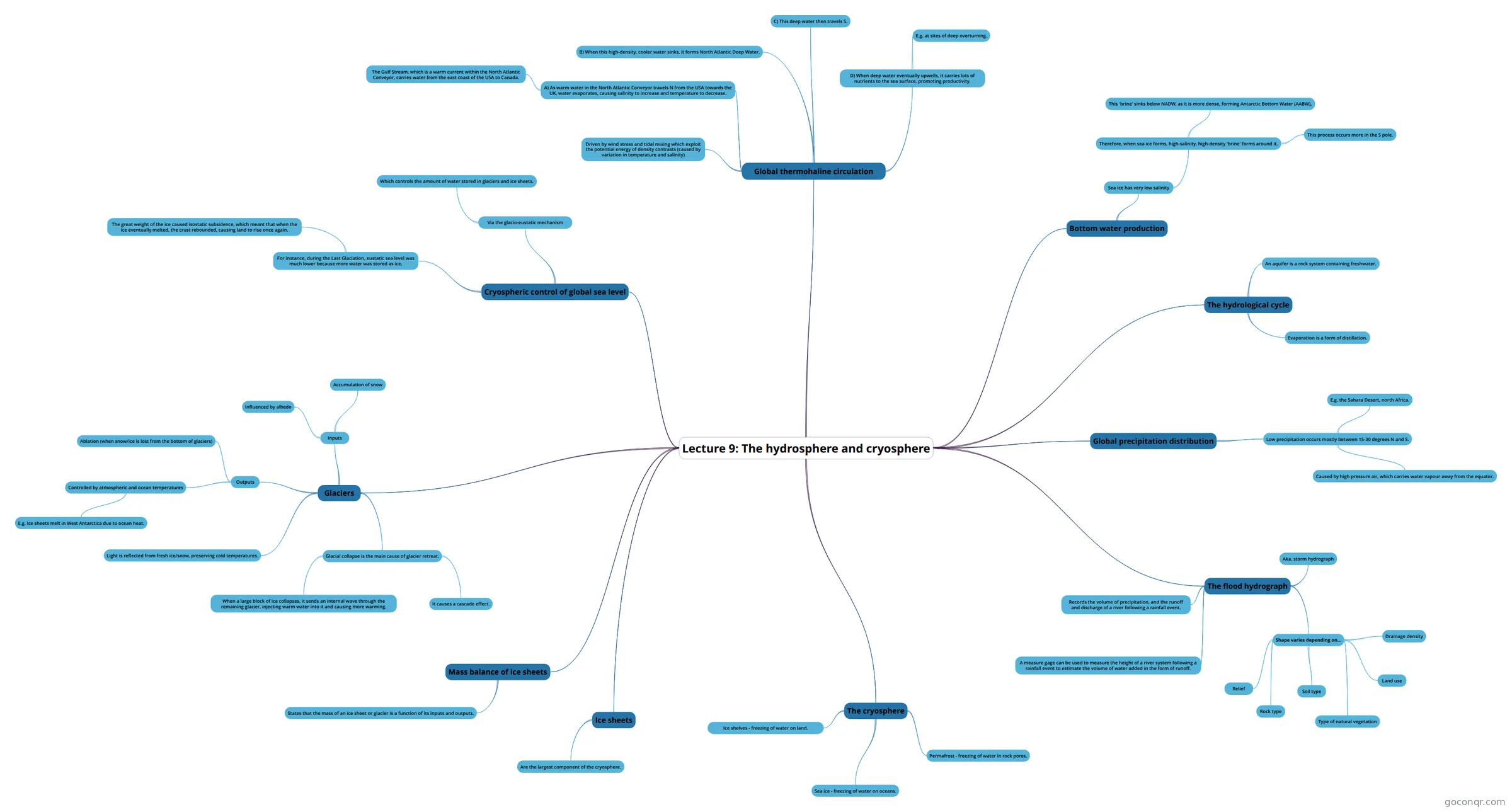
Mind map: The hydrosphere and cryosphere
Map content
Lecture 9: The hydrosphere and cryosphere
Global thermohaline circulation
- Driven by wind stress and tidal mixing which exploit the potential energy of density contrasts (caused by variation in temperature and salinity)
- A) As warm water in the North Atlantic Conveyor travels N from the USA towards the UK, water evaporates, causing salinity to increase and temperature to decrease.
- The Gulf Stream, which is a warm current within the North Atlantic Conveyor, carries water from the east coast of the USA to Canada.
- B) When this high-density, cooler water sinks, it forms North Atlantic Deep Water.
- C) This deep water then travels S.
- D) When deep water eventually upwells, it carries lots of nutrients to the sea surface, promoting productivity.
- E.g. at sites of deep overturning.
Bottom water production
- Sea ice has very low salinity
- Therefore, when sea ice forms, high-salinity, high-density 'brine' forms around it.
- This 'brine' sinks below NADW, as it is more dense, forming Antarctic Bottom Water (AABW).
- This process occurs more in the S pole.
- Therefore, when sea ice forms, high-salinity, high-density 'brine' forms around it.
- Sea ice has very low salinity
The hydrological cycle
- An aquifer is a rock system containing freshwater.
- Evaporation is a form of distillation.
Global precipitation distribution
- Low precipitation occurs mostly between 15-30 degrees N and S.
- E.g. the Sahara Desert, north Africa.
- Caused by high pressure air, which carries water vapour away from the equator.
- Low precipitation occurs mostly between 15-30 degrees N and S.
The flood hydrograph
- Aka. storm hydrograph
- Records the volume of precipitation, and the runoff and discharge of a river following a rainfall event.
- A measure gage can be used to measure the height of a river system following a rainfall event to estimate the volume of water added in the form of runoff.
- Shape varies depending on...
- Relief
- Rock type
- Soil type
- Type of natural vegetation
- Land use
- Drainage density
The cryosphere
- Ice shelves - freezing of water on land.
- Sea ice - freezing of water on oceans.
- Permafrost - freezing of water in rock pores.
Ice sheets
- Are the largest component of the cryosphere.
Mass balance of ice sheets
- States that the mass of an ice sheet or glacier is a function of its inputs and outputs.
Cryospheric control of global sea level
- Via the glacio-eustatic mechanism
- Which controls the amount of water stored in glaciers and ice sheets.
- For instance, during the Last Glaciation, eustatic sea level was much lower because more water was stored as ice.
- The great weight of the ice caused isostatic subsidence, which meant that when the ice eventually melted, the crust rebounded, causing land to rise once again.
- Via the glacio-eustatic mechanism
Glaciers
- Inputs
- Accumulation of snow
- Influenced by albedo
- Outputs
- Ablation (when snow/ice is lost from the bottom of glaciers)
- Controlled by atmospheric and ocean temperatures
- E.g. Ice sheets melt in West Antarctica due to ocean heat.
- Light is reflected from fresh ice/snow, preserving cold temperatures.
- Glacial collapse is the main cause of glacier retreat.
- When a large block of ice collapses, it sends an internal wave through the remaining glacier, injecting warm water into it and causing more warming.
- It causes a cascade effect.
- Inputs
Information
- Description
- Year 1 Earth Systems Science Mind Map on Lecture 9: The hydrosphere and cryosphere, created by Amber Hawkins on 19/11/2024.
- Created by
- Amber Hawkins
- Views
- 0
- Rating