
Mind map
Chalk & Clay: NORTH DOWNS
Map content
Chalk & Clay: NORTH DOWNS
LANDSCAPE USES
- farming
- pastoral
- sheep
- on steeper chalk hills
- impermeable = good pasture land (& surface water)
- dairy
- chalk slopes
- arable
- usually wheat
- on gentler chalk slopes
- pastoral
- settlements
- retirement
- commuters
- S. Downs = good access to London
- Fulking, W. Sussex
- racehorse training
- Epsom, Surrey
- stud farms, stables
- ideal terrain
- Aquifer
- water-holding rock
- underground source of draining water
- farming
LANDSCAPE FEATURES
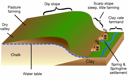
- dry valleys with seasonal streams called bournes
- clay valleys or vales
- Escarpment
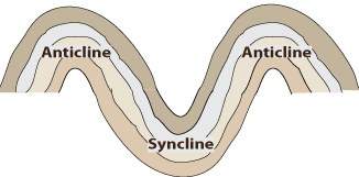
- Anticlines/synclines
Images and files in the map
Information
- Description
- GCSE Geography (Geology) Mind Map on Chalk & Clay: NORTH DOWNS, created by Alex C on 28/12/2015.
- Created by
- Alex C
- Views
- 3
- Rating