
Mind map
Geography: Volcanoes
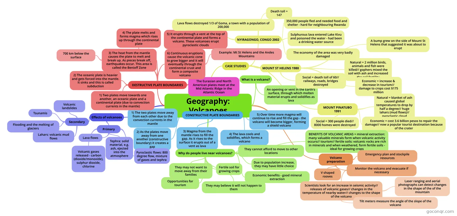
Mind map: Geography: volcanoes
Map content
Geography: Volcanoes
What is a volcano?
- An opening or vent in the Earth's surface, through which molten material erupts and solidifies as lava
CONSTRUCTIVE PLATE BOUNDARIES
- 1) The two plates move away from each other due to the convection currents in the mantle
- 2) As the plates move away from one another (constructive boundary) it creates a gap
- 3) Magma from the mantle rises to fill the gap. As it rises to the surface it erupts out of a vent as lava
- 4) The lava cools and solidifies, which forms a volcano
- 5) Over time more magma will continue to rise and fill the gap - the volcano will become bigger, forming a shield volcano
The Eurasian and North American plates meet at the Mid Atlantic Ridge in the Atlantic Ocean
DESTRUCTIVE PLATE BOUNDARIES
- 1) Two plates move towards one another, an oceanic plate and a continental plate (due to convection currents in the mantle)
- 2) The oceanic plate is heavier and gets forced into the mantle. It sinks and this is called subduction
- 3) The heat from the mantle causes the plate to melt and break up. As pieces break off, earthquakes occur. This area is called the Benioff Zone
- 700 km below the surface
- 4) The plate melts and forms magma which rises up through the continental plate
- 5) It erupts through a vent at the top of the continental plate and forms a volcano. These volcanoes erupt pyroclastic clouds
- 6) Continuous eruptions cause the volcanic cone to grow bigger and it will eventually through the continental crust and form a composite volcano
- Example: Mt St Helens and the Andes Mountains
CASE STUDIES
- NYIRAGONGO, CONGO 2002
- Lava flows destroyed 1/3 of Goma, a town with a population of 200,000
- Death toll = 147
- 350,000 people fled and needed food and shelter - hard for neighbouring Rwanda
- Sulphurous lava entered Lake Kivu and poisoned the water - had been a drinking water source
- The economy of the area was very badly damaged
- MOUNT ST HELENS 1980
- Natural = 2 million birds, animals and fish were killed// gophers mixed the soil with ash and increased the soil fertility
- Economic = increase & decrease in tourism// damage to crops cost $175 million
- Social = death toll of 60// railways, roads, bridges destroyed
- A bump grew on the side of Mount St Helens that suggested it was about to erupt
- MOUNT PINATUBO 1991
- Natural = blanket of ash caused global temperatures to drop by half a degree// huge lahars (mud flows)// pyroclastic cloud
- Economic = cost 3.6 billion pesos to repair the damage// now a popular tourist destination because of the crater
- Social = 300 people died// 8000 homes were destroyed
- NYIRAGONGO, CONGO 2002
Effects of volcanoes
- Primary
- Tephra: solid material, e.g. ash, ejected into the atmosphere
- Pyroclastic flows: 800 degree flow, mixture of gases and tephra
- Lava flows
- Volcanic gases released - carbon (dioxide/monoxide), sulphur dioxide, chlorine
- Secondary
- Lahars: volcanic mud flows
- Flooding and the melting of glaciers
- Tsunamis
- Volcanic landslides
- Primary
Why do people live near volcanoes?
- They cannot afford to move to other locations
- They may not want to move away from their families
- Due to population increase, they may have little choice
- Economic benefits - good mineral extraction
- Opportunities for tourism
- Fertile soil for growing crops
- They may believe it will not happen to them
- BENEFITS OF VOLCANIC AREAS = mineral extraction: many valuable minerals form when volcanic activity occurs// tourism// fertile soils: volcanic rocks are rich in minerals and when weathered, form fertile soils - ideal for growing crops
Volcano preparation
- Emergency plan and stockpile resources
- V shaped rooves
- Monitor the volcano and evacuate if necessary
- Scientists look for an increase in seismic activity// releases of volcanic gases// changes in the temperature of nearby water// changes to the shape of the volcano
- Tilt meters measure the angle of the slope of the volcano
- Laser ranging and aerial photographs can detect changes in the shape of the of the mountain
- Scientists look for an increase in seismic activity// releases of volcanic gases// changes in the temperature of nearby water// changes to the shape of the volcano
Information
- Description
- Mind Map on Geography: Volcanoes, created by elliemorris on 21/05/2014.
- Created by
- elliemorris
- Views
- 38
- Rating