
Mind map
Flood Management
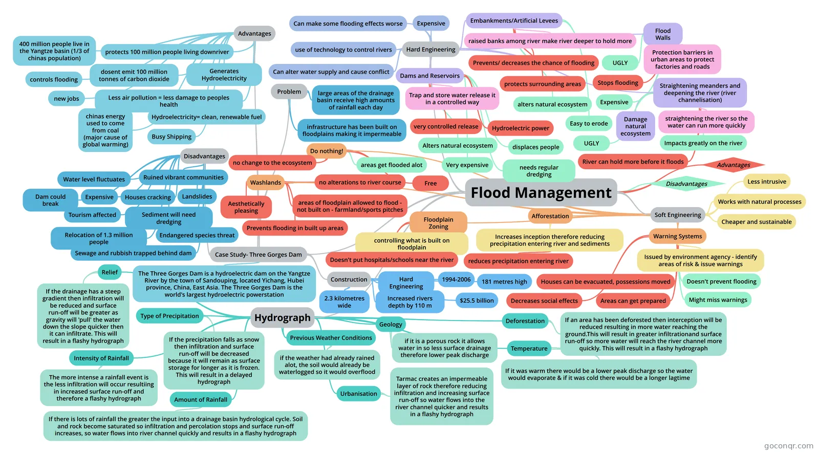
Mind map: Flood Management
Map content
Flood Management
Hard Engineering
- use of technology to control rivers
- Expensive
- Can make some flooding effects worse
- Can alter water supply and cause conflict
- Dams and Reservoirs
- Trap and store water release it in a controlled way
- very controlled release
- Hydroelectric power
- Alters natural ecosystem
- Very expensive
- needs regular dredging
- displaces people
- Embankments/Artificial Levees
- raised banks among river make river deeper to hold more
- Prevents/ decreases the chance of flooding
- protects surrounding areas
- alters natural ecosystem
- Easy to erode
- Flood Walls
- Protection barriers in urban areas to protect factories and roads
- Stops flooding
- UGLY
- Expensive
- Straightening meanders and deepening the river (river channelisation)
- straightening the river so the water can run more quickly
- River can hold more before it floods
- Impacts greatly on the river
- UGLY
- Damage natural ecosystem
Soft Engineering
- Less intrusive
- Works with natural processes
- Cheaper and sustainable
- Do nothing!
- no change to the ecosystem
- Free
- areas get flooded alot
- Washlands
- areas of floodplain allowed to flood - not built on - farmland/sports pitches
- no alterations to river course
- Prevents flooding in built up areas
- Aesthetically pleasing
- Floodplain Zoning
- controlling what is built on floodplain
- Doesn't put hospitals/schools near the river
- Afforestation
- Increases inception therefore reducing precipitation entering river and sediments
- reduces precipitation entering river
- Increases inception therefore reducing precipitation entering river and sediments
- Warning Systems
- Issued by environment agency - identify areas of risk & issue warnings
- Houses can be evacuated, possessions moved
- Areas can get prepared
- Decreases social effects
- Doesn't prevent flooding
- Might miss warnings
Advantages
Disadvantages
Case Study- Three Gorges Dam
- Advantages
- protects 100 million people living downriver
- Generates Hydroelectricity
- Less air pollution = less damage to peoples health
- Hydroelectricity= clean, renewable fuel
- chinas energy used to come from coal (major cause of global warming)
- 400 million people live in the Yangtze basin (1/3 of chinas population)
- new jobs
- controls flooding
- dosent emit 100 million tonnes of carbon dioxide
- Busy Shipping
- Disadvantages
- Relocation of 1.3 million people
- Sediment will need dredging
- Sewage and rubbish trapped behind dam
- Dam could break
- Tourism affected
- Endangered species threat
- Expensive
- Ruined vibrant communities
- Houses cracking
- Landslides
- Water level fluctuates
- Construction
- Hard Engineering
- 1994-2006
- $25.5 billion
- 181 metres high
- 2.3 kilometres wide
- Increased rivers depth by 110 m
- The Three Gorges Dam is a hydroelectric dam on the Yangtze River by the town of Sandouping, located Yichang, Hubei province, China, East Asia. The Three Gorges Dam is the world's largest hydroelectric powerstation
- Problem
- large areas of the drainage basin receive high amounts of rainfall each day
- infrastructure has been built on floodplains making it impermeable
- Advantages
Hydrograph
- Urbanisation
- Tarmac creates an impermeable layer of rock therefore reducing infiltration and increasing surface run-off so water flows into the river channel quicker and results in a flashy hydrograph
- Amount of Rainfall
- If there is lots of rainfall the greater the input into a drainage basin hydrological cycle. Soil and rock become saturated so infiltration and percolation stops and surface run-off increases, so water flows into river channel quickly and results in a flashy hydrograph
- Type of Precipitation
- If the precipitation falls as snow then infiltration and surface run-off will be decreased because it will remain as surface storage for longer as it is frozen. This will result in a delayed hydrograph
- Intensity of Rainfall
- The more intense a rainfall event is the less infiltration will occur resultiing in increased surface run-off and therefore a flashy hydrograph
- Relief
- If the drainage has a steep gradient then infiltration will be reduced and surface run-off will be greater as gravity will 'pull' the water down the slope quicker then it can infiltrate. This will result in a flashy hydrograph
- Deforestation
- If an area has been deforested then interception will be reduced resulting in more water reaching the ground.This will result in greater infiltrationand surface run-off so more water will reach the river channel more quickly. This will result in a flashy hydrograph
- Geology
- if it is a porous rock it allows water in so less surface drainage therefore lower peak discharge
- Previous Weather Conditions
- if the weather had already rained alot, the soil would already be waterlogged so it would overflood
- Temperature
- If it was warm there would be a lower peak discharge so the water would evaporate & if it was cold there would be a longer lagtime
- Urbanisation
Information
- Description
- Mind Map on Flood Management, created by Elemanda M on 28/02/2015.
- Created by
- Elemanda M
- Views
- 3
- Rating
More on Flood and River Management