
Mind map
FIELDWORK
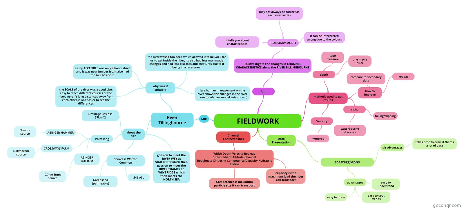
Mind map: fieldwork river Tillingbourne
Map content
FIELDWORK
Site
- River Tillingbourne
- why was it suitable
- easily ACCESIBLE was only a hours drive and it was near juniper fsc. It also had the A25 beside it.
- the river wasn't too deep which allowed it to be SAFE for us to get inside the river, its also had less man made changes and had less diseases and creatures due to it being in a rural area.
- the SCALE of the river was a good size, easy to reach different courses of the river, weren't long distances away from each other,it was easier to see the differences
- less human management on the river shows the changes in the river more (bradshaw model gets shown)
- about the site
- Drainage Basin is 57km^2
- Source is Wotton Common
- Greensand (permeable)
- 246 ASL
- 19km long
- ABINGER BOTTOM
- 0.7km from source
- CROSSWAYS FARM
- 4.3km from source
- ABINGER HAMMER
- 6km for source
- ABINGER BOTTOM
- goes on to meet the RIVER WEY at SHALFORD which then goes on to meet the RIVER THAMES at WEYBRIDGE which then meets the NORTH SEA
- why was it suitable
- River Tillingbourne
Channel Characteristics
- Width-Depth-Velocity-Bedload Size-Gradient-Altitude-Channel Roughness-Sinuosity-Competence/Capacity-Hydraulic Radius
- Competence is maximum particle size it can transport
- capacity is the maximum load the river can transport
- Width-Depth-Velocity-Bedload Size-Gradient-Altitude-Channel Roughness-Sinuosity-Competence/Capacity-Hydraulic Radius
Data Presentation
- scattergraphs
- advantages
- easy to understand
- easy to spot trends
- easy to draw
- disadvantages
- takes time to draw if theres a lot of data
- advantages
- scattergraphs
Aim
- To investigate the changes in CHANNEL CHARACTERISTICS along the RIVER TILLINGBOURNE
- BRADSHAW MODEL
- it tells you about characteristics
- may not always be correct as each river varies
- it can be interpreted wrong due to the colours
- BRADSHAW MODEL
- To investigate the changes in CHANNEL CHARACTERISTICS along the RIVER TILLINGBOURNE
methods used to get results
- depth
- tape measure
- one metre ruler
- Velocity
- hyroprop
- risks
- waterbourne diseases
- falling/slipping
- how to improve
- repeat
- compare to secondary data
- depth
Information
- Description
- Mind Map on FIELDWORK, created by 08alamk on 11/01/2014.
- Created by
- 08alamk
- Views
- 727
- Rating